
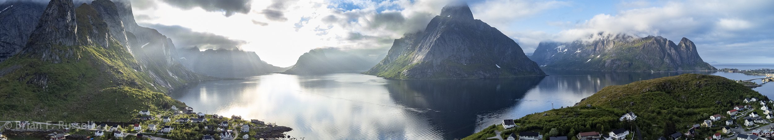
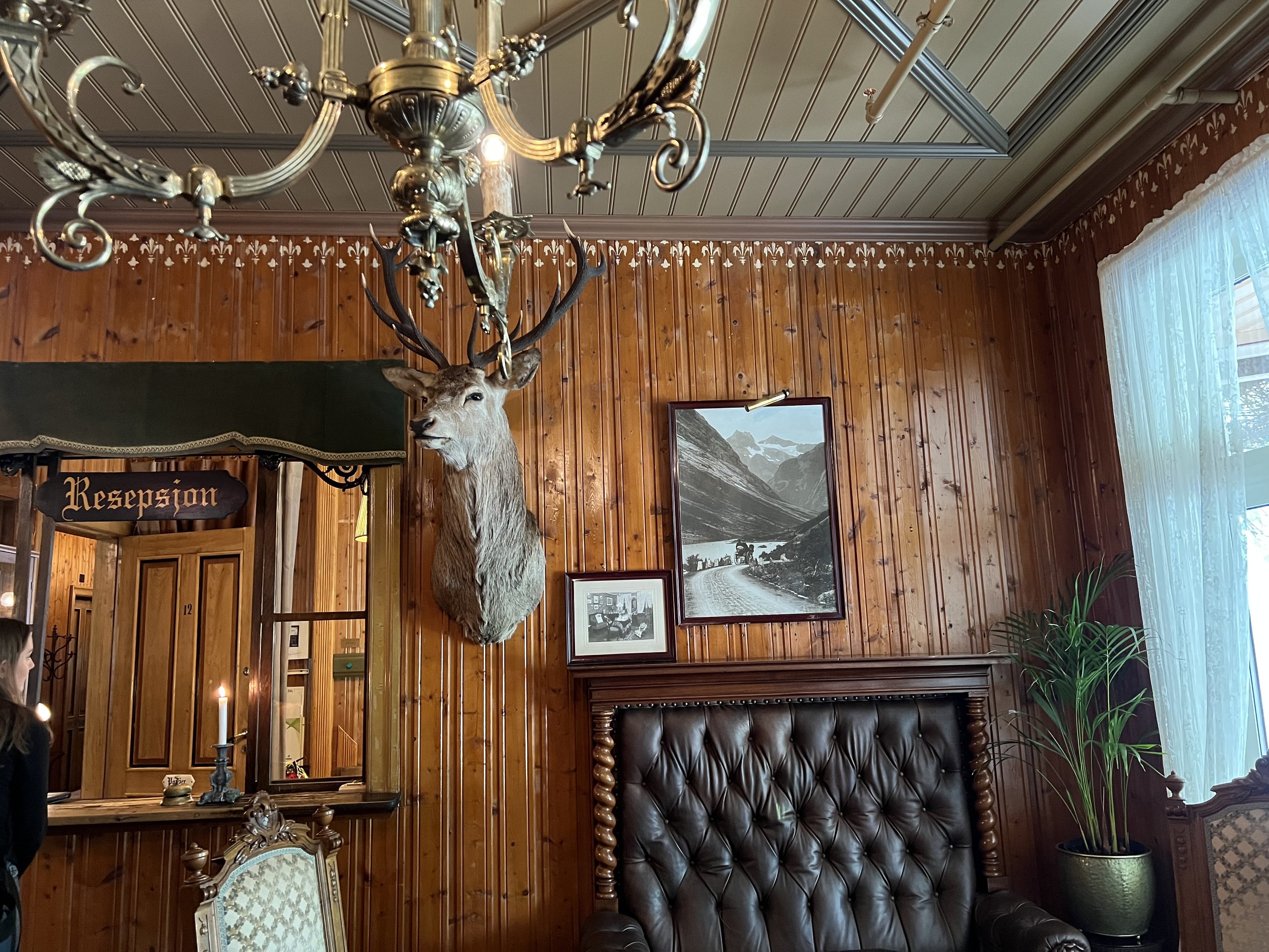
Observations on La Palma
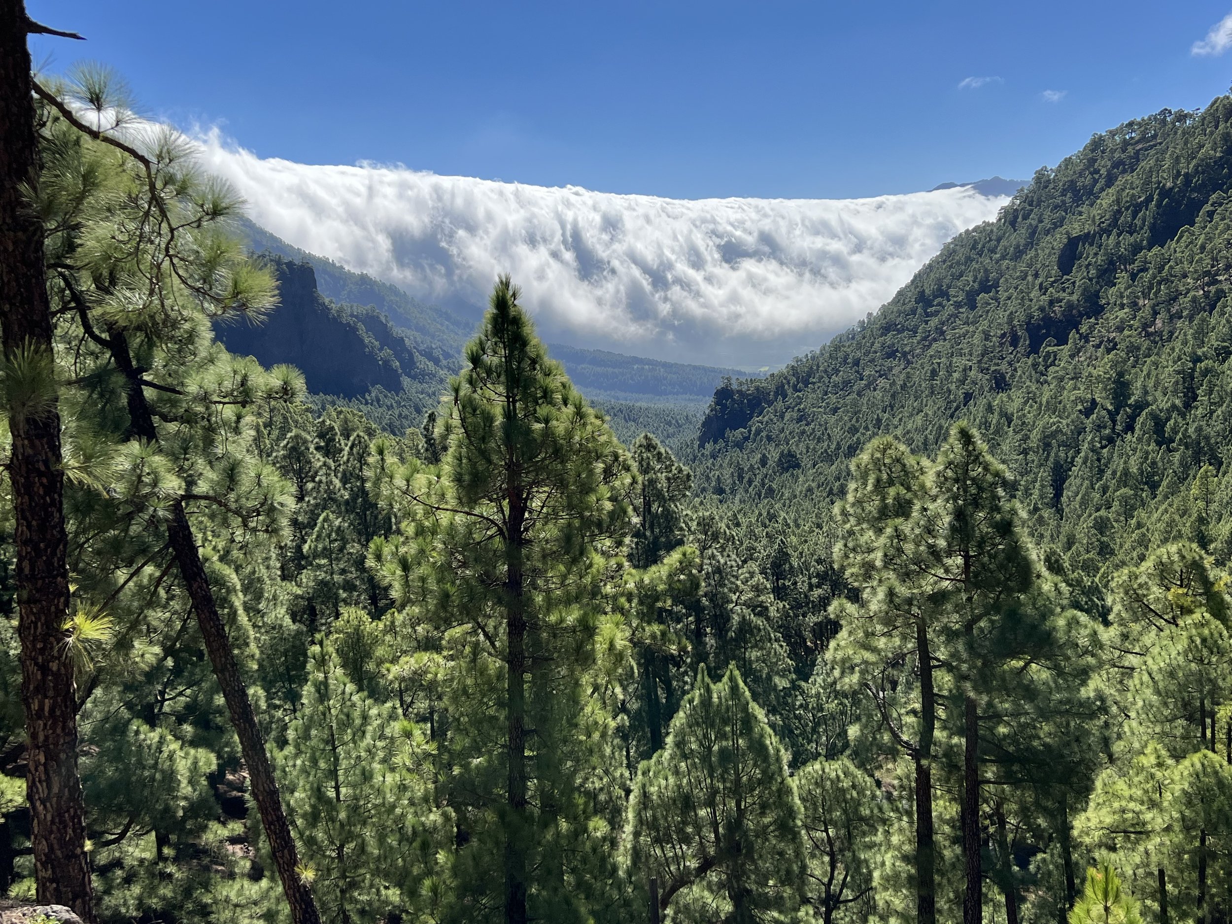
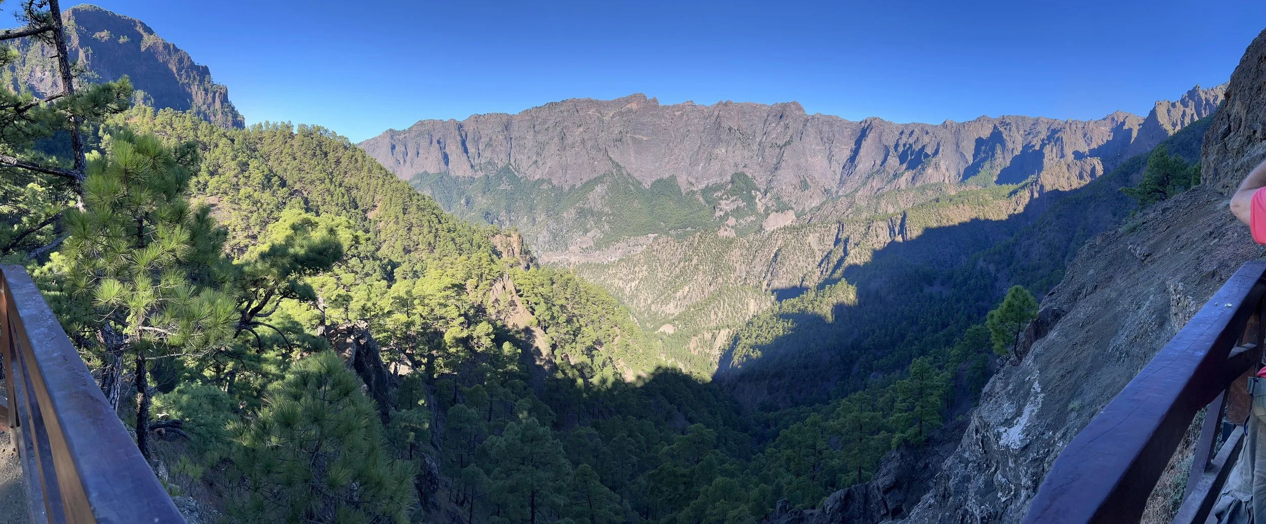
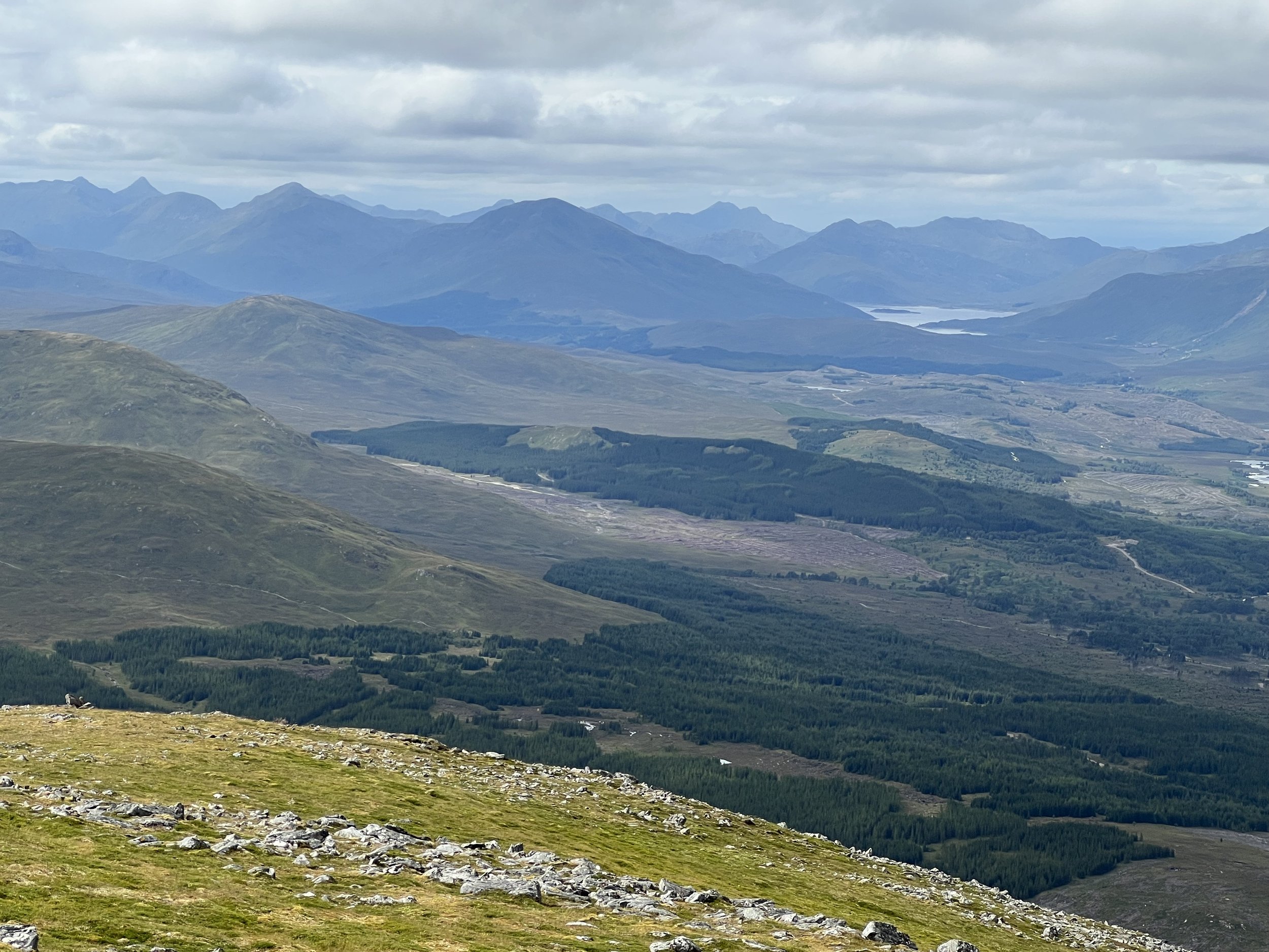
Clouds spilling into the Caldera de Taburiente.
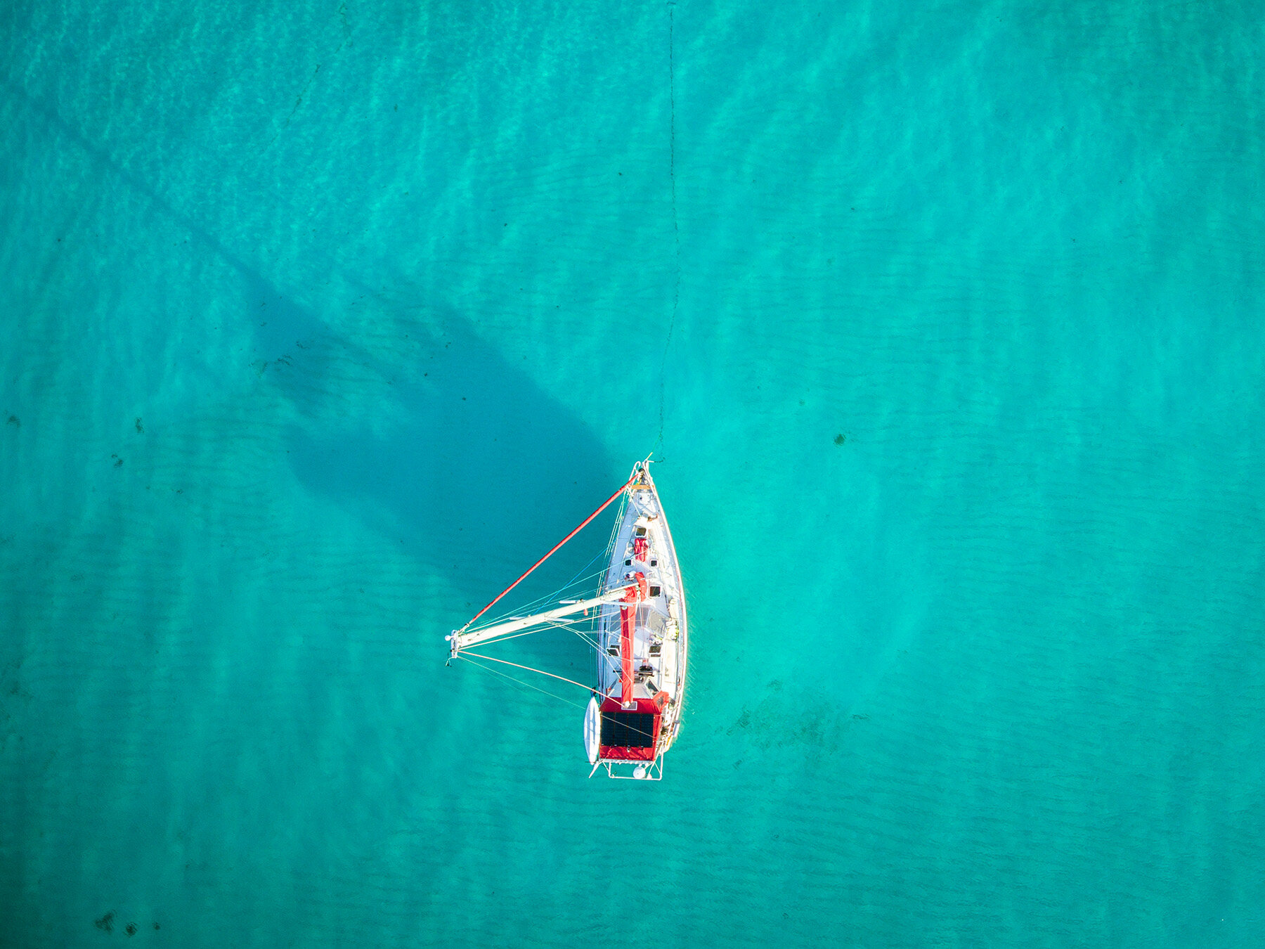
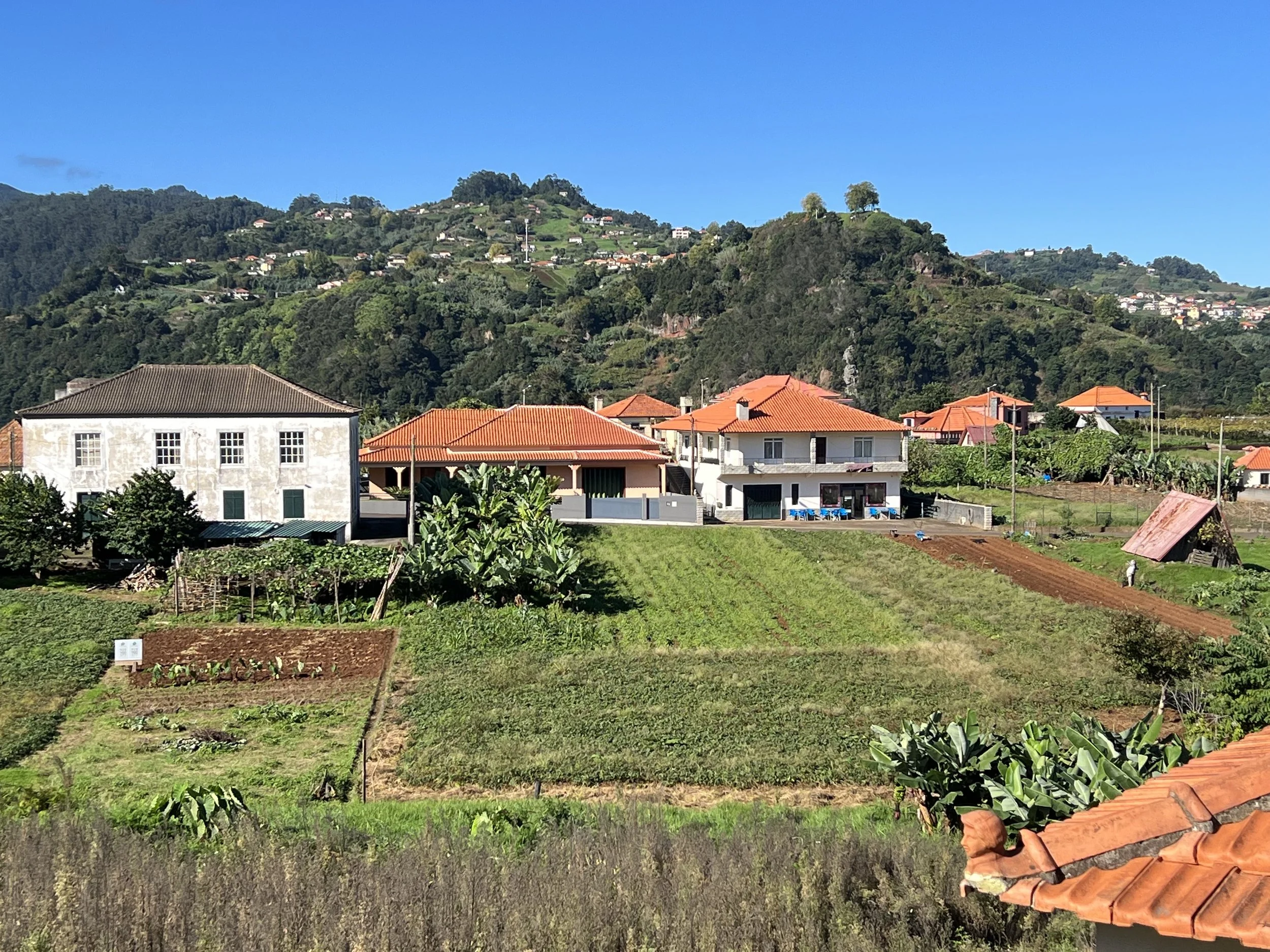
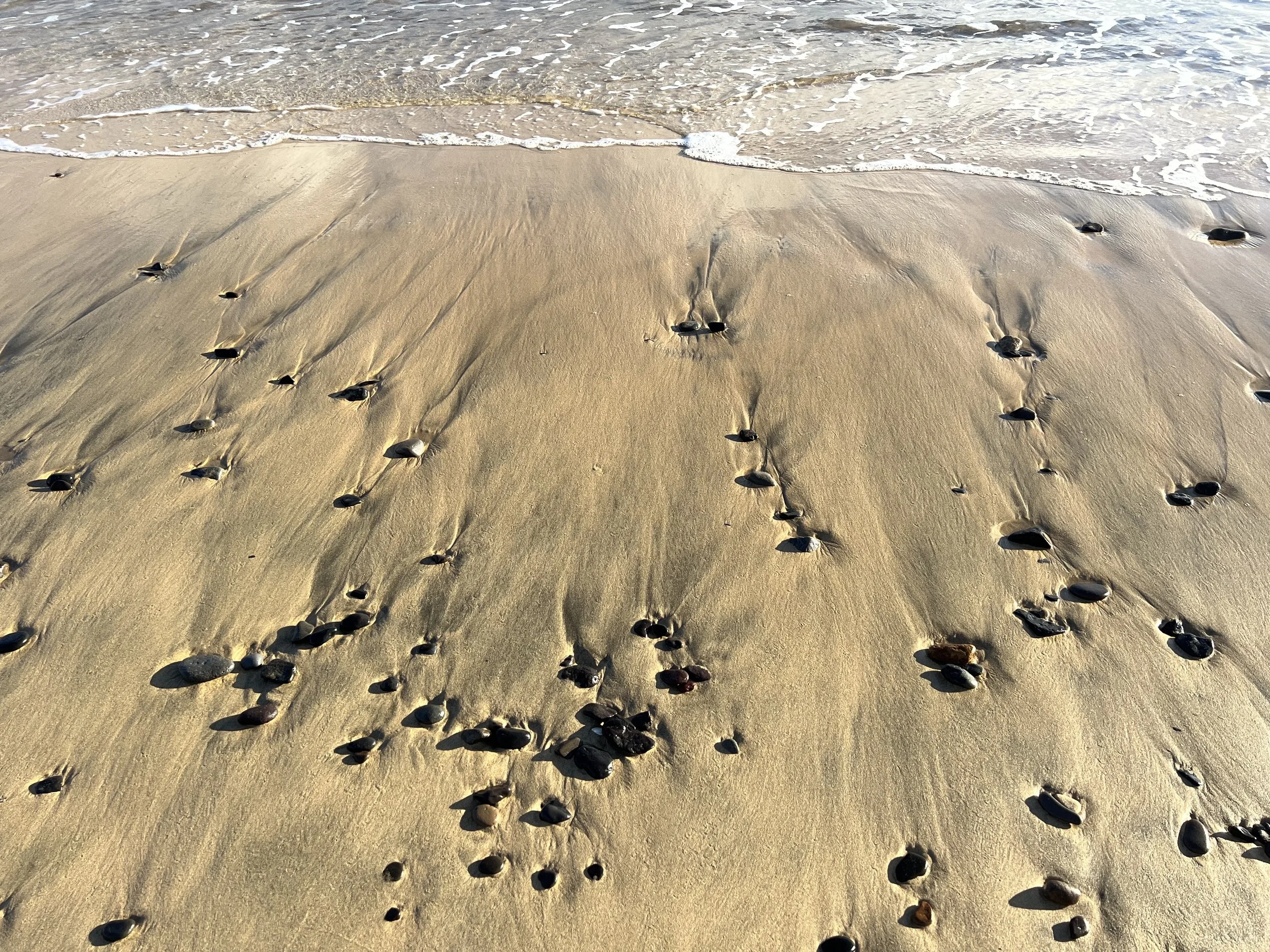
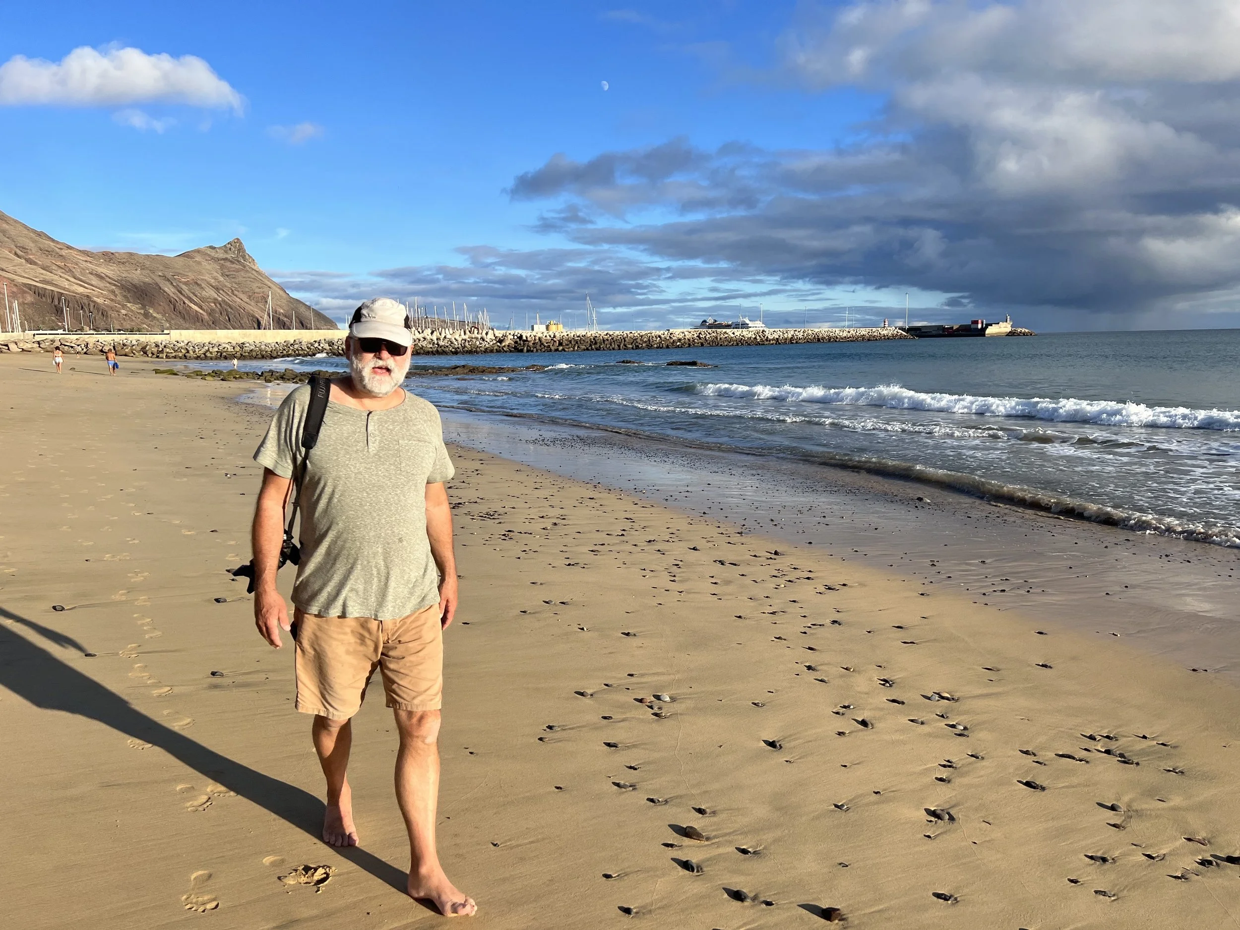
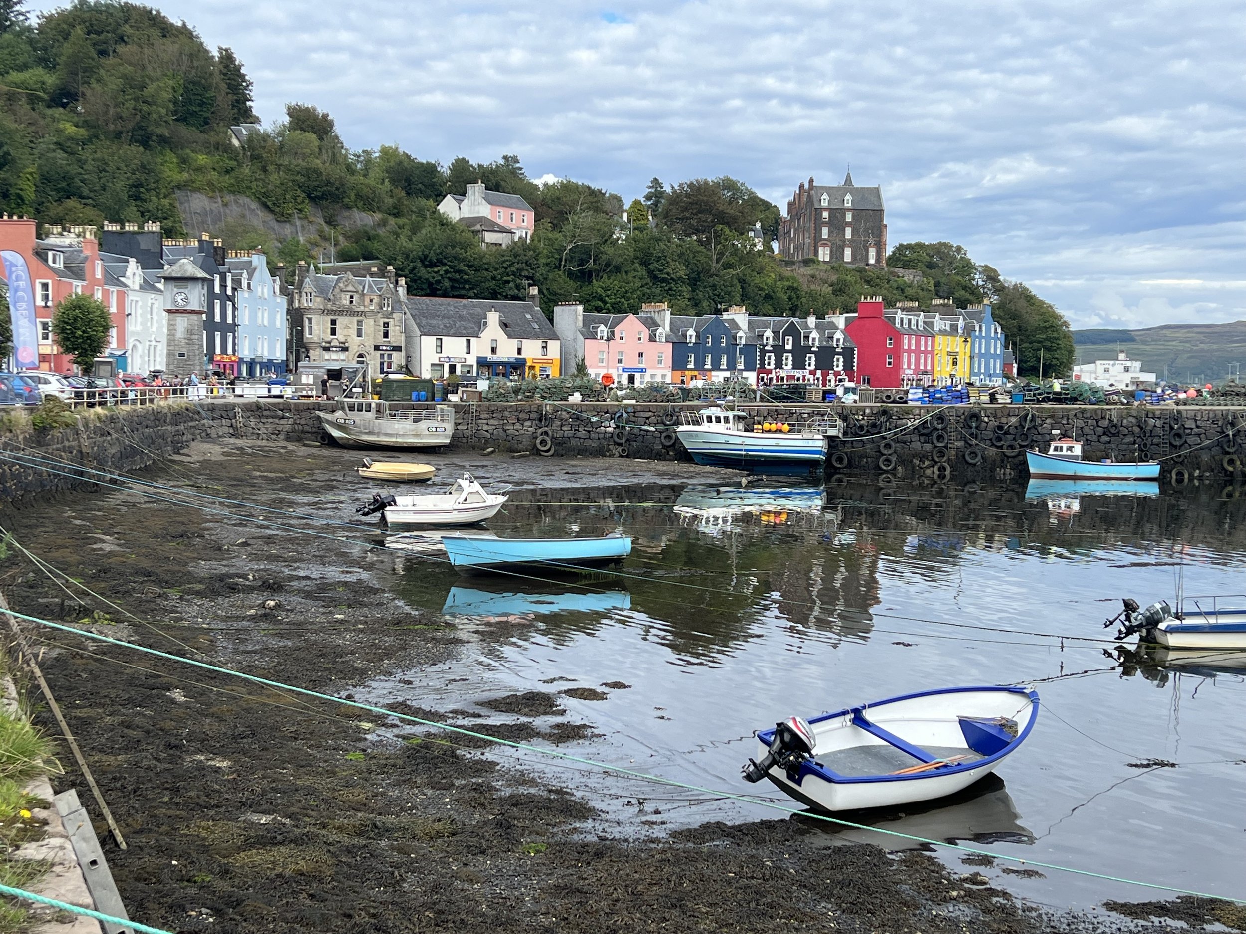
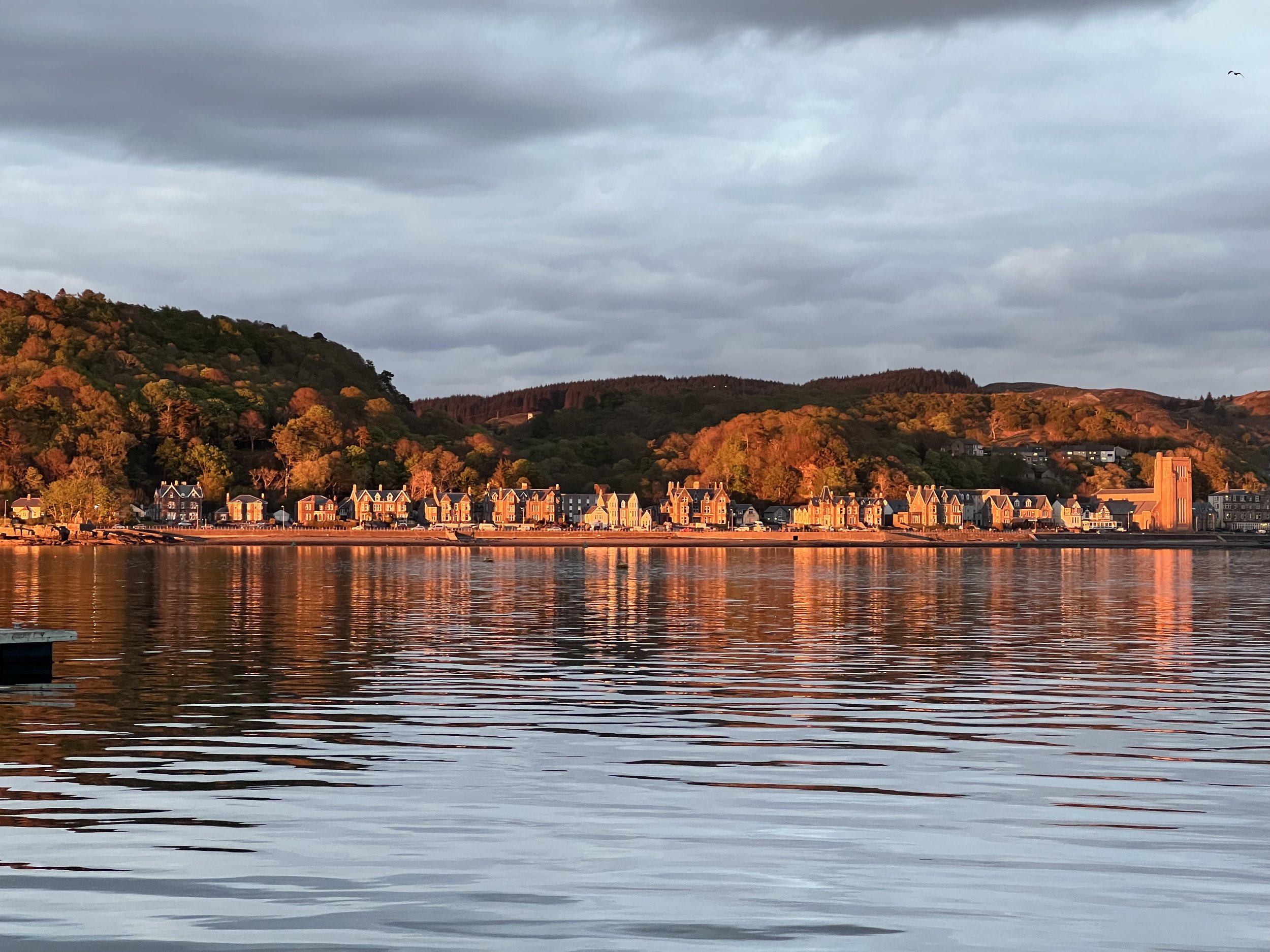
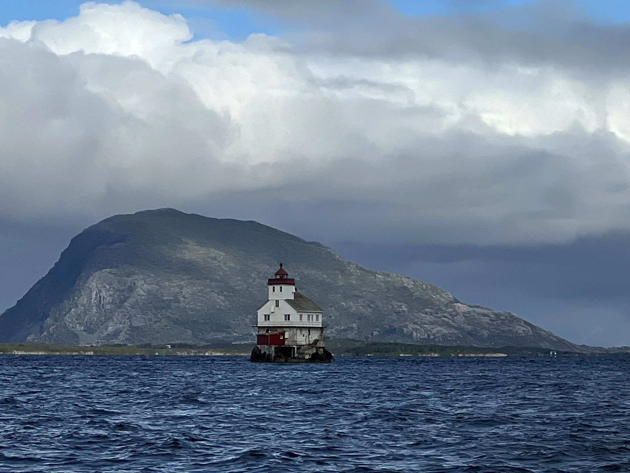
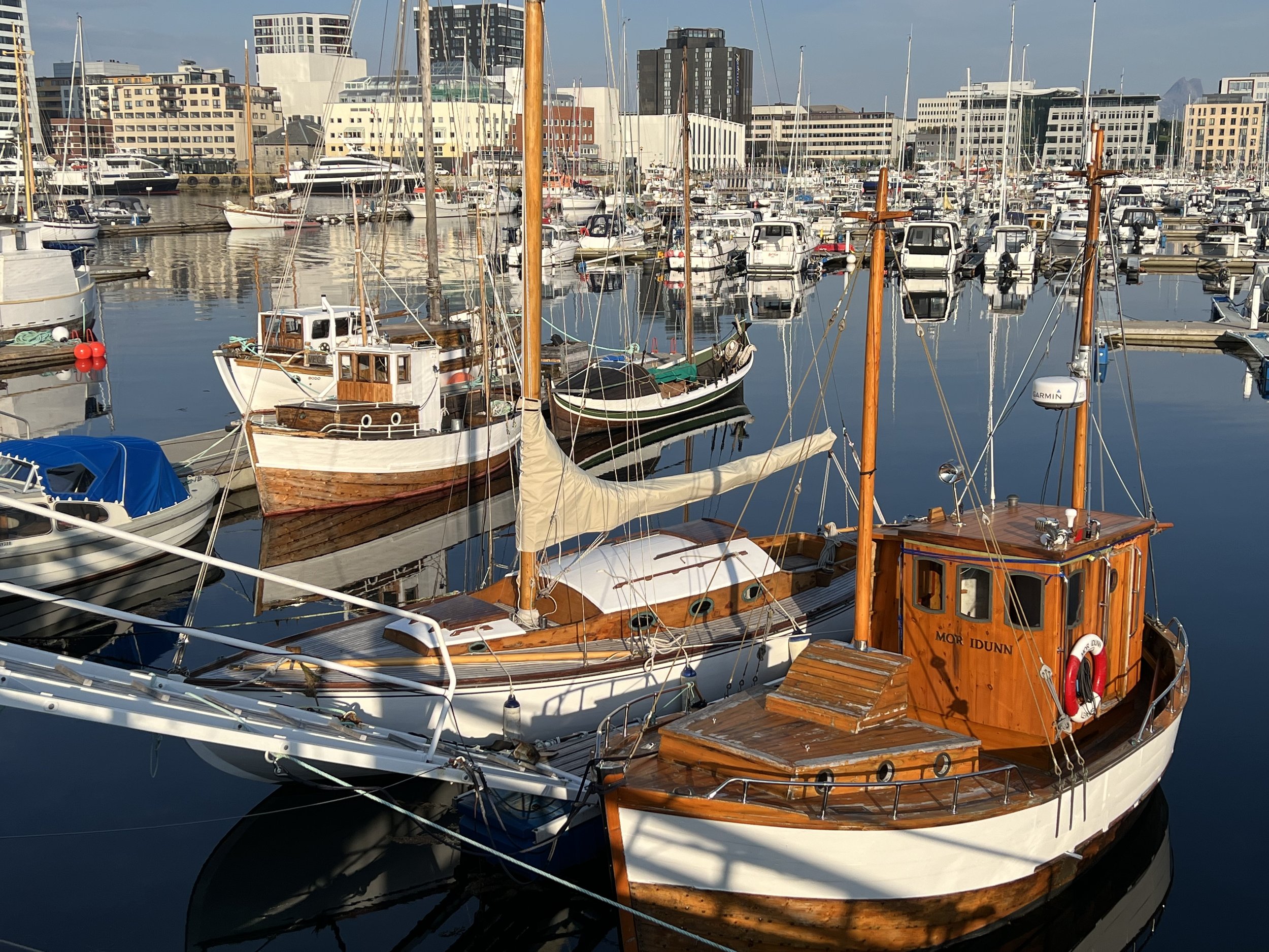
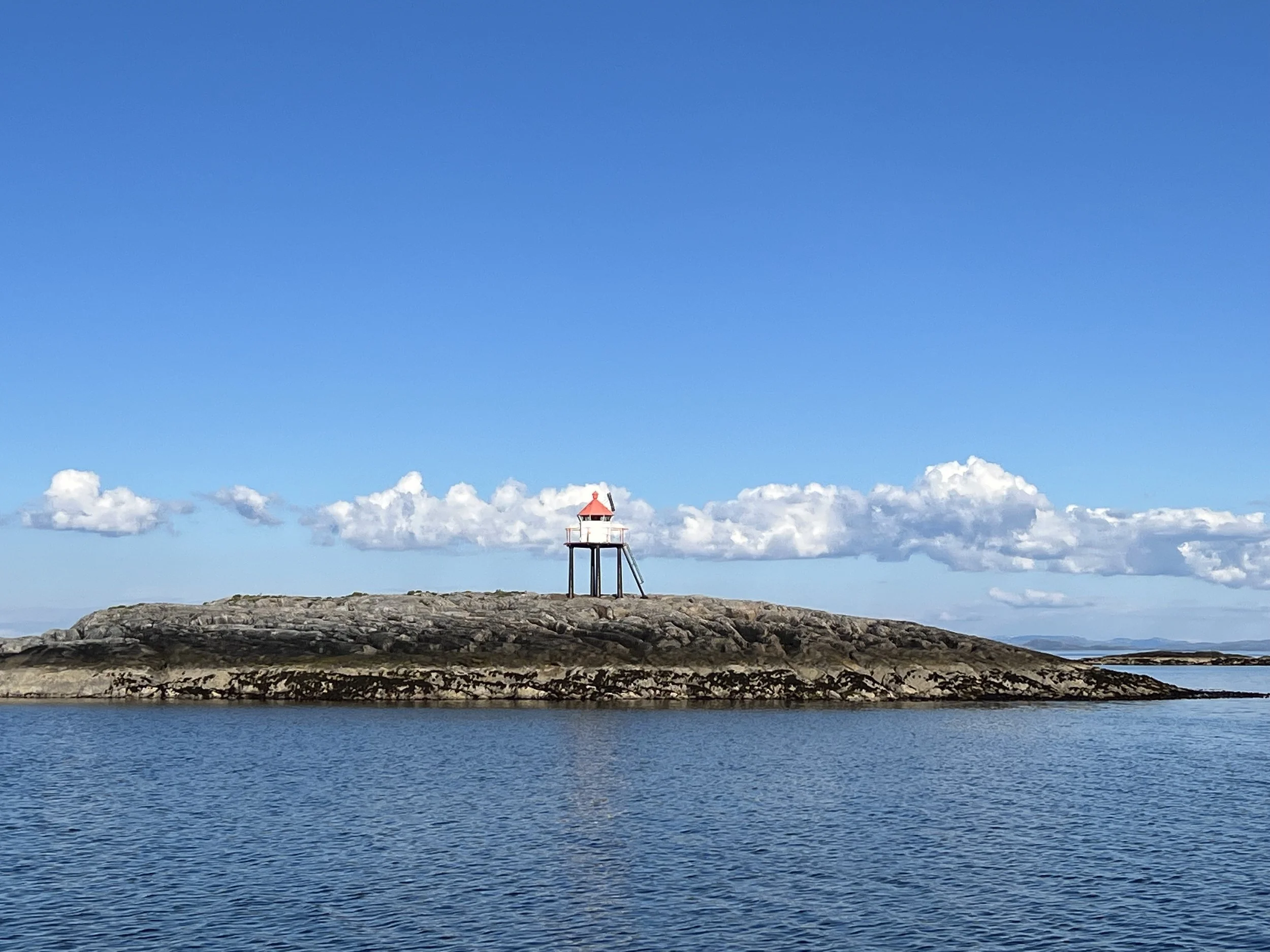
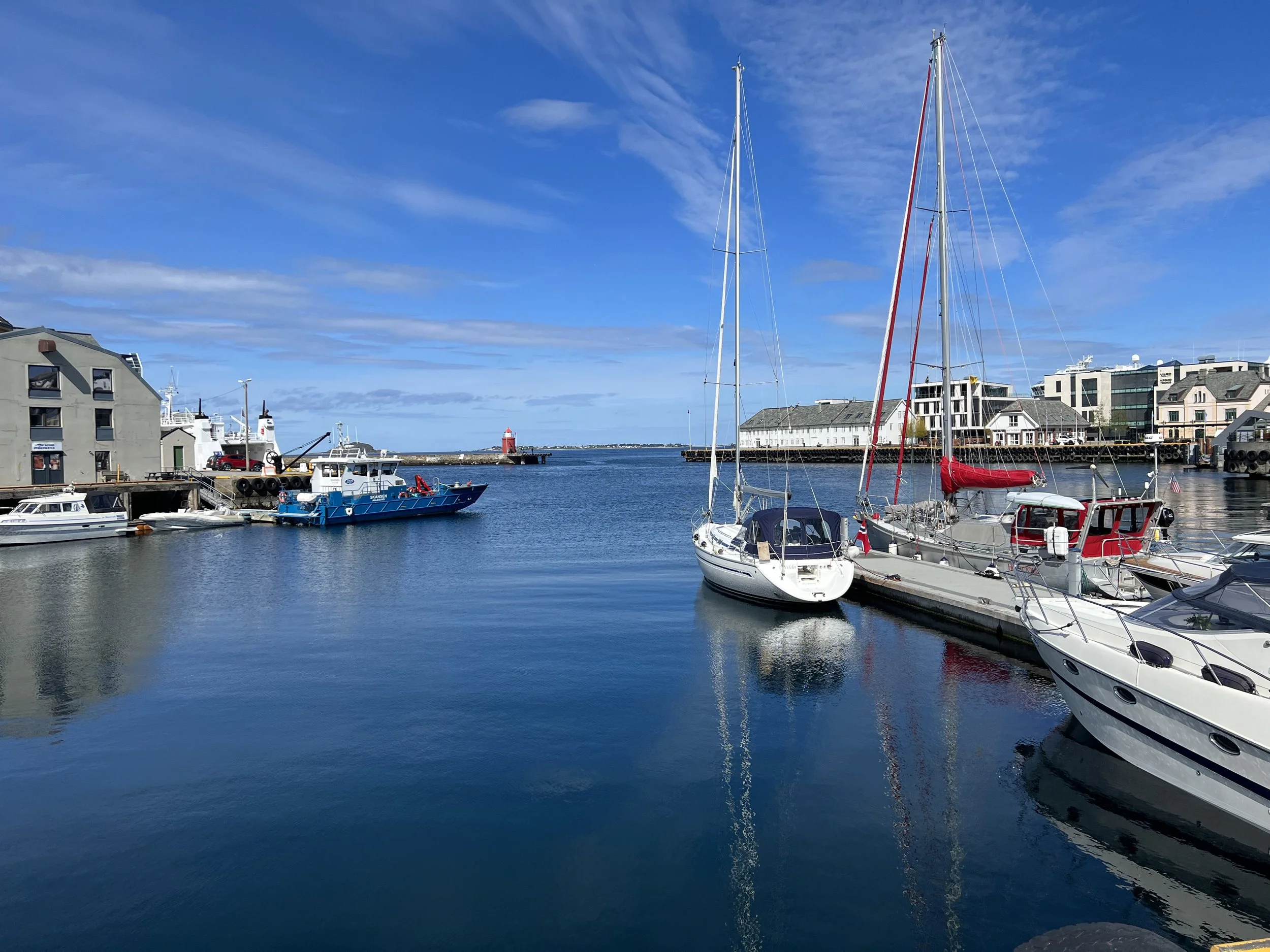
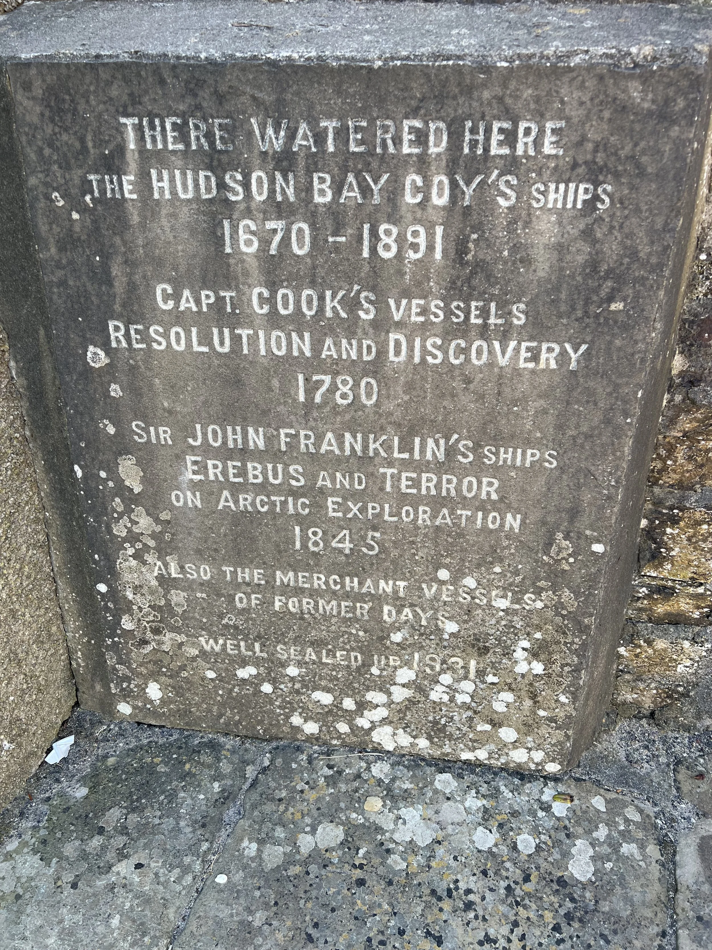
The Canaries are an archipelago of seven volcanic islands. Due to time constraints we decided to pick just one to visit, to explore it properly and leave the others such as Tenerife, Lanzarote and Grand Canaria for another time. We picked a good one, La Palma. The westernmost island, it is the most mountainous of the Canaries, and the greenest. The crossing from Madeira took two and a half days. We called the marina office in Santa Cruz de La Palma to gain entrance through the sea gate into the marina itself. The gate was installed to try and control the huge swell that sweeps around the harbor wall and up to the marina at the head of the bay. It only partially works, as we snapped back and forth on our lines, especially when the ferry came in. However I am sure it is a big improvement on the situation before the gate was there.

Marina La Palma.
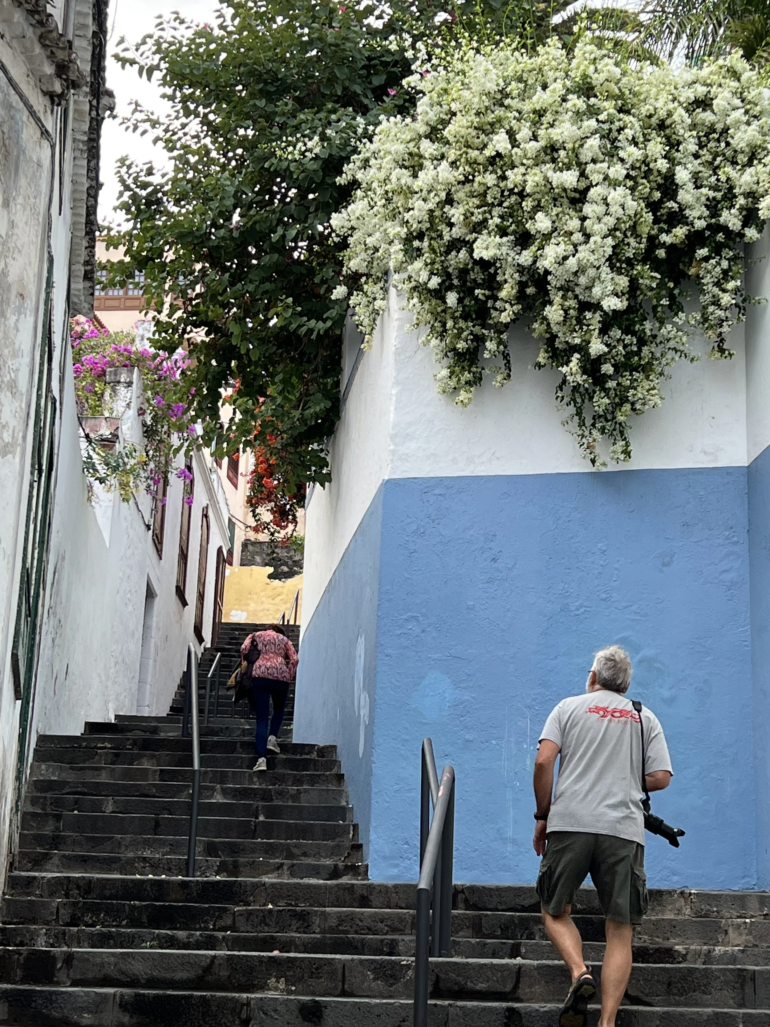
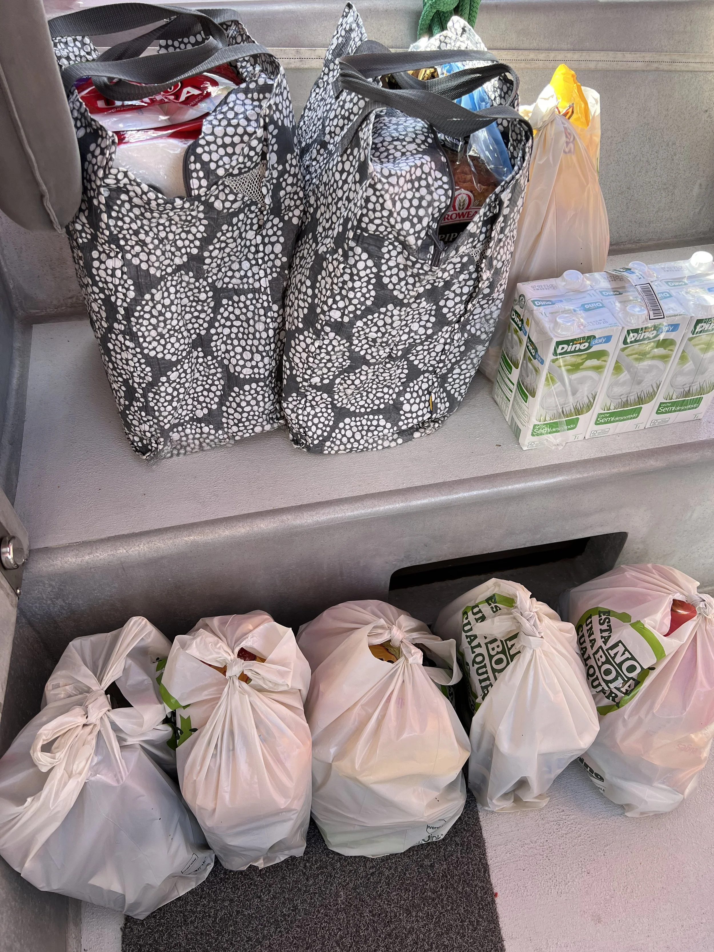
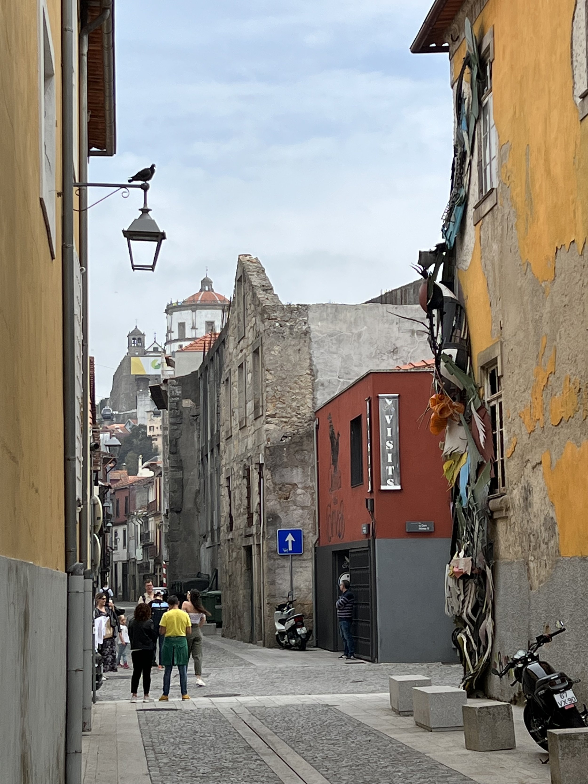
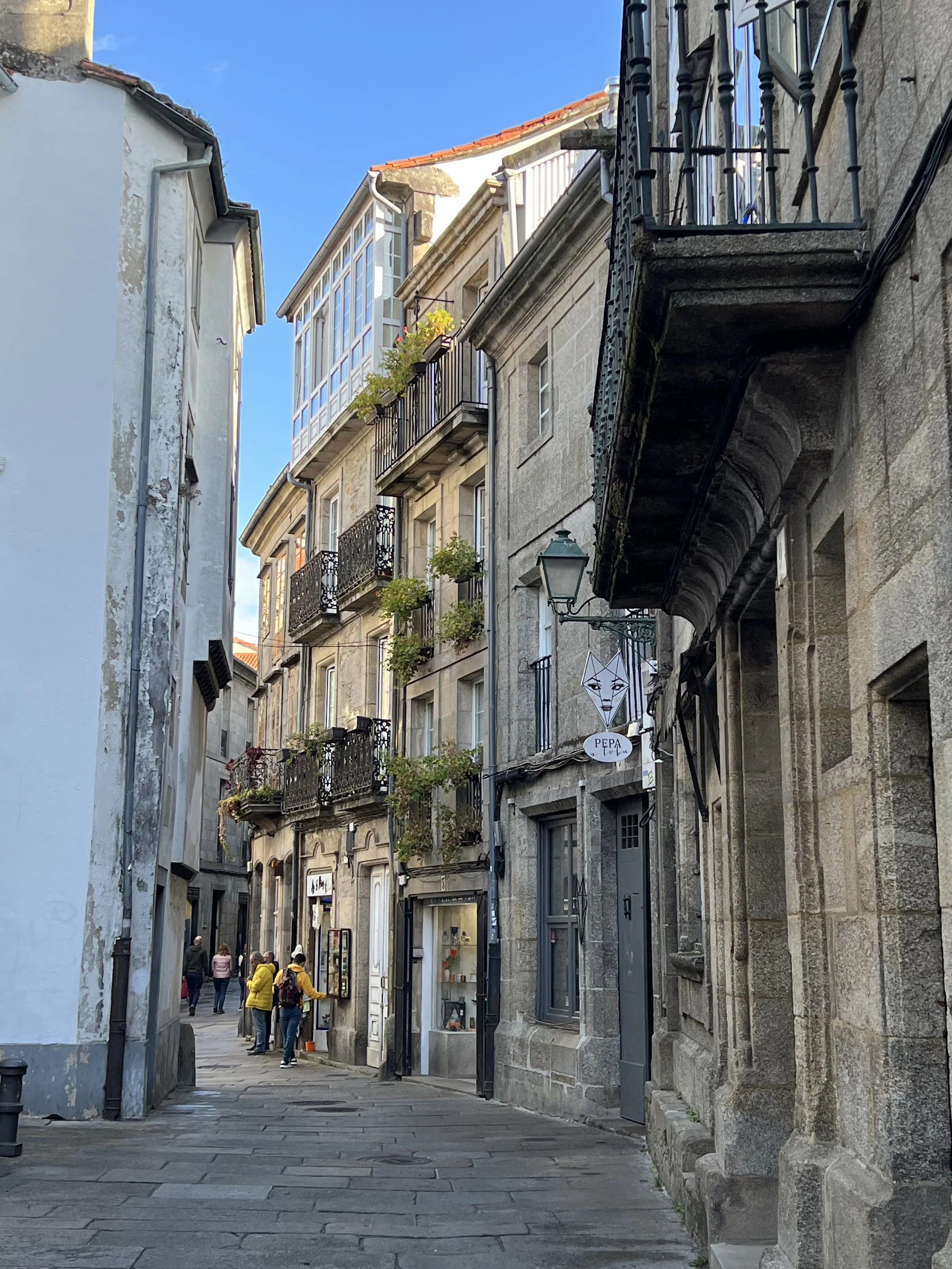
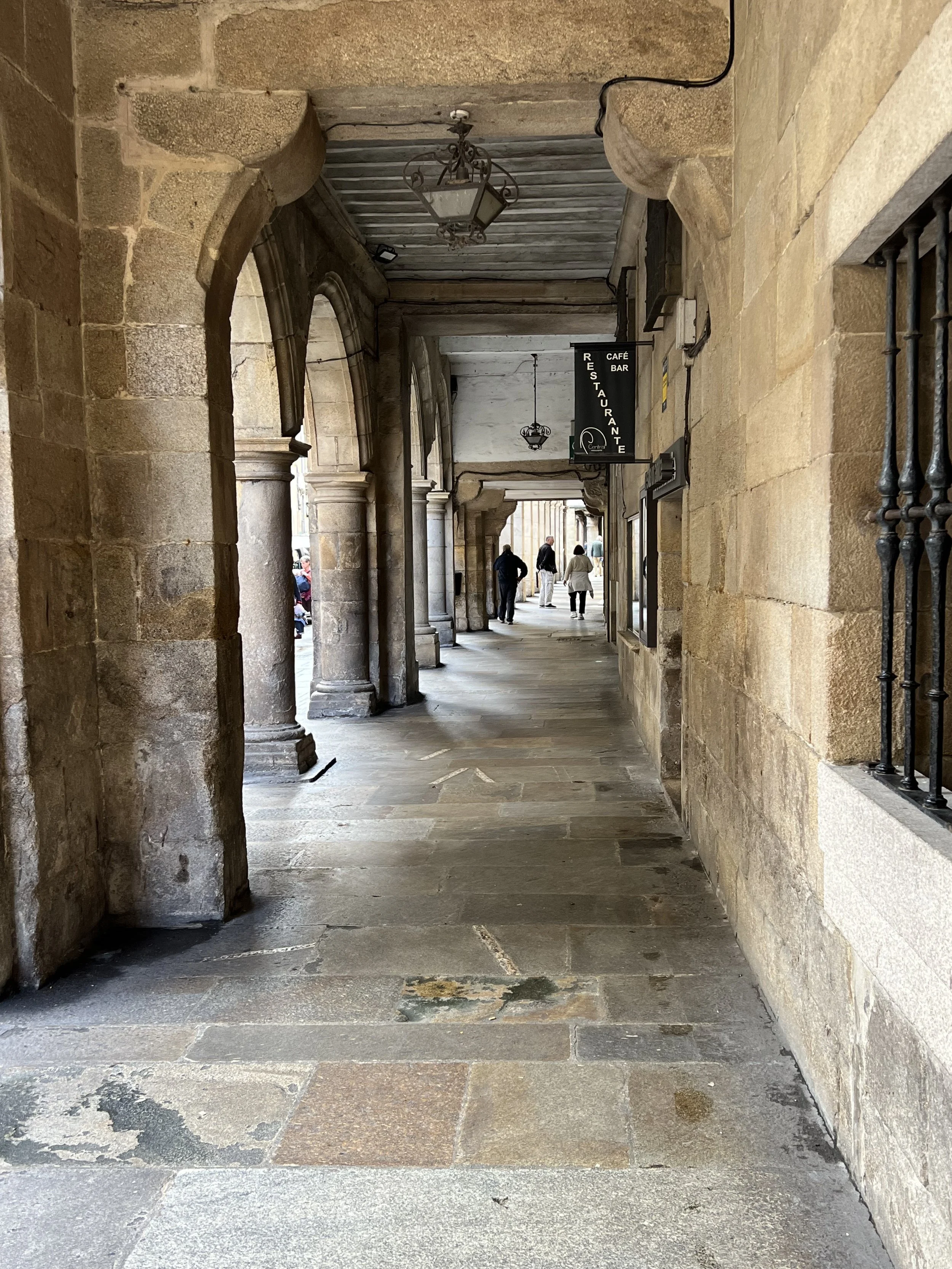
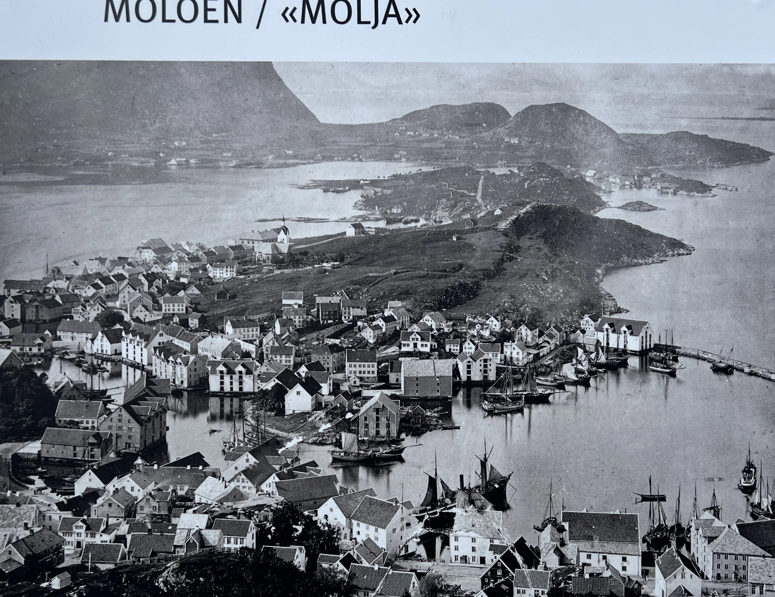
We wandered around town to check out the lay of the land. Where were the grocery stores.? How well stocked were they? Were they within walking distance of the marina? We got good results on all the above, so provisioning here for our trans-Atlantic crossing was going to be relatively straightforward. It was interesting watching the Christmas lights going up, strung between buildings and palm trees. Santa Cruz is the capital of La Palma and the old buildings and narrow streets stretched away from the coast and up the steep hillsides.


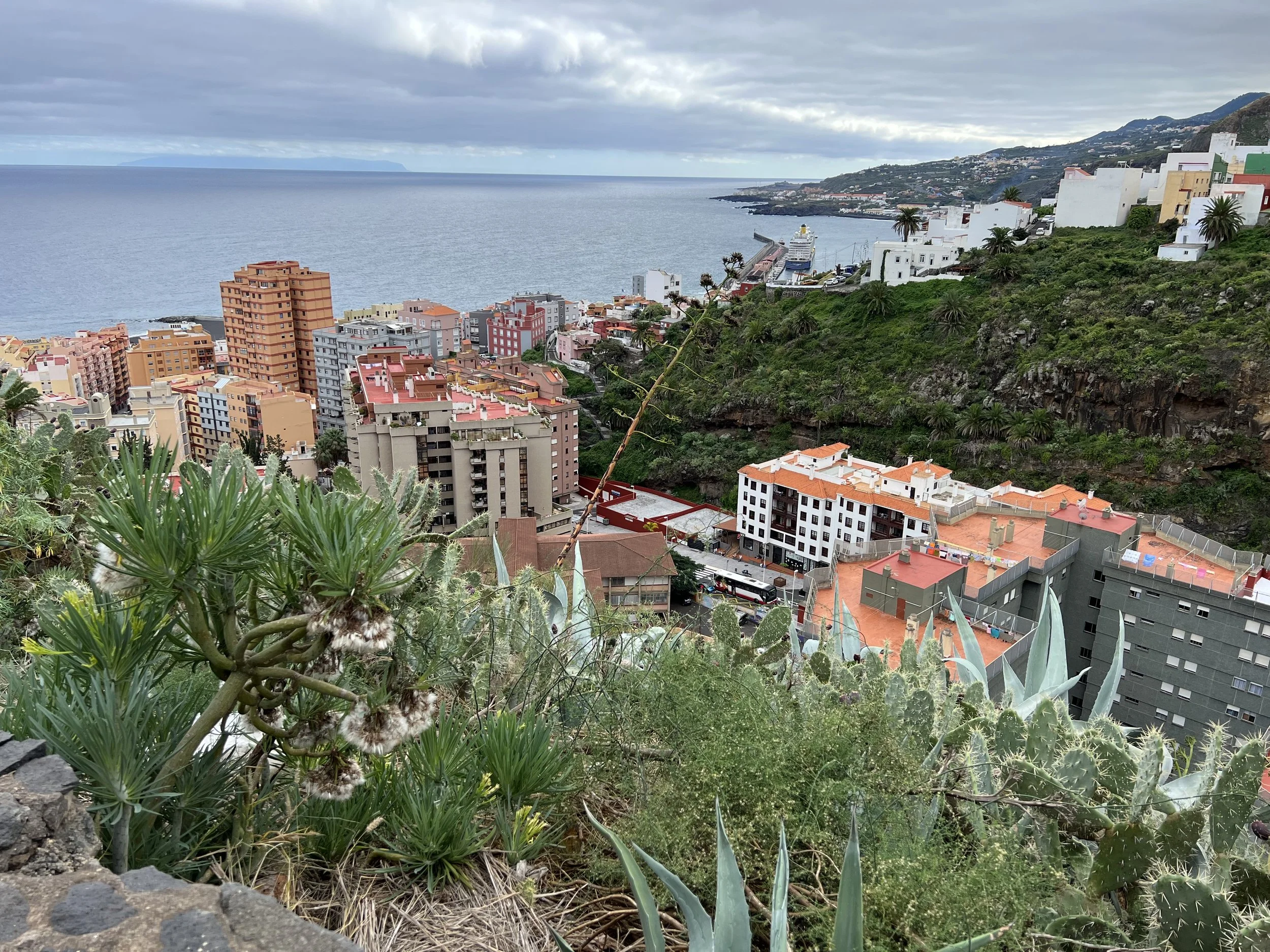

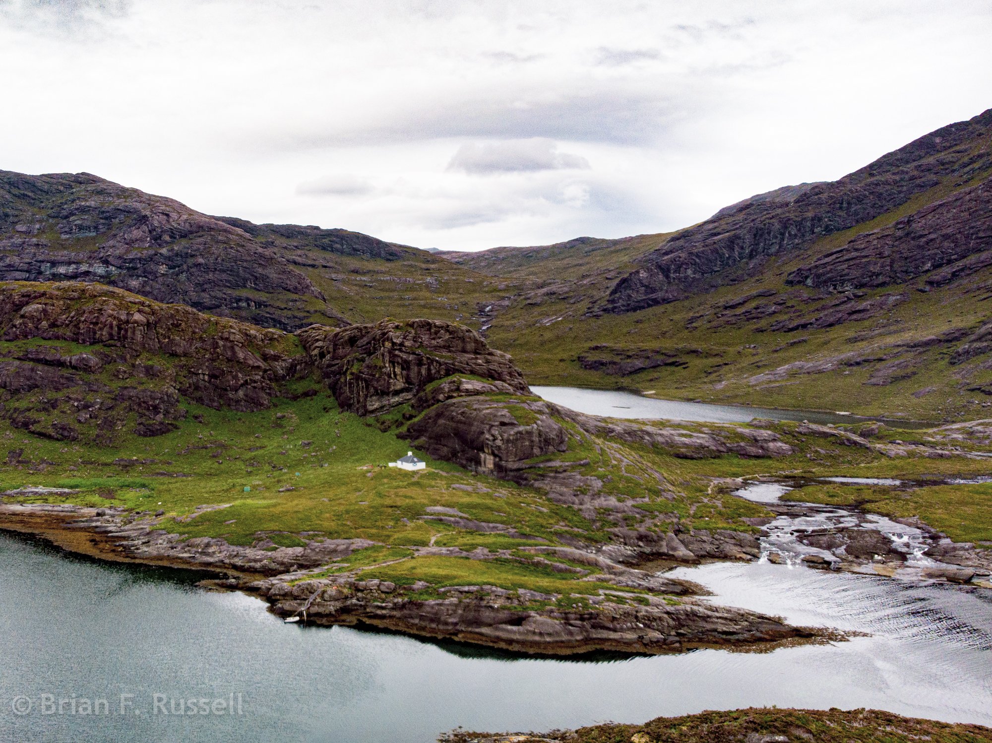
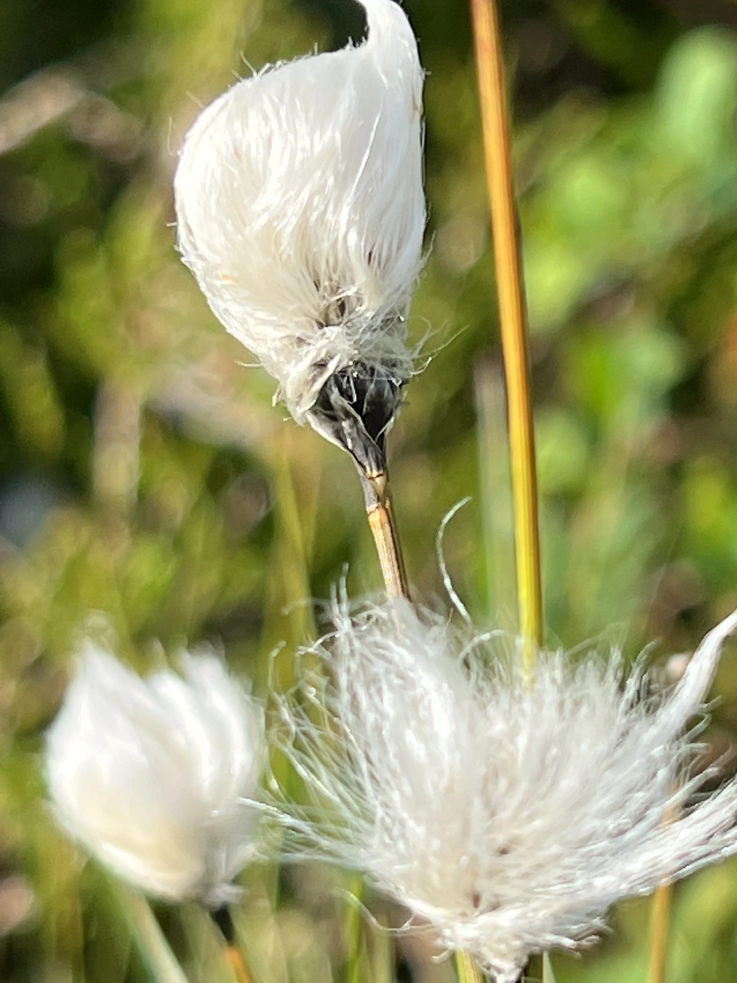
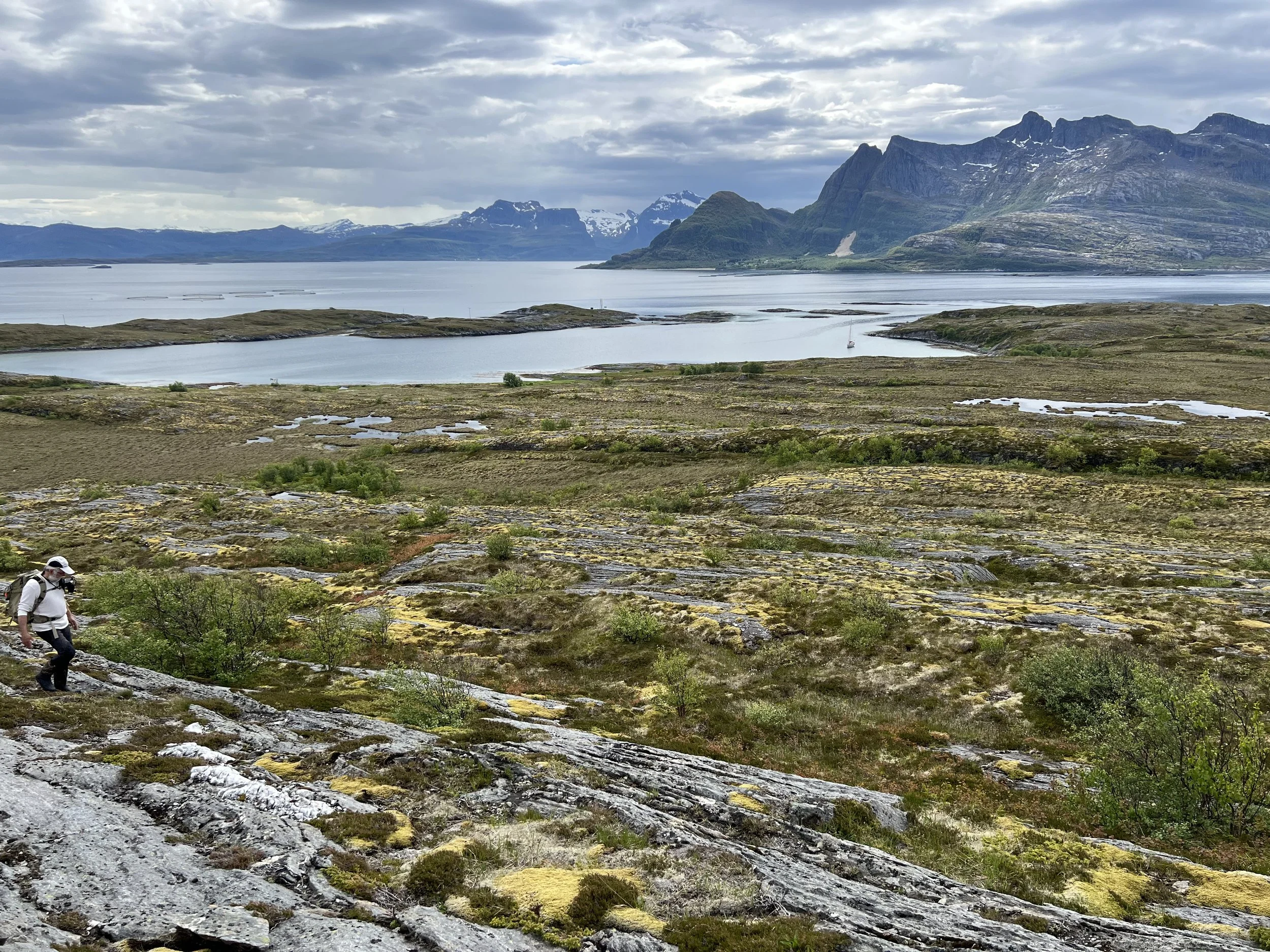
We found a trail that led up one of the steep ravines and overlooked the town. The path was a little tenuous at times, but we persevered and had a fine afternoon. The houses clinging to steep hillsides, the grassy valley on the way down, as always the varied and novel flora made the hike very interesting.


The goat farm at the end of the hike was unexpected, especially when the farmer opened the gate for them to run down the hill to the barn for feeding time.
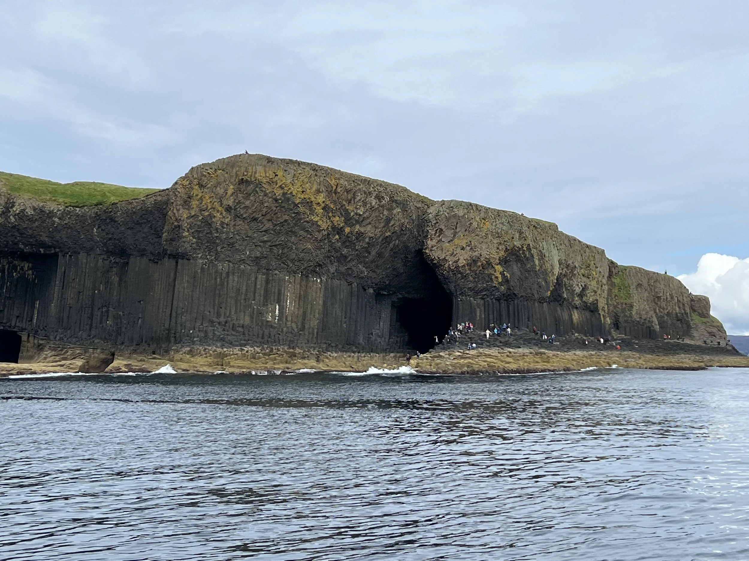
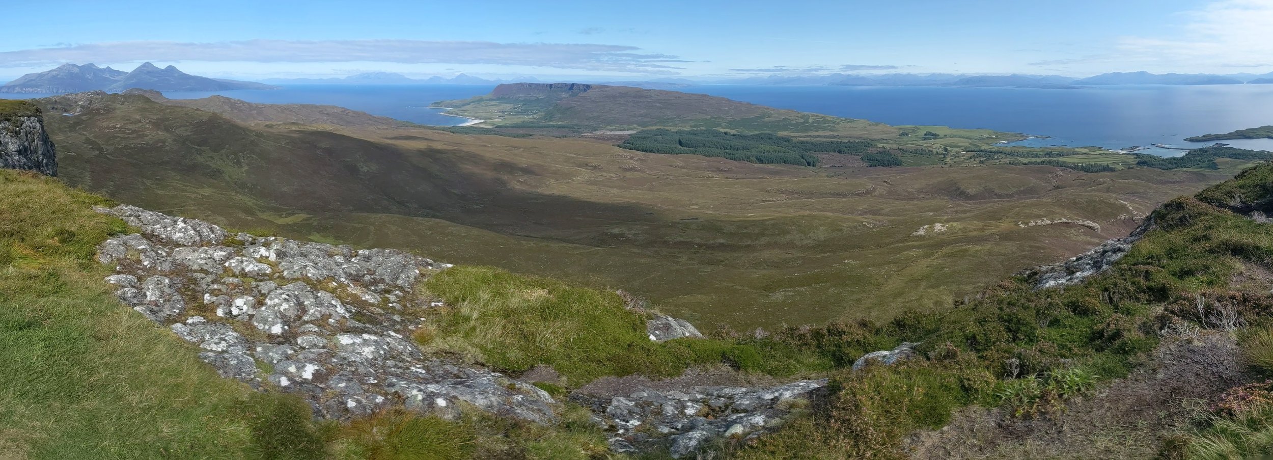
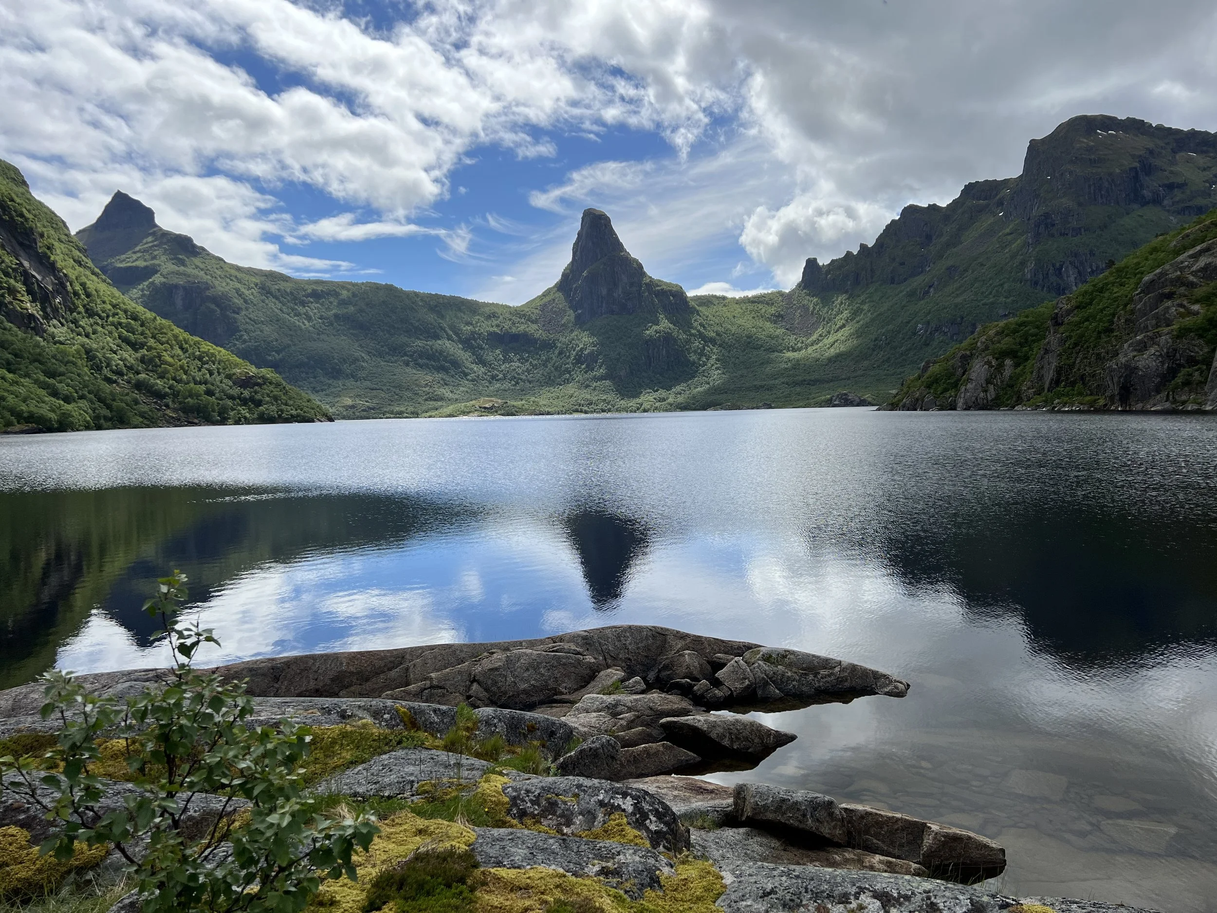
We rented a car for a couple of days to explore the rest of the island. The first day we reserved our parking spot at La Caldera de Taburiente. There were only 10 spots available and so reservations were essential to visit the crater of the extinct volcano at the center of the island. The perfect time to visit it is the morning. As the day heats up the clouds roll in from the ocean and spill over the rim of the caldera. Presumably making good views in the afternoon a little harder to enjoy. The encroaching clouds were an amazing feature in their own right.


We parked the car and took a trail down into the crater through a beautiful pine forest with amazing views looking back up to the rim.


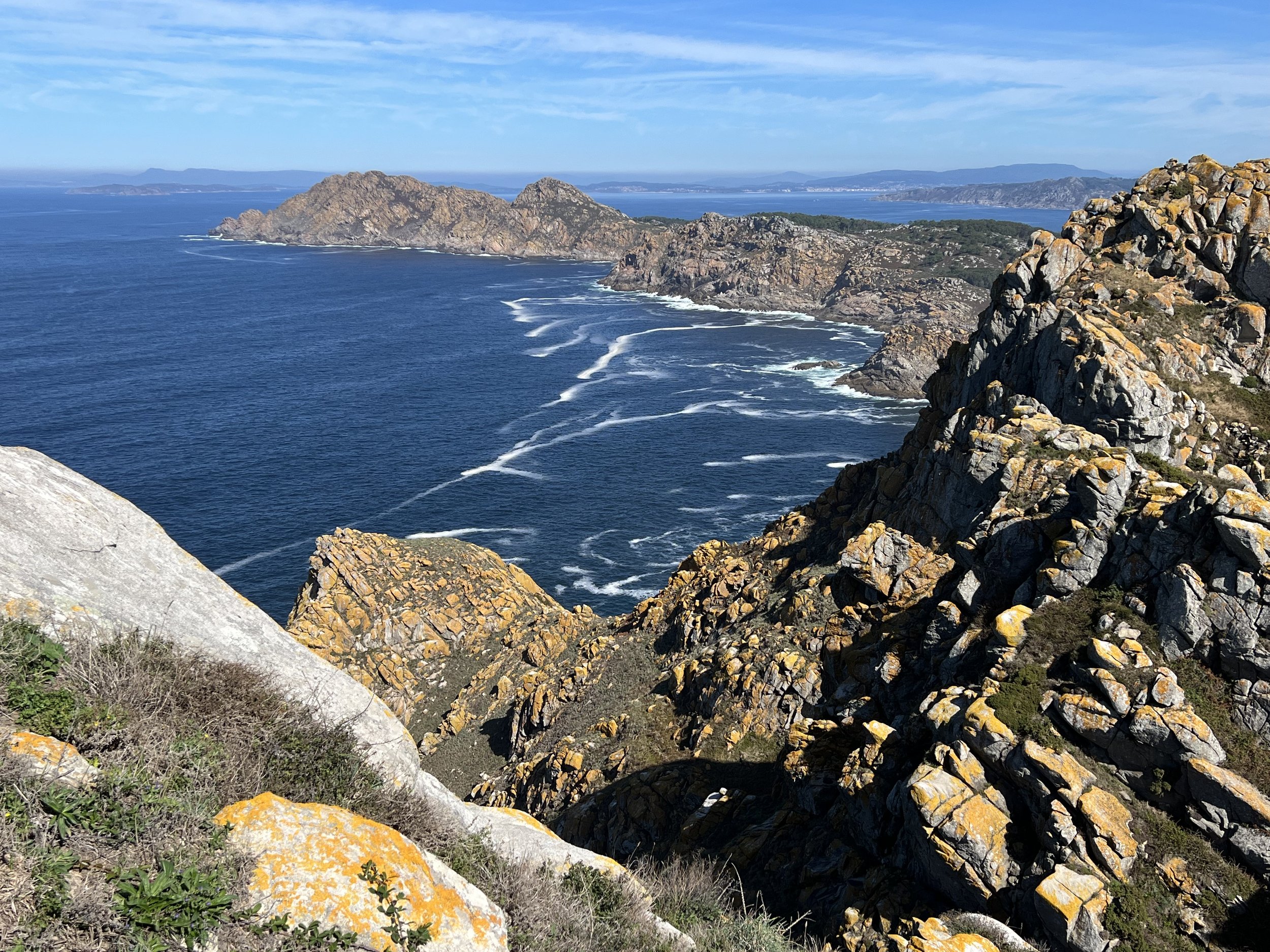
We went in search of lunch and then explored the west coast of the island. On September 19 2021 there was a volcanic eruption from the ridge on the west coast of the island that lasted 85 days. It destroyed over 3,000 buildings and the coastal highway, wiping out the town of Todoque and creating a new peninsula, jutting out into the ocean.
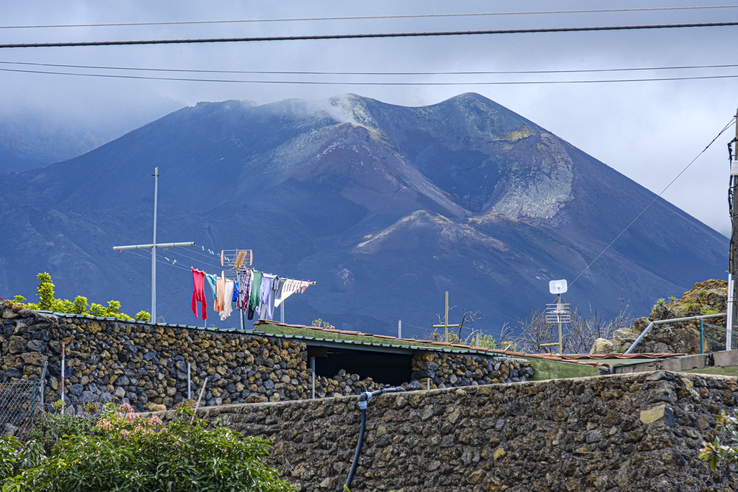
Volcano Tajogaite, still smoldering.
The highway had only recently been reopened, and its construction was still a work in progress. There were signs warning of poisonous gases and indicating stopping for a view was not an option.


Looking back across the lava field
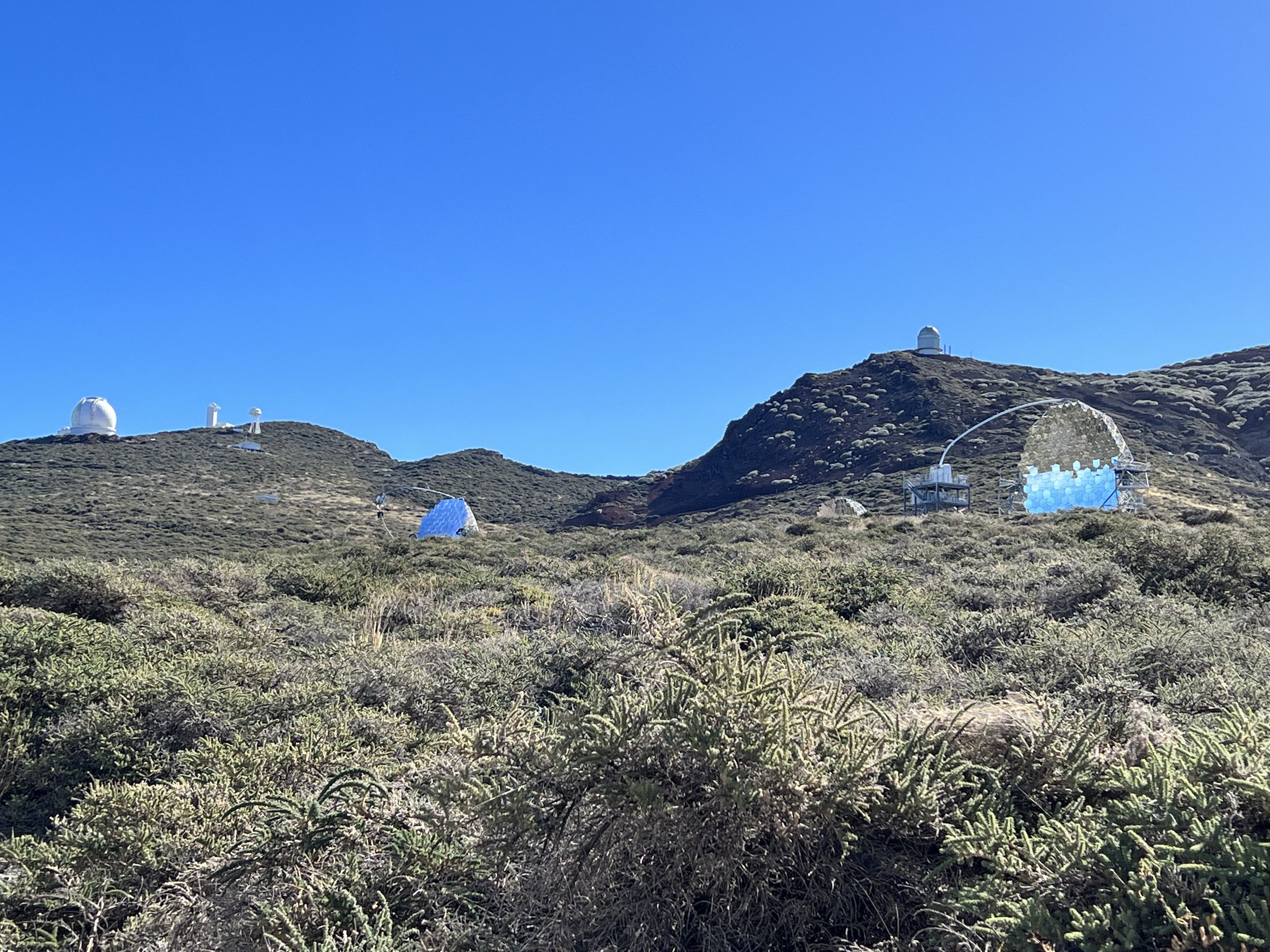
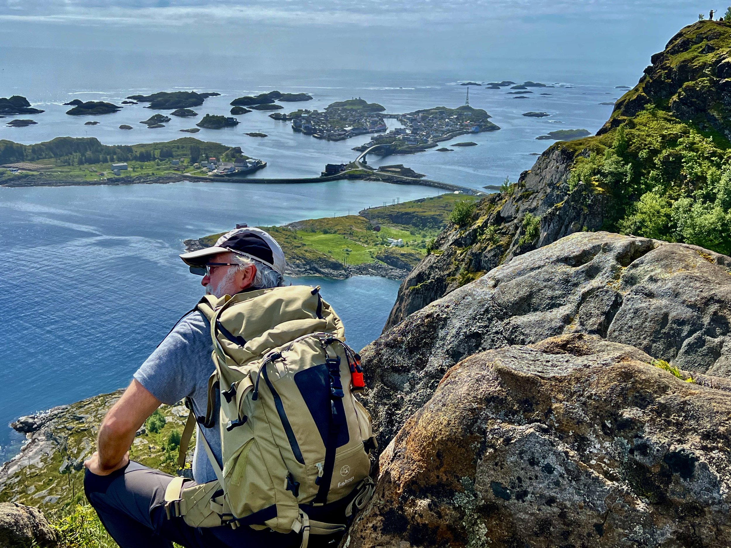
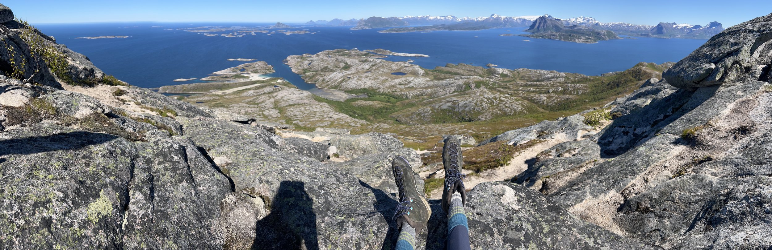
The highest point on La Palma is Roque de los Muchachos which rises 2,422m above sea level. The air is so clean and free from both chemical and light pollution that it is a center for astronomical observations with as many as twenty observatories belonging to many different nations.
The drive up to this point was wonderful as we climbed we looked back toward Tenerife to see Pico de Teide rising high above the clouds.

Pico de Teide on Tenerife.


In reference to that last photo…. no we didn’t!
Upon reaching the summit we found the observatories scattered along the rim of the crater that we had visited the previous day. The MAGIC Telescopes observing gamma rays from galactic and extra galactic sources were really cool.


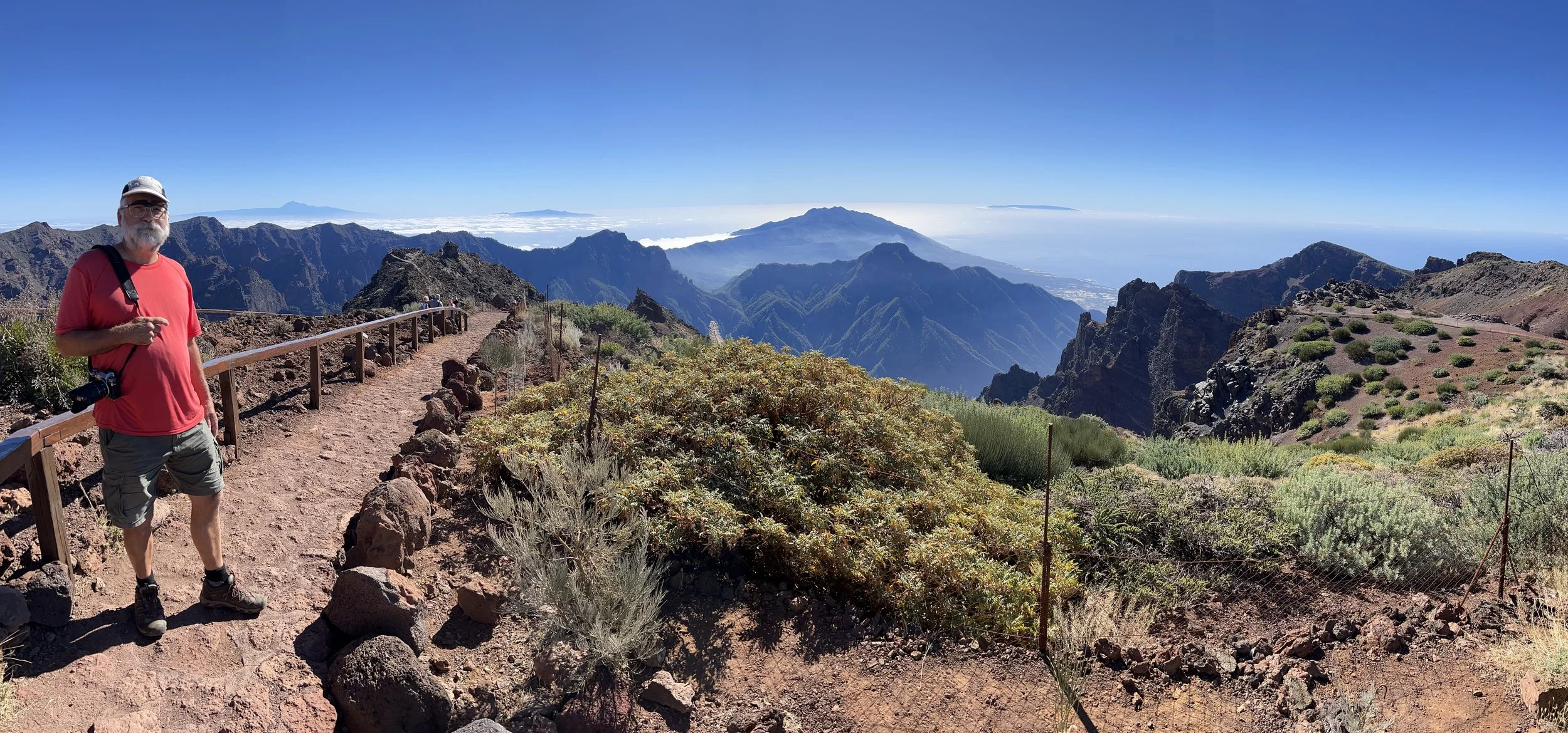
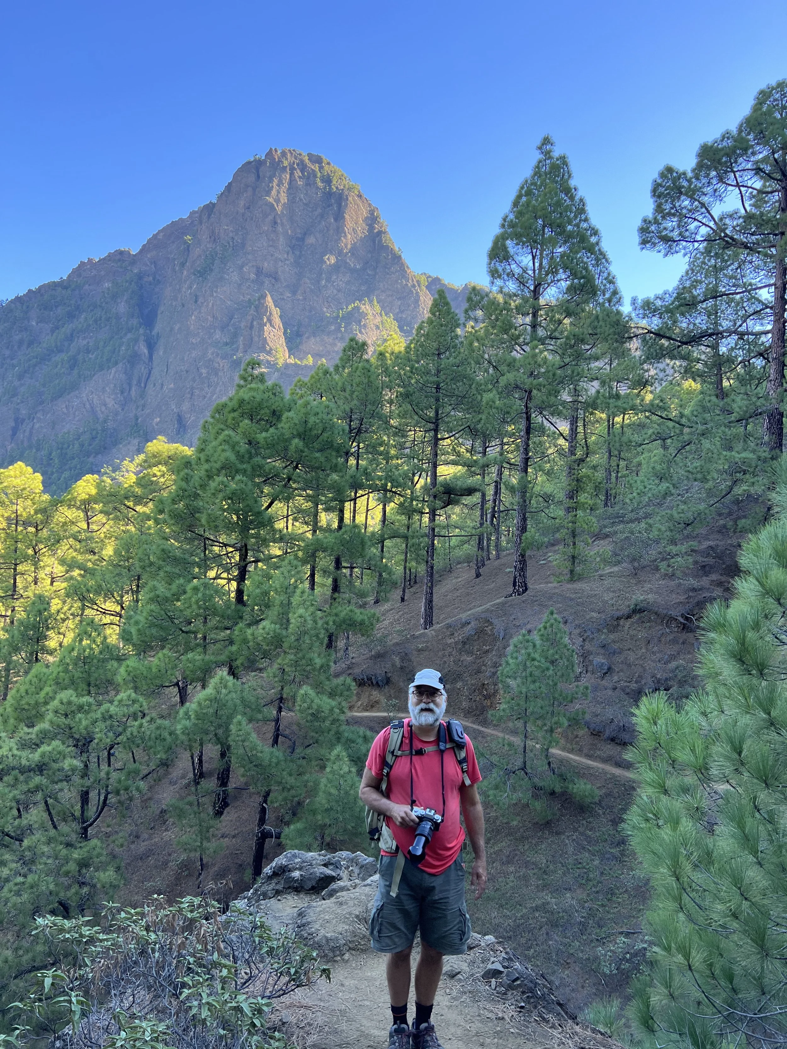
Brian walking out to the viewpoint Roque de la Muchachos.


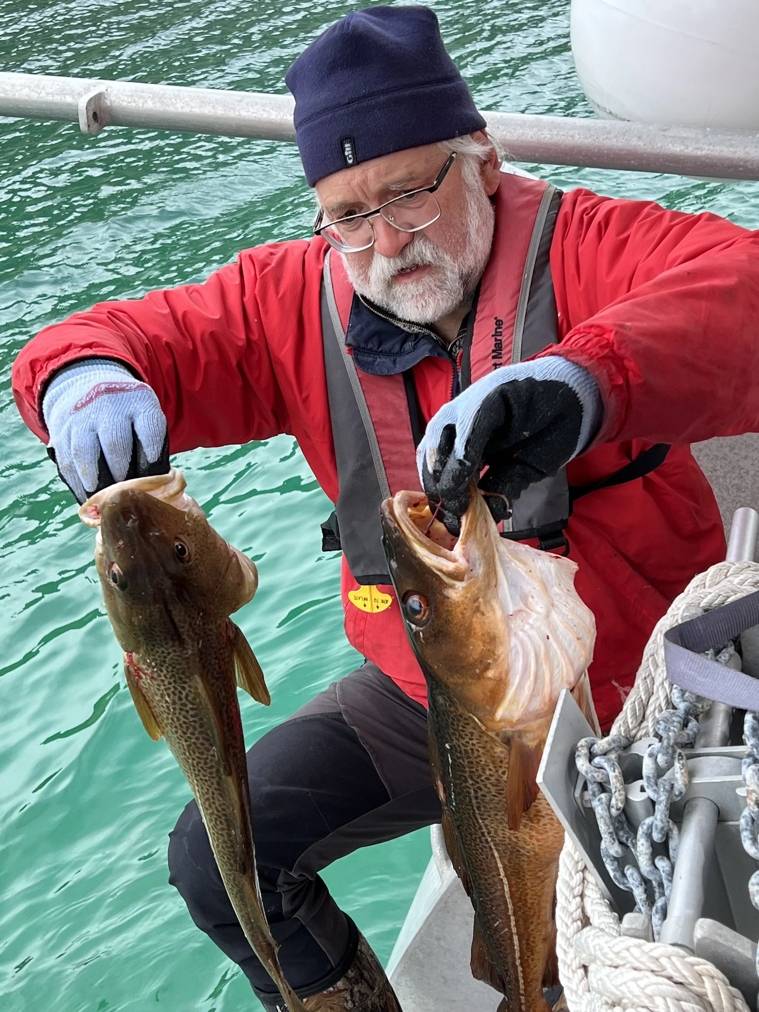
Time was slipping away. We needed to get ready for the trans Atlantic crossing. Making sure all systems on the boat are operational and in good repair. A fully stocked fridge and freezer with supplies to last us for the passage and for months in the Caribbean. We know from our previous visit that provisions are somewhat limited in the small Caribbean nations.


Once we had everything loaded, we checked the weather and calendar. It was not the best forecast, but we had to go, we had a date in St Lucia, meeting Jake for Christmas. We checked out of Europe and headed south, hoping to pick up the trade winds near Cape Verde Islands.
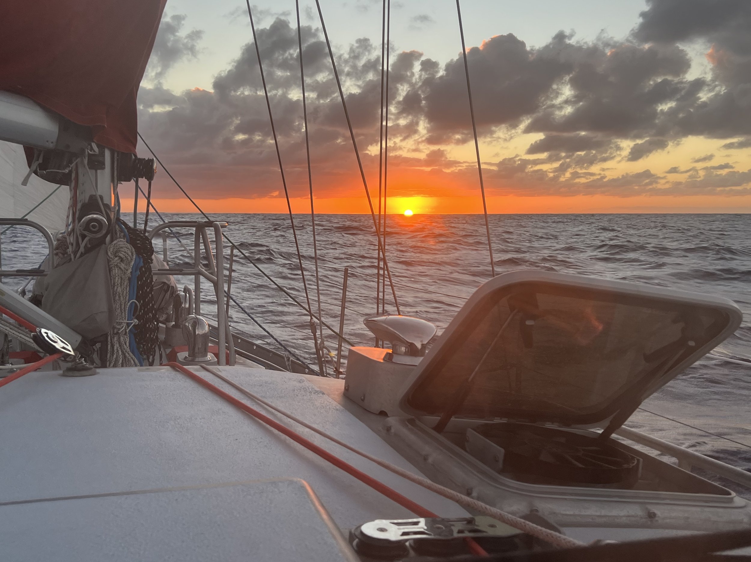
Sunset, first night at sea.

Above the clouds.

Pico do Areeiro, mountainous central Madeira.
We had an easy sail south to the main island of Madeira and tucked in under the dramatic cliffs of Sào Lourenço. The anchorage was described as being prone to swell, but we had mild weather and the couple of days we stayed there were quite comfortable. The next morning we took Dingbat (the dinghy) in to the beach and hauled her up on the rocky shore. It was the last time we used the yellow dinghy wheels; they did not survive the relaunch.

Anchorage off Sao Lourenço with Ilhas Desertas in background.
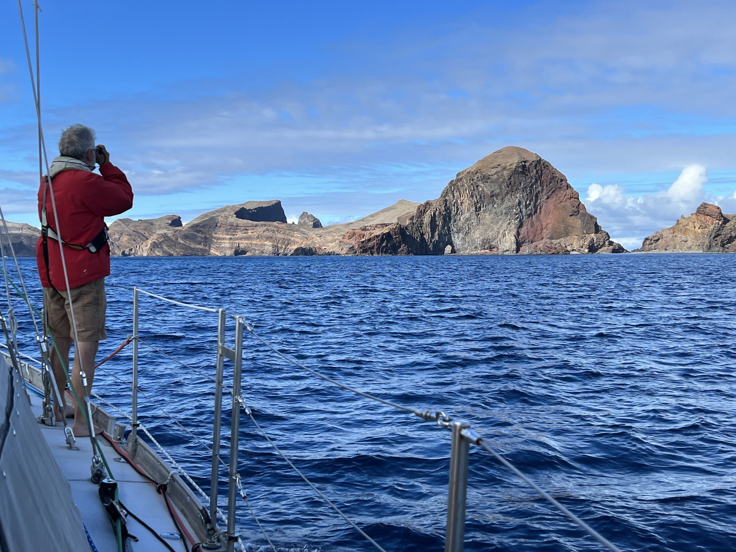


We took our lunch and hiked the beautifully maintained trail to the easternmost tip of Madeira. The geology was incredibly dramatic. The hike, although popular, never felt crowded.


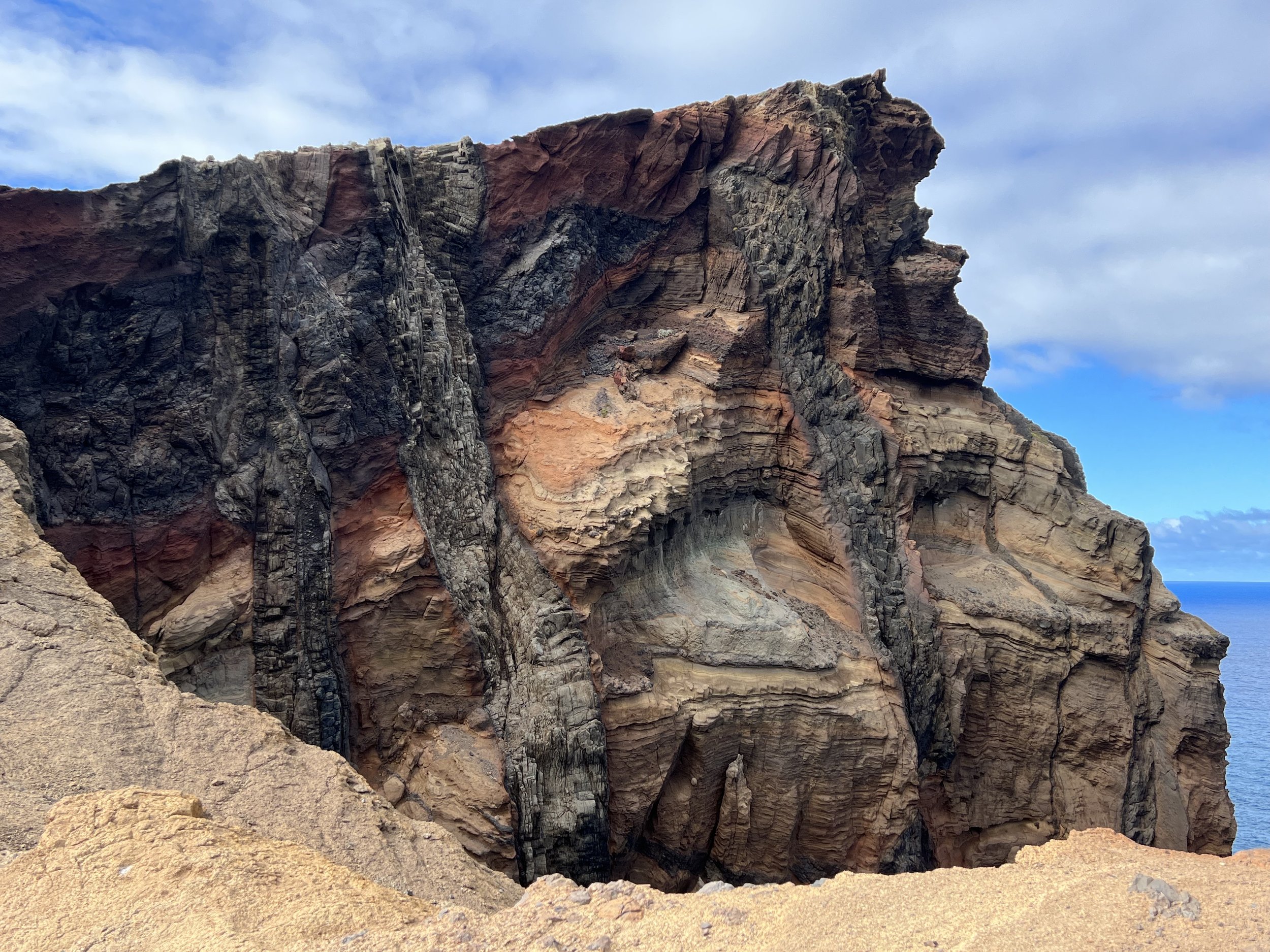


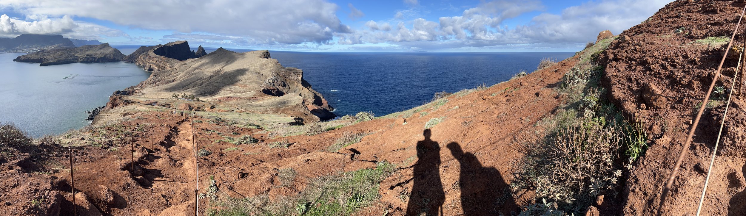
View from easternmost tip of Madeira.
There are very few anchorages around the coast of Madeira due to the very steep shoreline. We really did not want to be tied up to an expensive marina, so we made our way to the town of Machico and checked out the fishing harbor. The cruising guides indicated the bay was subject to swell, they did not mention the harbor was as well. Helacious was too large for the pontoons so Initially we rafted up to a catamaran against the harbor wall. There was some surge, but the other boat took the brunt of the movement. It was only when they left the next day that we realized how tenuous and unsafe it was to be directly tied to the harbor walls. Within 5 minutes we had untied our lines and headed out to the bay where we set anchor. To mitigate the swell we put out a stern anchor so we faced the incoming waves. Much more comfortable.

Machico, Madeira.


We rented a car for a few days and took off to explore the island. Our first day out we left Machico in heavy cloud and climbed to the center of the island for a hike recommended by Justine and Phillip, setting out from Pico do Areeiro heading toward Pico Ruivo. This hike involved some dizzying vistas above the clouds and trails that ran through tunnels inexplicably passing through the mountain. It seemed like an awful lot of work for just a footpath.
The weather above the clouds was sunny and warm, the views and scenery were just incredible. We hiked to the low point and through all the tunnels, then reversed our steps and made the steep climb back to the start.

Starting out at Pico do Areeiro.


Along the way we met these very bold birds, the Red-legged Partridge. They were completely unfazed by the passing hikers, and frequently held up the trail as they hopped along.


Then we arrived at the first of the five tunnels. We donned our headlamps and headed in. They were quite long and drippy in places, you could see the pick axe scars from when it was carved out of the mountain by hand. Just incredible to think of the work involved, and why?


The clouds were beginning to move in so we turned around and retraced our steps. The climb back up to the summit was not quite as bad as we had feared, and we got back just as the clouds closed in. Perfect timing to end a most perfect day.


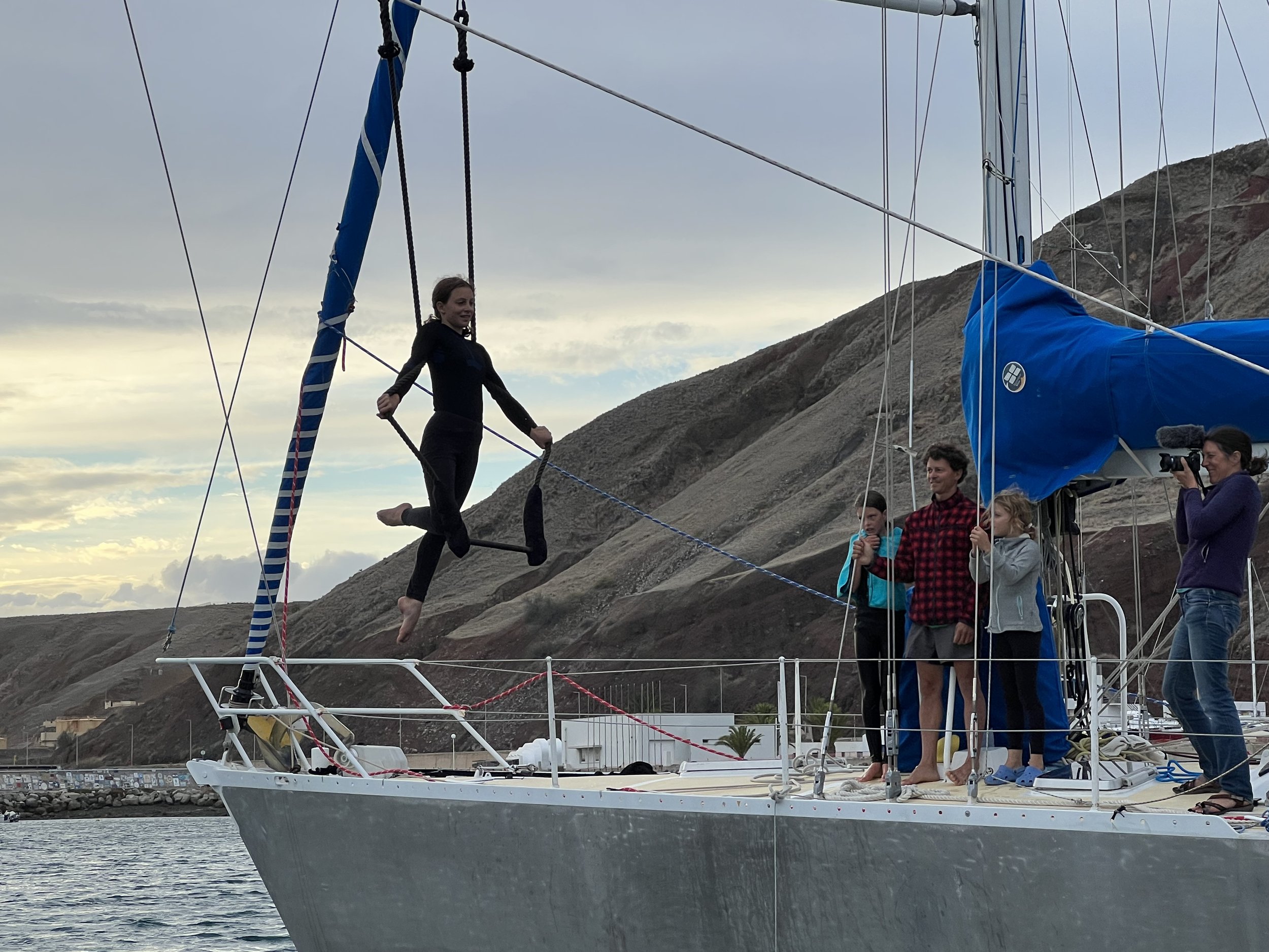
We were not alone in the bay, our neighbors were the french family on Nansen that we had met previously in Porto Santo. The girls had performed a trapeze show for the cruisers. We got to know them a lot better over the couple of weeks we were in Machico. They were a very adventurous family, prior to traveling on a boat they had cycled through South America on tandems with the girls, the youngest at the time was only 5 years old. We left them with an additional crew-mate, one of Helen’s crochet creatures.


The northern coast of Madeira
We had the car for a few days so our next outing was to explore the northern coast of Madeira. The road makes its way along the coast, following the valley sides where possible, and where there was no route along the coast, they simply carved into the mountains and went through tunnels, some were miles long. The coastline was spectacular, villages squeezed in to the few flat areas. Terraced fields climbed the hillsides towards the interior.


We found ourselves in the small town of Seixal for lunch. They have a couple of natural swimming pools, similar to those we had first seen in the Azores. After lunch, a tasty mix of steak, rice, french fries all topped with a fried egg, we walked off the calories through the backstreets and alleyways.


No trip to Madeira would be complete without exploring the levadas in the interior of the island. These are walkways along the side of irrigation canals. We selected Levada do Caldeiráo Verde that ended at a waterfall and began our walk. The nice aspect of these trails is that there is very little climbing, the paths are relatively flat as they follow the gentle slope that keeps the water flowing. The challenge was the narrow ledge we walked upon, along with the steep drop off down the mountainside. As in other cases on Madeira, when faced with a wall of rock, they simply tunneled through, the levadas were no exception.


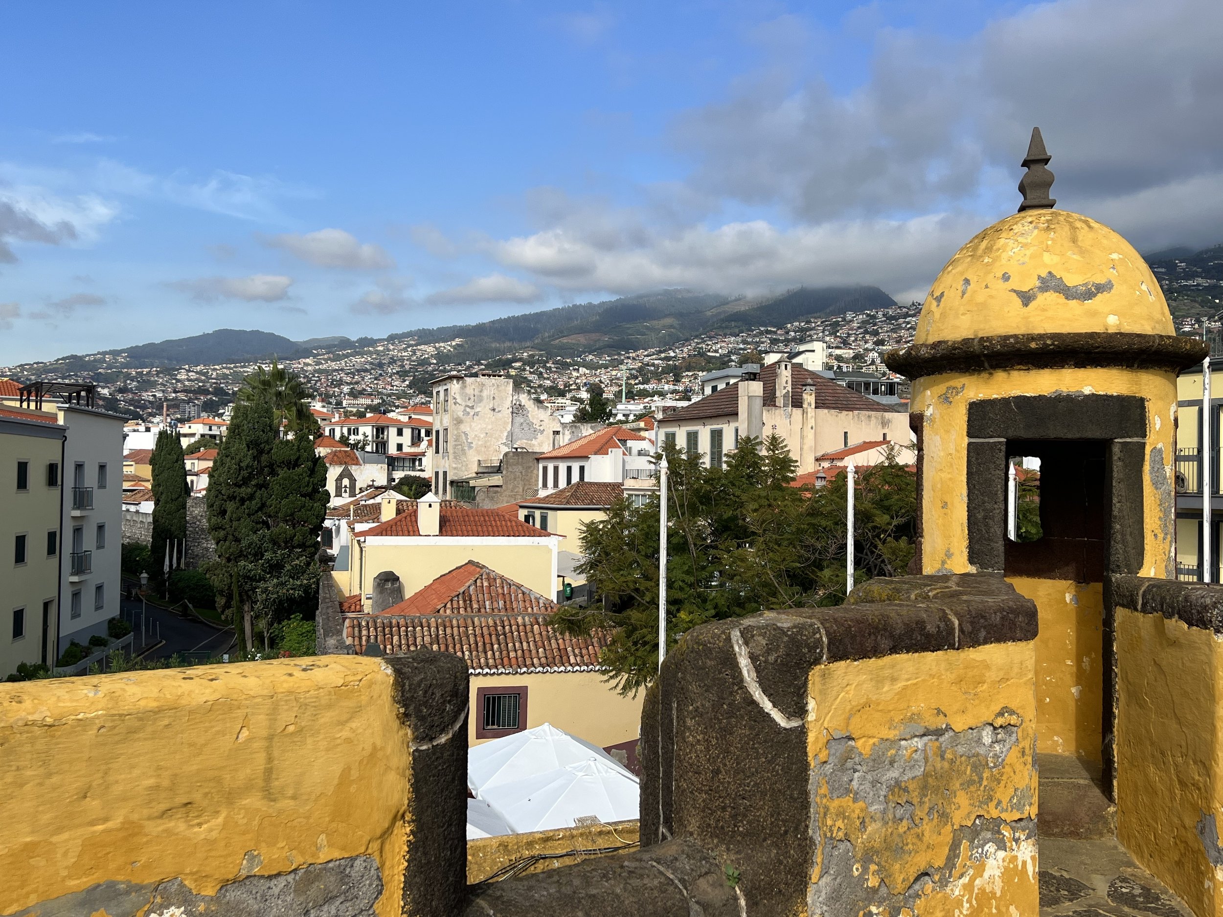
Our final trip in Madeira was to the capital city of Funchal, we caught a bus from Machico. It was unfortunate that we arrived the same day five cruise ships docked in the harbor. We have got so used to the quiet and calm of small fishing villages that when we do visit a city it is rather overwhelming. We spent the day walking around, visited the fort, the fish and vegetable markets and had a lovely lunch out. We enjoyed the painted doorways in the old part of town along Rua de Santa Maria. We bought our Madeira souvenirs, a pottery sardine and small watercolor and headed back to Helacious, exhausted.
Funchal spreading out along the southern coast.


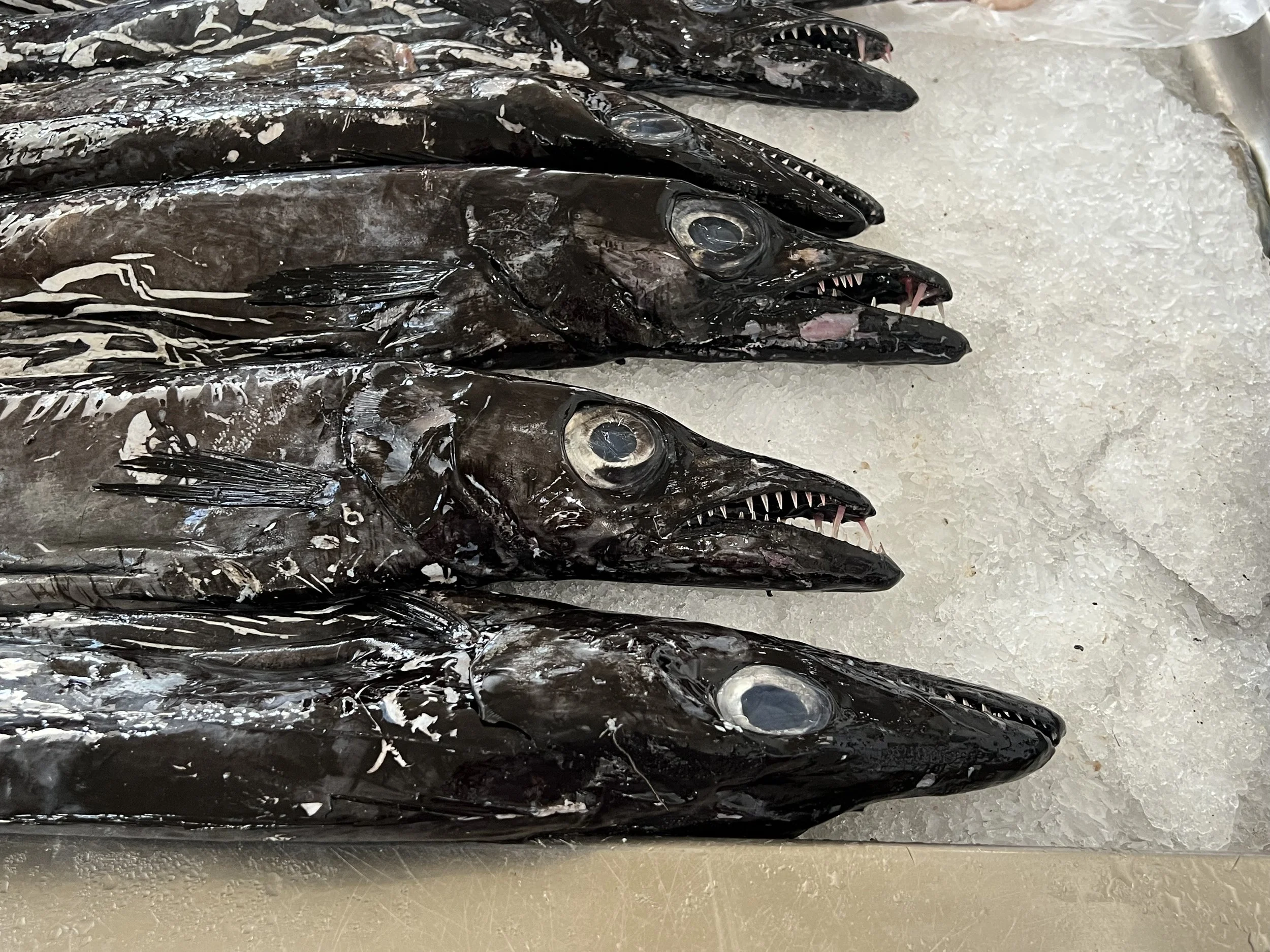
Black Scabbard fish, a lot tastier than they look.

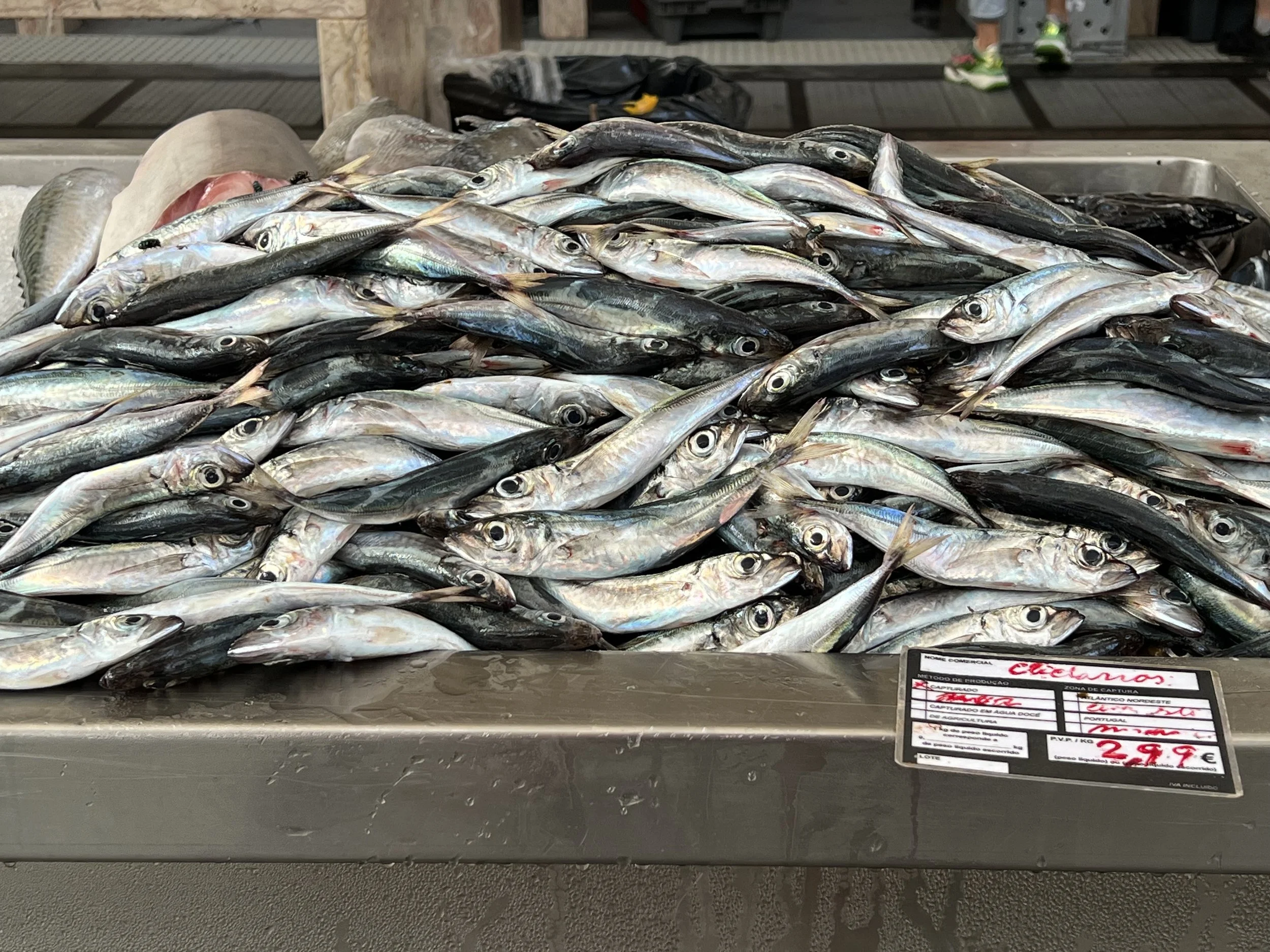


Farmers market, Funchal.


Our time in Madeira inevitably came to an end and we spent the last few days provisioning for the passage south to the Canaries. The lady at the meat counter, protected by her chain mail glove, prepared us some delicious ground beef. And then the weather was right, we left Machico, sailed out past the airport runway clinging to the hillside and spent an overnight at the uninhabited Ilhas Desertas before finally leaving Madeira waters. What an unexpected delight this island group was, so much variety packed into a small island, and the people were all so friendly. We would love to return someday.


The Ranger station on Ilhas Desertas, the hike on the island was taken out by the rock slide behind the buildings.

Island time
Beach, Porto Santo.
The passage to the Madeira archipelago from the Portuguese mainland took about four and a half days, we arrived in the harbor of Porto Santo, the most northeasterly island in the early afternoon. Porto Santo is the smaller of the two main islands, the remaining Ilhas Desertas and Ilhas Selvagens are little more than uninhabited rocks. As we approached it was clear this island was quite different from anywhere we had been before. Volcanic and arid, it looked like we were approaching Mordor.

The marina was tiny and full of boats, rafted up to 3 deep on the wall. The overflow was relegated to anchor within the harbor walls. There is just one small town on the island which was pleasant to walk around and as with the Azores, the benefit of being a member of Europe was very evident with a nice new library and official buildings. The beautifully decorated sidewalks reminded us we were still part of Portugal. The main attraction of Porto Santo is the beach. It stretches the length of the island and is lovely golden sand, a rarity in these mountainous Atlantic islands. A ferry brings tourists from Madeira, 25 miles away, for a day at the beach.


After a week in the anchorage we managed to secure a berth in the marina making it a lot easier to get on and off the boat to explore more. Just next to the harbor was a curious industrial installation; a collection of glass pipes, many bubbling and in various shades of green. Jake informed us this was a photo-bioreactor producing algae for biofuels and/or feed. Cool.
The hike around the island coastline was a favorite, and we did it many times during the three weeks we stayed in Porto Santo. It was good to just stay put for a while, getting familiar with a place and the people is nice and restful. We needed the break.


One day while we were at anchor a dinghy came by to deliver an invitation.
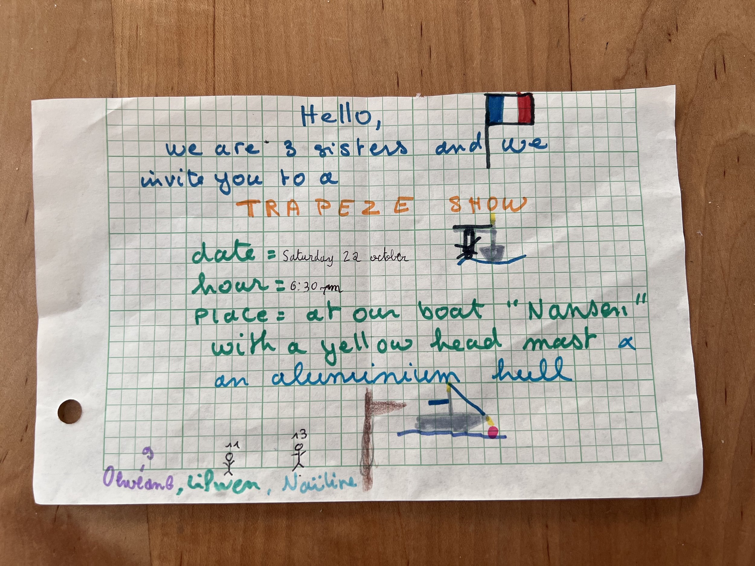
Well of course we went. Along with about 10 other dinghies we gathered alongside Nansen for the big show.


We loved Porto Santo, it was a great place to relax and just wait until we were ready to move again. We made friends, we did some boat work, we enjoyed the local food, we borrowed bicycles and rode the length of the island, we had dock parties and watched the sunsets. The bonus was the marina fees were very reasonable, three weeks (two of which were on the dock) was only 140 euro (about $150).


Helacious’ visit is recorded on the marina wall.
Then it was time to go. We wanted to make sure we had enough time to explore the remaining Atlantic islands properly and by this time it was already November. We were half way into our 90 day Shengen visa time. We said our goodbyes and set sail for Madeira.

Fog bound in Portugal.

Foggy sailing down the Portuguese coast.
Heading south out of the protection of the Rias of north west Spain, we sail south down the Atlantic coast of Portugal. This is not an easy area to cruise, the coast has no little welcoming bays nor dramatic cliffs. It is straight and broken only by river entrances, which can be extremely dangerous with the combination of onshore swell, entrance bars and strong river currents flowing out. Throw in the continuing concern about being attacked by a pod of orca, we did not dawdle in this area.

Entrance to Viana do Castelo
Our first stop was the old town of Viana do Castelo, on the banks of the River Lima. We manoevered past the breakwater and the shallow areas and called the marina on the radio to make sure there was a berth and also to ask them to raise the drawbridge to enter the marina. We were told that the marina was full but there was space for visiting yachts in the old fishing harbor alongside the museum ship Gil Eannes.


This was perfect, as in addition to having the whole dock to ourselves for much of the stay, we were much closer to the center of town. Interestingly, the Gil Eannes acted as a hospital ship for the Portuguese fishing fleet as they fished for cod off the Grand Banks and Norway. It has been fully restored and is open as a museum about the cod fishery. We felt we had covered that well enough this summer, so missed the tour. Instead we climbed the stairs to the Santuário de Santa Luzia, an impressive church with fine panoramic views all around.


Beyond the church at the summit of the hill was the excavated ruins of a substantial Bronze Age and Roman settlement, Citania de Santa Luzia. The older ruins outlined circular dwellings with a protective porch area, maybe to shelter the animals as well as protecting the main entrance. The later Roman ruins showed skillful masonry with double walls. The size of the site was impressive considering less than half is estimated to have been excavated.


We explored the town of Viana do Castelo, even the train station was an interesting building. We had the most delicious pizza lunch and checked out the fort guarding the river entrance. Viana do Castelo was a wonderful little town and we are so glad we stopped there, thanks for the recommendation Peter.


Moving down the coast we sail in some serious fog.
And arrive safely in the marina at Leixòes (pronounced Layshoinsh). This was not the most scenic stop, a commercial port full of container ships and oil terminals, but it was a strategic stop. Porto, our next place of interest to visit is inland on the Rio Duoro. The bar across the entrance is quite dangerous in strong onshore winds and the entrance can be closed to all traffic. We did not want to find ourselves stranded in this way, so we opted to visit Porto by bus from Leixóes.

Leixóes marina

The weather continued foggy and stormy, so we stayed in the marina. It was not very nice, dirty water and terrible facilities. We explored the town and enjoyed the variety of tiled houses, so colorful and every one is different. Classic Portuguese.


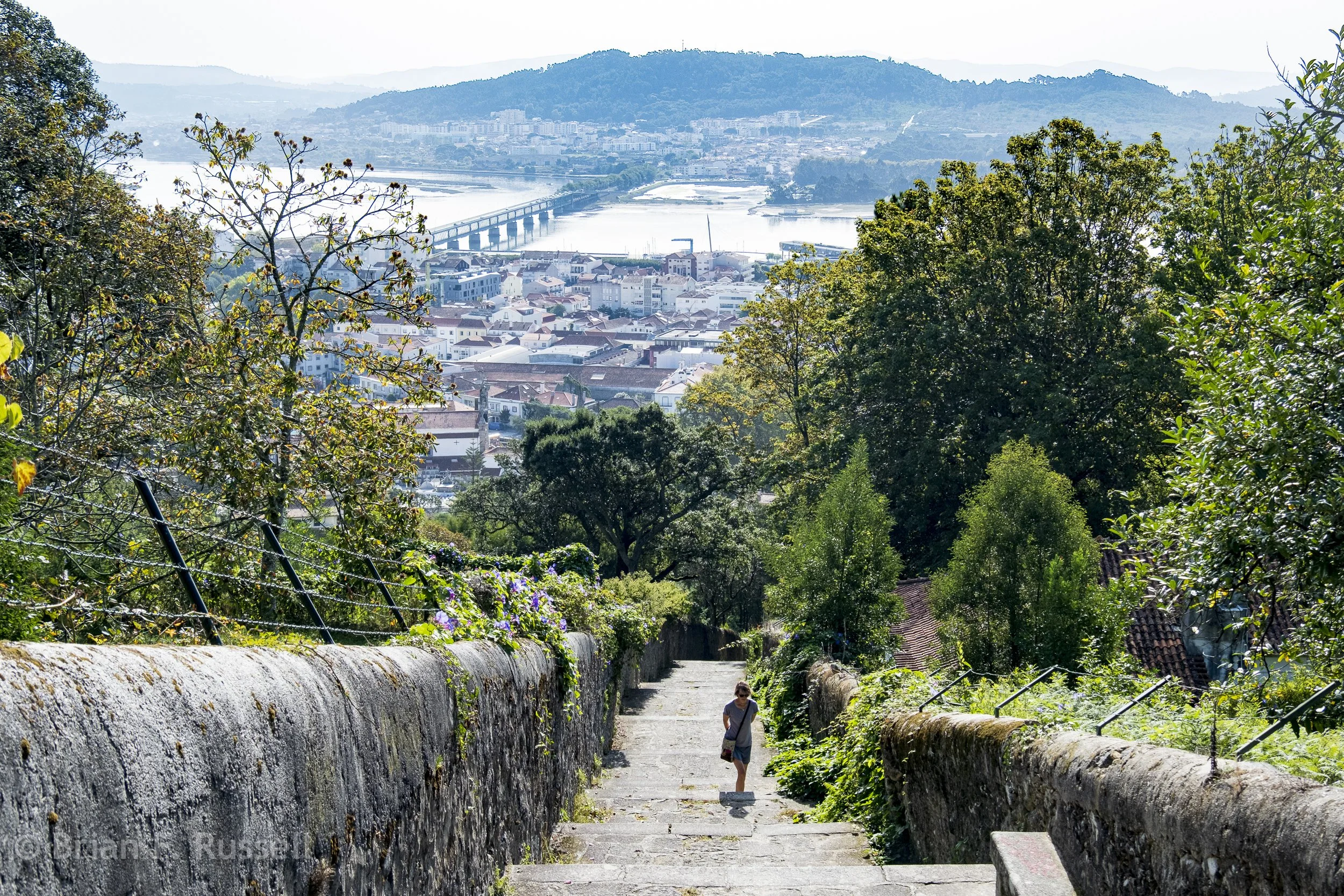
We caught the morning bus to Porto which deposited us in the center of town. The streets were packed. We had not seen such crowds in many years (think covid) and it was rather overwhelming. We stayed in the backstreets and enjoyed the multistoried buildings and beautiful tile work. The city straddles the Rio Duoro, the main commercial center is on the north shore and the port wine trading center is to the south. An impressive double level bridge connects the two.
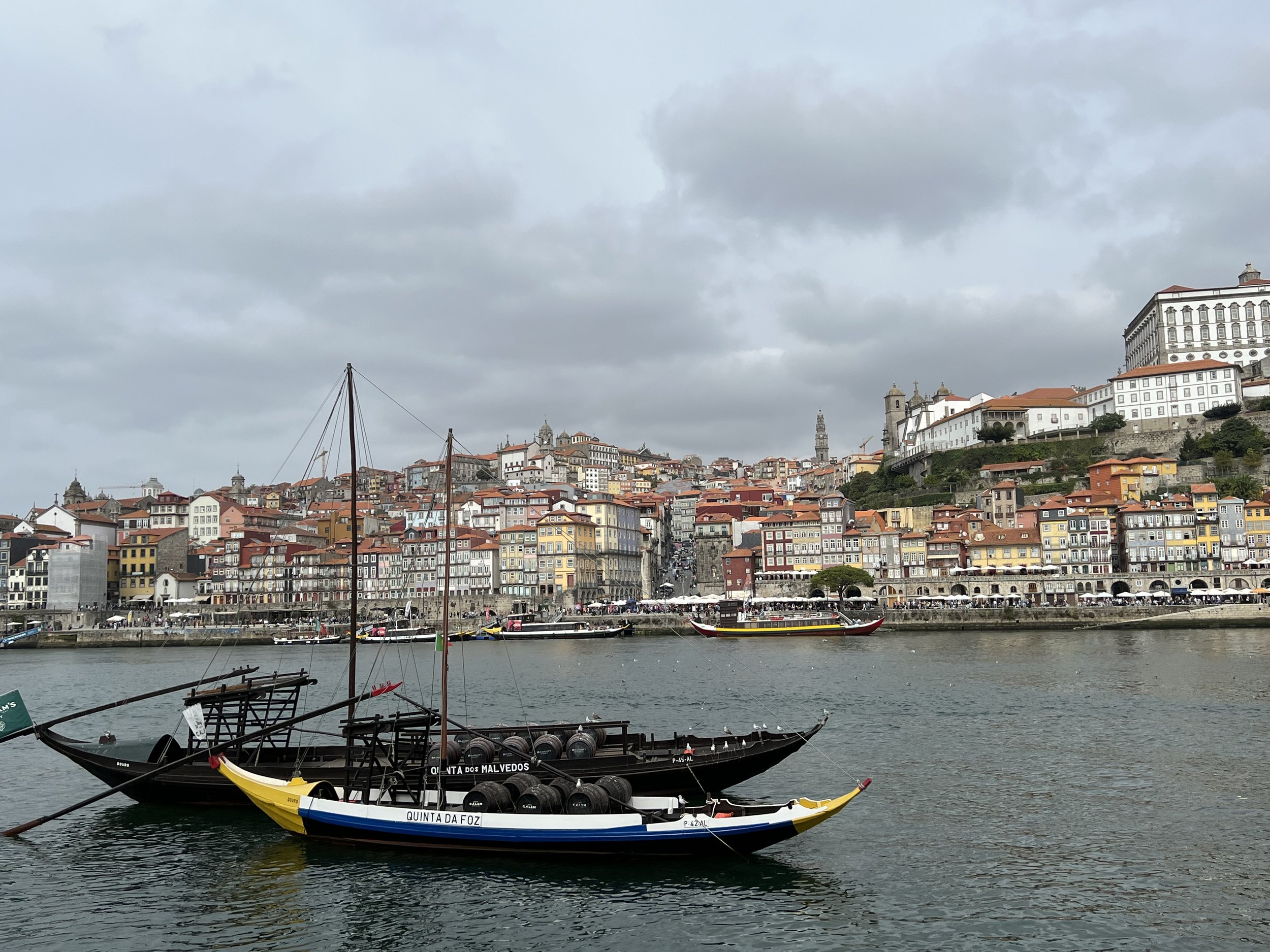
Porto from the south shore of Rio Duoro.


The reason one visits Porto is of course to sample the port. The south side of the river is full of warehouses for all the different port-houses. The streets wind around up the hill with restaurants, tasting rooms and the warehouses themselves. We opt to do a self guided tour in the Fonseca house.

Rooftops in the warehouse district.


All this time we had been watching the weather and reading reports of boats being attacked by orca. It seemed they were particularly active in the area around Lisbon, potentially our next stop. A weather window to sail offshore presented itself. We decided Lisbon will still be there in a few years and we had had enough of the orca situation. We opted to leave the mainland and head for the Atlantic island of Madeira.

Sunset glow, first night at sea.

Gorgeous Galicia.

Lighthouse off Cabo Villano
The sail from Å Coruna around the Costa da Morte, ominously named due to the rugged coastline and frequently inclement weather, was fine, fortunately, with no issues from weather nor orcas. All of our flotilla arrived safely in the first of the Rias of Galicia, Ria de Camariñas.

Camariñas
Camariñas is not the most pituresque of towns, it is a working fishing village with a small marina for pleasure craft. We anchored off the shore and took the dinghy in to explore with friends Mads and Ava from their boat Athena. We explored the town and discovered it is famous for its lace making. There was a lovely shop selling fine examples in addition to a museum and a statue honoring the lacemakers of Camariñas.


We walked around the waterfront and checked out the fishing boats where they were busy mending nets.. We had a most delicious lunch and then explored the back streets. We saw the first of many strange small sheds built up on high supports. We puzzled what they could be used for, drying hams? Storing grain? Drying grapes? We returned to the dinghy and found we had misjudged the tide, wet feet were in order to retrieve the dinghies. The following morning we bid farewell to Athena crew and headed south.


We sailed around Cabo Finisterre, the westernmost point in Europe, and tucked into Ria de Muros, the winds became quite strong toward the end of the day and we had to dock in the marina with 27kt crosswinds. Ria de Muros is the least developed of the rias and the old fishing town of the same name is very quaint. The maze of cobblestoned streets and 18th century stone buildings made it a very pleasant stop for a few days.

Muros


Muros church, built in 15th century.
Muros was a good place to leave the boat and go on an excursion to Santiago de Compostela. We took the 2hr bus ride which was a delight in and for itself, winding through the countryside and joined the pilgrims from all over Europe on the final approach up the hill to the cathedral the end point of the pilgrimage known as Camino de Santiago.

Cathedral of Santiago de Compostela.
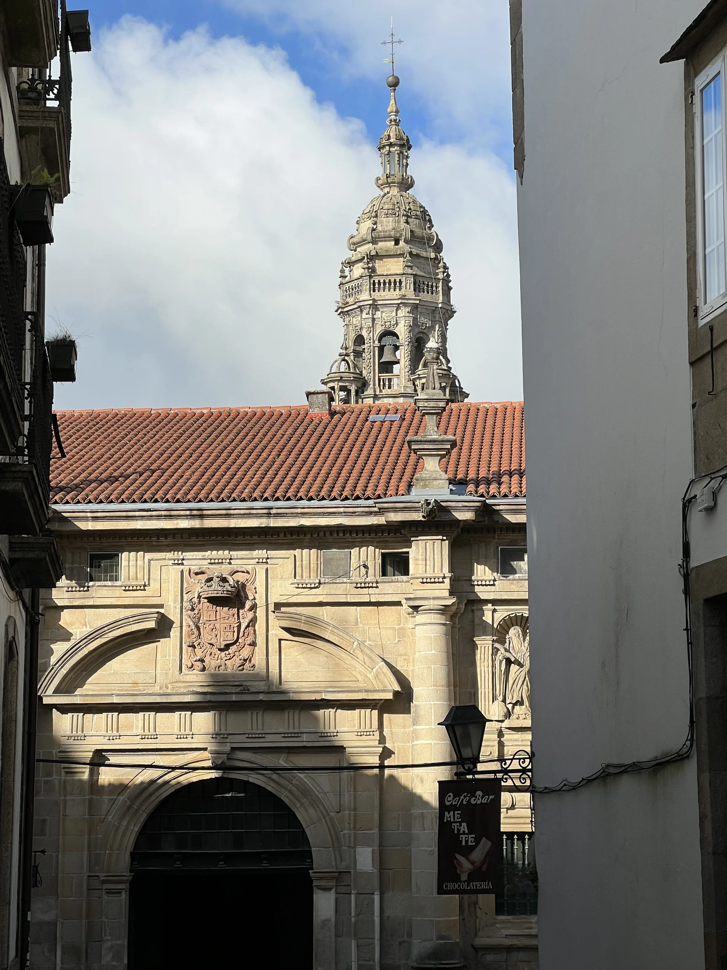


The cathedral is massive and very ornate, but that is nothing compared with what we found inside. The altar under which the remains of Saint James, first disciple of Jesus and patron saint of Spain are buried is covered in gold leaf and has every variety of cherubim and seraphim dancing along the outside.


We explored the streets enjoying the beautiful buildings and colonnades.


The next day we left Muros and motored south into the first of many foggy days. The day warmed up and the fog cleared as we rounded the cape and headed for Isla Ons, one of the three barrier islands that protect the Rias from the Atlantic storms. We had previously applied for the permit giving us permission to anchor in the islands for the week, and started with the northernmost island. The anchorage was rather rolly and uncomfortable so the following day, anticipating similar swell after visiting friends Iain and Jackie of Fatjax we headed into the shelter of Ria Pontevedra and anchored off the fishing village of Combarro.

Granaries lining the waterfront in Combarro.
Here we finally learnt purpose of these small stone huts, they are granaries (horreo) for drying corn as feed for the pigs to make the delicious Galician hams. Combarro has an unusually high number for which it is known in addition to the eight stone crosses placed throughout the village. All the old fishing homes have at least one window facing the sea, to watch for the return of their loved ones.


After a couple of days we headed back to the barrier islands, Islas Cies, and anchored off the beautiful beach on Isla del Norte. Here we spent four relaxing days, waiting for the winds to take us south, out of Spain and into Portugal.

Isla del Norte


Time to head south.

It was now well into September 2022 and we could see the weather was changing. There was no time to be lost, we had to leave Scotland and head south to get across the Bay of Biscay before the winter storms began.
We left Oban early September 12th and sailed south through now familiar waters, down the Sound of Jura and past the Gulf of Corryvreckan. The currents were strong and with us so we made good time and did a quick overnight stop at Gigha where we transferred the dinghy from the davits to the front deck, much more secure for a big ocean passage.. The next day we took down our UK courtesy flag and set sail for Spain.


The forecast was showing the remains of a low passing across the Bay of Biscay, so we decided to pause for a day in Ireland to let it pass before we embarked on the four day passage to Å Coruna, Spain. The closest marina was Kilmore Quay on the south west coast of Ireland. We could not get in touch with the harbormaster to make sure there was space, but we thought as it was past the busy season and it was not a weekend, there was bound to be space. As we approached a German boat who had been ahead of us radioed back to say it was very full, but we could raft up to them on the quay. For that we were very grateful as when we finally got in the tricky entrance, we could see this was a working port, it was packed full of fishing boats of all sizes. We tied up and slept. The next morning they left and we claimed the one free spot next to the lifeboat.
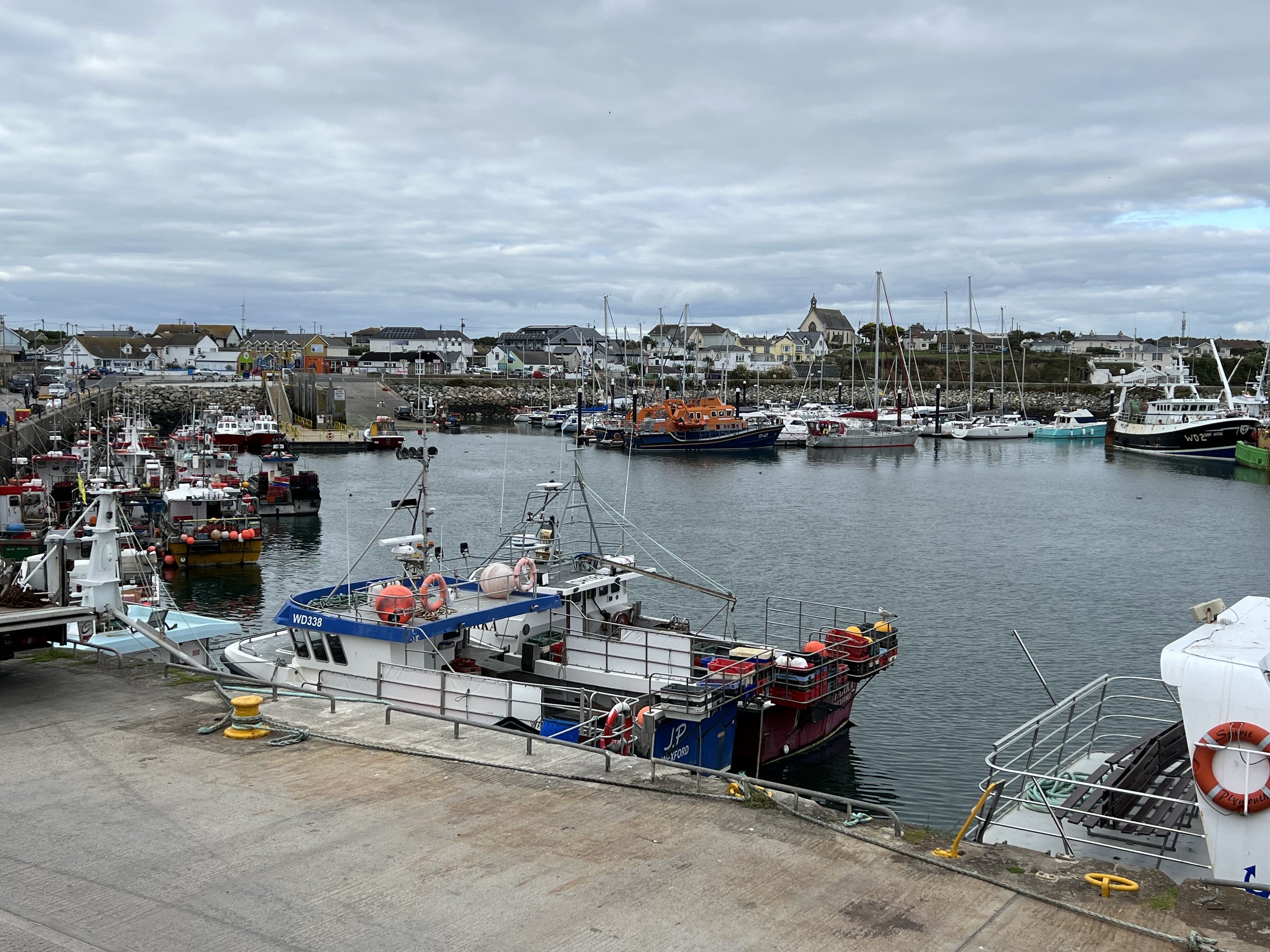
Helacious in Kilmore Quay.


The following day we left in the early morning, bound for Spain! The forecast had calmed down, to the point we were having to be careful to stay in the wind and not get overtaken by the high coming off the southern Irish coast. The passage gave us some lovely sunsets, with an eerie glow in place of the “green flash”. We passed close to the Queen Mary, heading for New York, and toward Spain the traffic got quite heavy at times, there was no napping at the helm.


The Bay of Biscay was kind to us and we approached Å Coruna as the sun was rising on the fifth day. We sailed past a flotilla of five sailboats leaving to head west on down the coast. There have recently, in the last few years, been pods of orca attacking sailing vessels. The attacks getting more severe and more common and frequently disabling the boats by damaging the rudders. The flotilla was a group hoping to avoid orca attacks, or if it happened to have a friendly vessel nearby to assist. We heard later four of these boats were indeed attacked, one came close to sinking. We were very lucky to arrive unscathed.


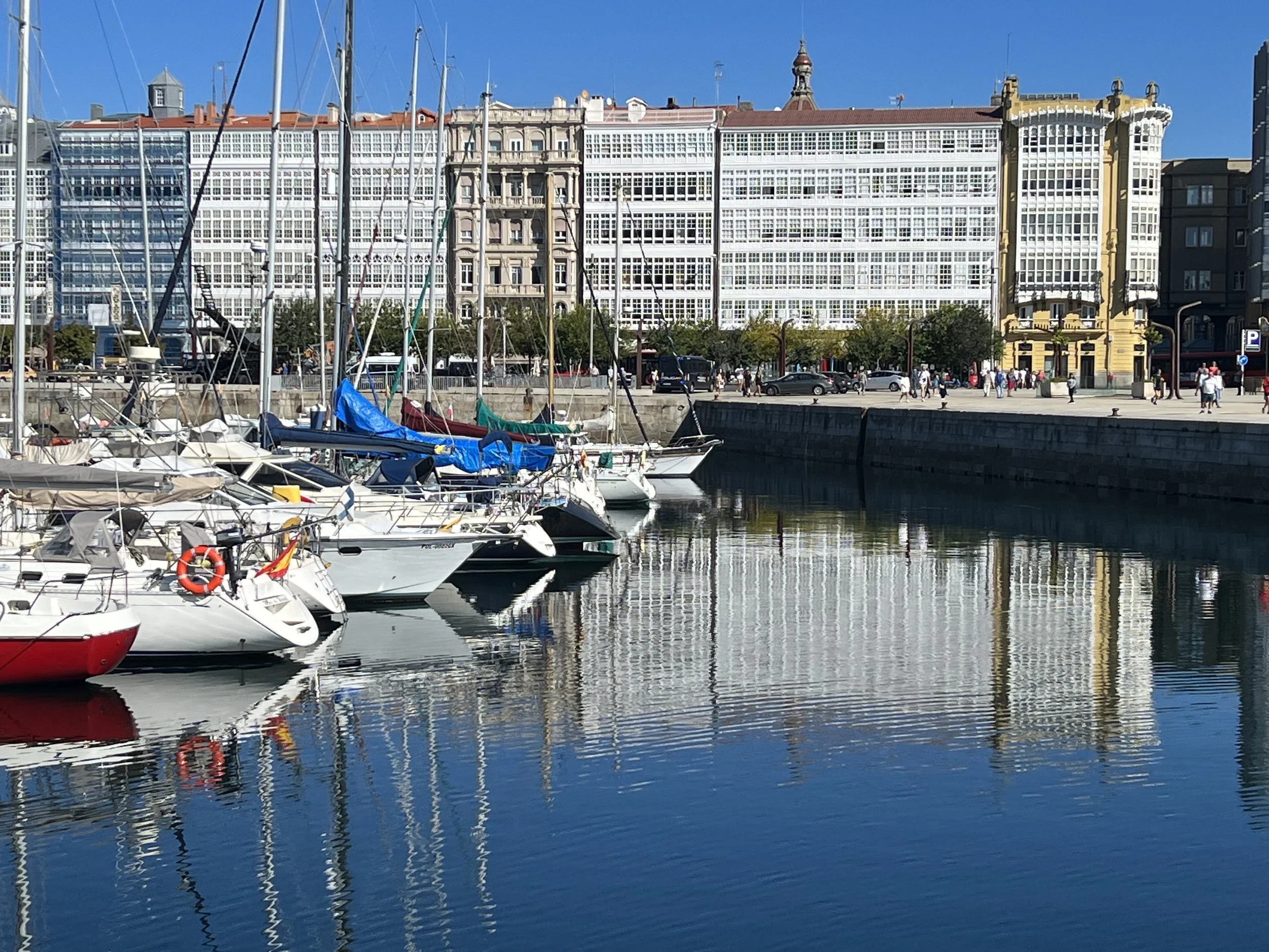
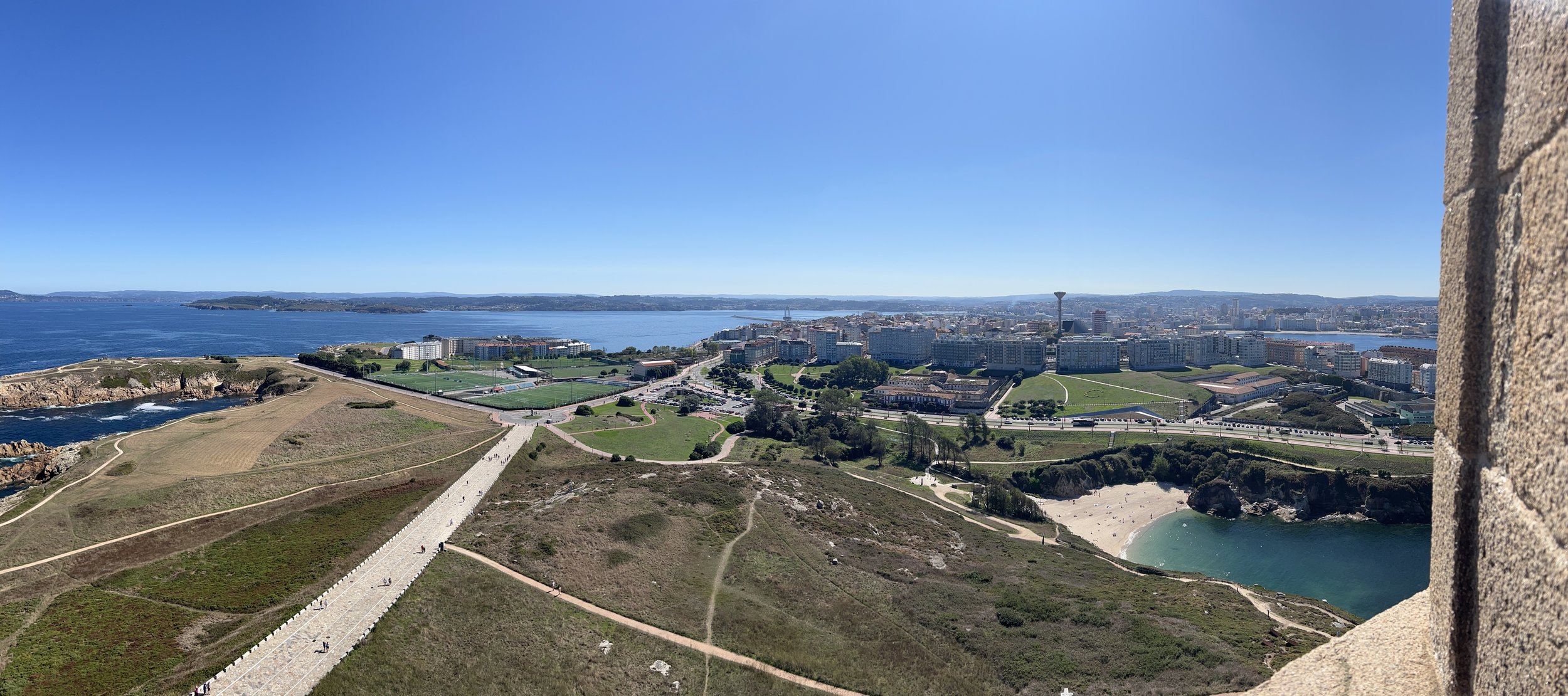
We checked in at the police station and the Shengen clock started to tick, we had 90 days to enjoy Europe, then we must leave. We spent three days in Å Coruna; it is a lively city, a perfect blend of ancient and modern. Busy, but not too busy. We enjoyed the narrow streets lined with bars, restaurants and shops. Most were closed as we wandered around in the morning, they open for lunch (after 1pm) and really come alive in the evening (after 8 or 9pm) when we are often back on Helacious. The Spanish eat so late we have not been able to adapt, so we stick with lunch out. The buildings along the waterfront all have the characteristic glassed-in balconies or galeria, an architectural feature introduced in the late 19th century, presumably to give ventillation but protect from the weather.

Waterfront in Å Coruna. Once again the marina is right in the center of town, perfect.


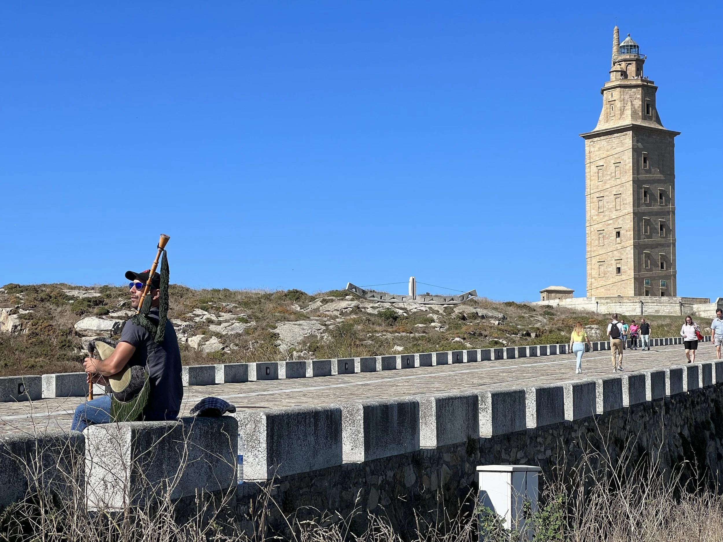
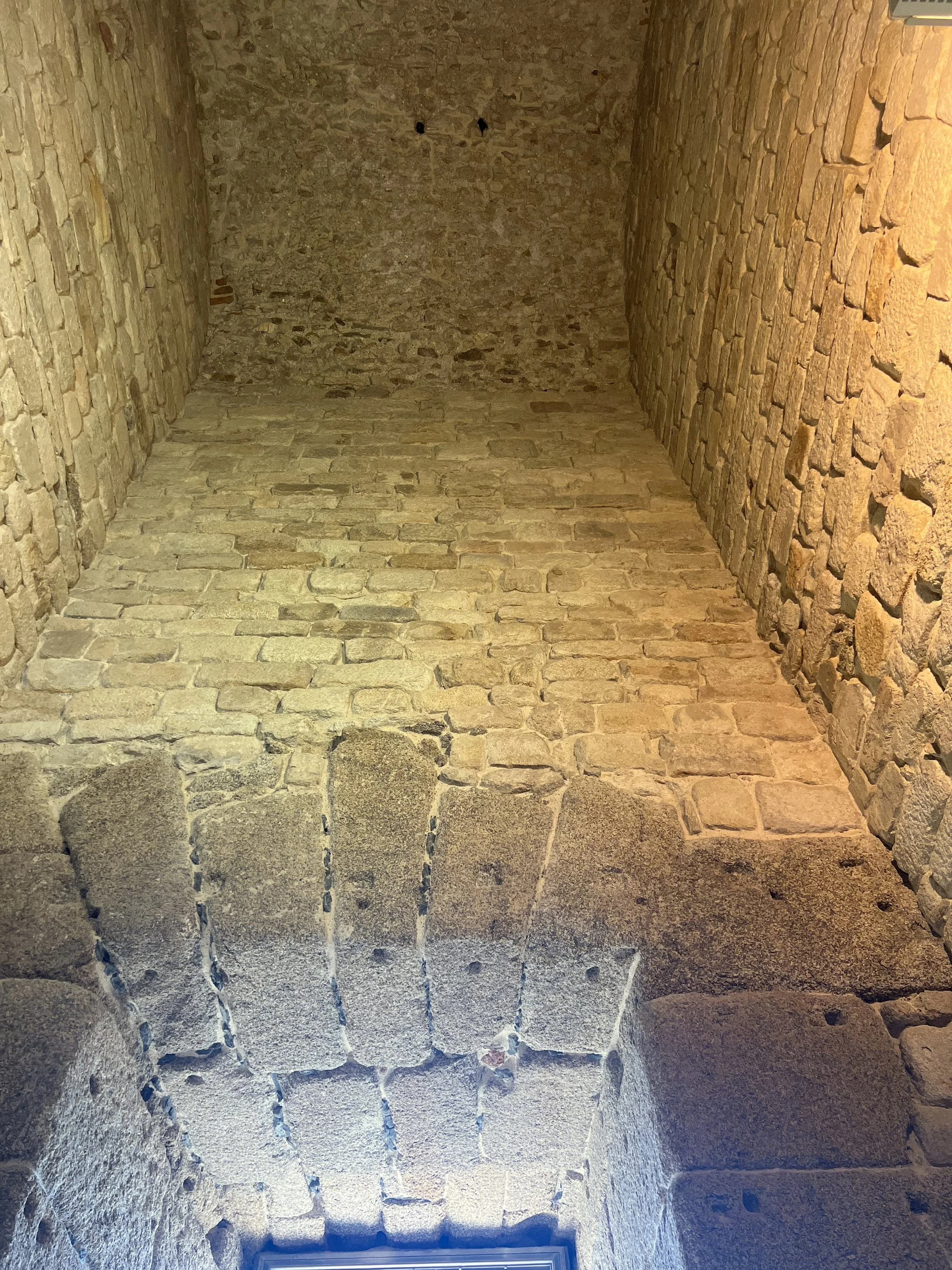
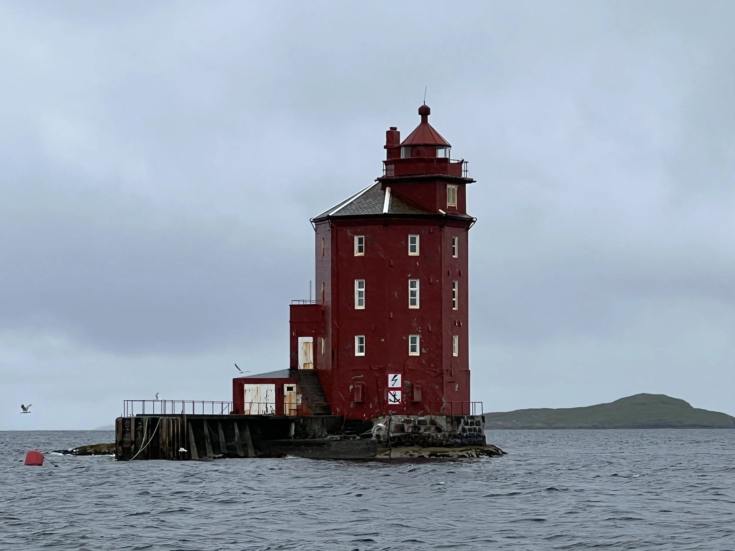
We explored the Torre de Hérules, the oldest lighthouse in the world, built originally by the Romans, modifed and substantially renovated by an enlightened architect in the late eighteenth century. It is still in use, we saw it as we passed in the final approach to Å Coruna.

Torre de Hércules


We spend a lot of time in the grocery store, the wonderful meats and cheeses, olives and wines were a delight. Soon however it was time to leave. We were gifted some industrial strength firecrackers, to be used as an orca deterant, which we hoped never to have to deploy. We arranged our own flotilla and early one morning five boats left Å Coruna as the sun was rising.


Family time

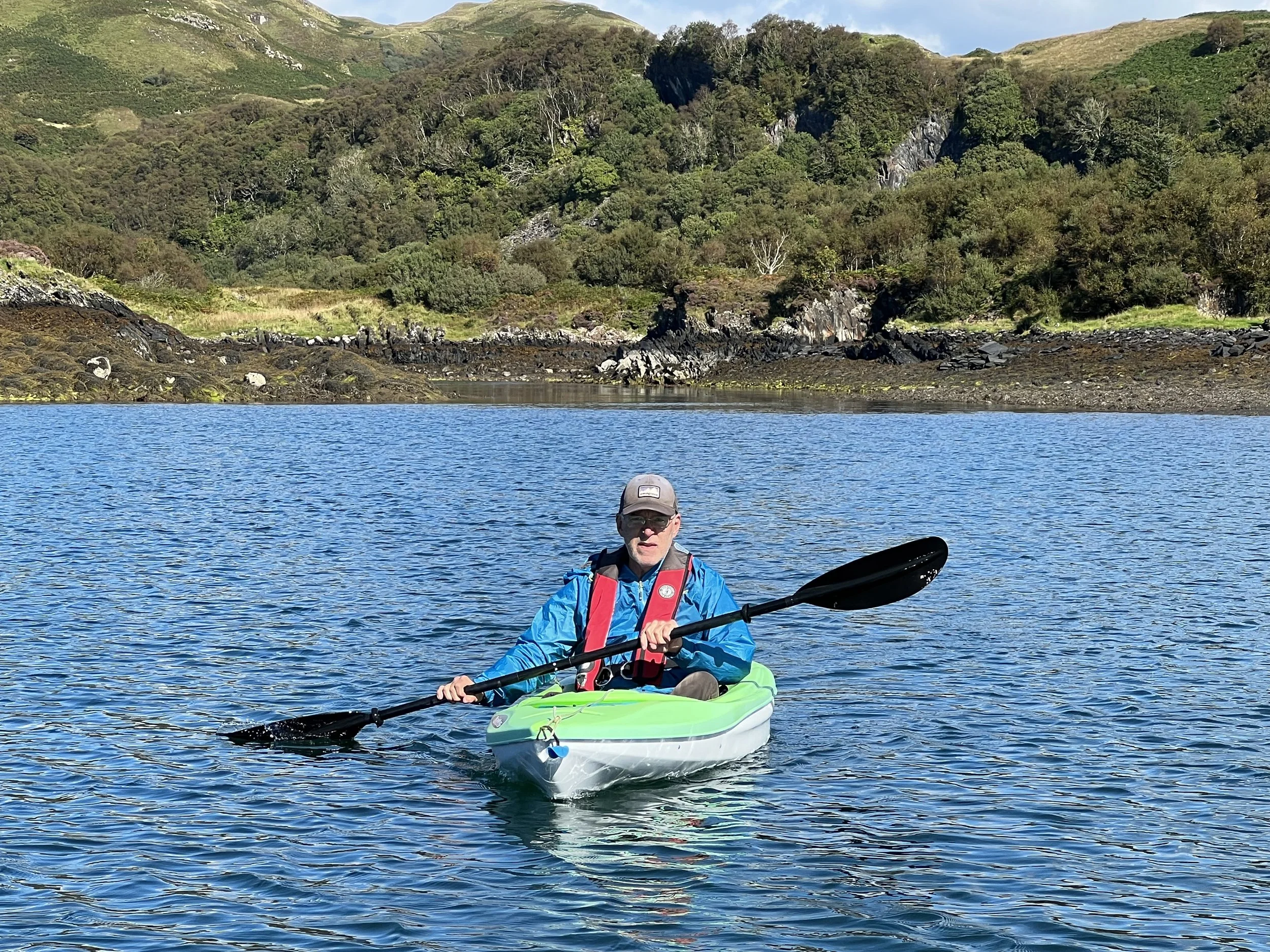
Russells, and a Russell to be, on the ascent of Am Bodach
We sail back to familiar waters on the west coast of Scotland. Our first port of call was to meet up with Peter from Supertramp, our companion on a number of the more memorable hikes in Norway. We explore Dunstaffnage castle, admiring the way it rises up from the rock, and enjoying the stonework of old fireplaces, kitchens and the chapel.


Following that we arrived in Oban in time to stock up with good food and to have our freezer checked out and hopefully fixed before Mark and Grace arrived from Colorado to spend a week onboard.


Once our guests are onboard we set off for a circumnavigation of Mull. First stop Puilladobhrain anchorage and a trip to the pub. The next day we set off around the south coast of Mull and anchor in Ardalanish bay. The fishing was good, Mark and Brian caught many mackerel for dinner that night.


We motor through the channel between Iona and Mull and on to check out the Staffa rocks. We anchor for the night at Gometra and enjoy a walk around the island. On to Tobermory and a sail down the sound of Mull marvelling at the waves thrown up by strong currents before heading back to Oban for more freezer work.


We manage to squeeze in a little fun on the water and a hike around Kerrera too.


In no time a week was up and we were off to meet up with the rest of the family for the epic final munro. Justine and Philip had been bagging munro’s for around 10 years and they had saved Am Bodach for the final ascent. We were all determined to be there and to climb it with them.

Castle Stalker on the way to Kinlochleven.
The gathering began in Kinlochleven, it was touch and go whether everyone would arrive in time. Flights from France and Memphis with little time for delays and transfers left the poor organizers in a tizzy, however it all worked out and soon we were all together. The large number gathering in the parking lot the next morning was a testament to their popularity, especially as the weather forecast predicted gale force winds for the day.


The prossecco was shared out, the piper tuned his pipes (oxymoron there I think) and we were off.


The ascent was steep, and the wind did indeed howl, but then we got to the ridge where there was potentially a real danger of being blown off, and yet the wind seemed to scoot right over our heads. The final push and subsequent celebration on top was in fine conditions.


We all did it!
To complete the story, we safely and slowly descended. The weather turned and we were pounded by iceballs, which are really quite painful. The evening celebration was appropriately with haggis, tatties and neeps with plenty of whisky and the next day we staggered home. Thanks Justine and Philip for a very memorable weekend.
A full video telling the story is found here
https://youtu.be/QptVbm9m5TE

Favorite anchorages of Scotland
We spent the summer of 2021 then May and August of 2022 sailing the west coast of Scotland. We had not posted much of the 2021 trip as this blog was on hold for a while. I would like to catch up with some of our favorite spots, just for the photographic record.
Sanda: Just off the tip of the Mull of Kintyre, only a fairweather anchorge, fortunately we had the calmest of all days.
Sanda


Gigha: Ardminish Bay, Gigha is known for the Rhododendron collection at Achamore Gardens and the halibut at the local restaurant. Unfortunately we missed out on the halibut as we arrived too late and there was no room for us. The gardens were very pleasant though.

Ardminish Bay


Islay: Anchored off the Lagavulin and Ardbeg distilleries on the south coast of Islay. A fantastic walk to explore the early christian Kildalton Chapel and the Celtic Cross. Then an instructive tasting at the Ardbeg distillery.

Lagavulin Distillery


Oronsay: This small island is connected to the larger Colonsay at low tide. Here we learnt the trick to mackerel jigging from a friendly fisherman, we were also gifted mackerel and crab to keep us going. We walked across the causeway to Colonsay and visited the Oronsay priory.

Anchorage off Oronsay.


Jura, Loch Tarbert: This well protected loch has a tortuous entry with very high tidal streams, made accessible only at the turn of high tide. The area is famous for the raised stone beaches, remnants of the retreating glaciers during the Ice Age.

Raised stone beach, Loch Tarbert, Jura.


Gometra: The anchorage is actually in the channel between Gometra and Ulva, which dries out at low tide. There is a one track bridge connecting the two, suitable only for hikers and all terrain vehicles. The Gometra gallery was a wonderful surprise and we bought our favorite Scottish souvenir there, a set of Gometra stamps. A hike around and over the island, surprising deer in the bracken was a highlight of our Scottish summer.

Anchorage between Ulva and Gometra.


Anchorage from Gometra.


View from the top of Gometra.


Lunga: The calm weather permitted an overnight stop here. The island just northwest of Staffa is known for the large puffin colony that nests here. The puffins had left the burrows but we caught some rafting at sea. We were also delighted by the evening serenade of seals singing to us. A special place.

Puffins at Lunga.


Kerrera: The main town of Oban and the island of Kerrera across the sound, are two of our favorite spots on the west coast. We spent many days in this area, hiking around Kerrera and visiting Gylen castle. The marina on Kerrera was friendly and the restaurant very good. The views from the hill across the sound to Mull were hard to improve on.

Gylen castle, south end of Kerrera.


Oban is a bustling town, it was a good place to provision and the Green Shack served the best sea food.


Oban at sunset.
Loch Aline: We were in a number of anchorages around Mull and the nearby lochs, one we enjoyed was at the head of Loch Aline with the Ardtornish estate and archimedes screw turbine to explore. It was here we were reminded to check the tides more closely when going ashore. Fortunately we had Charlie with us to rescue the dinghy.

Boathouse at the head of Loch Aline.


Loch Moidart: North of Ardnamurchan Point there are more dramatic and less visited anchorages. We sailed in the company of Charlie and Chris on Stomper for a few days, The first we visited was Loch Moidart with Castle Tioram, an iconic castle on an island.
Helacious anchored off Castle Tioram.


We pulled out the drone and took some shots. The walk around the inlet was nice and the spotting of sea eagles made our day.


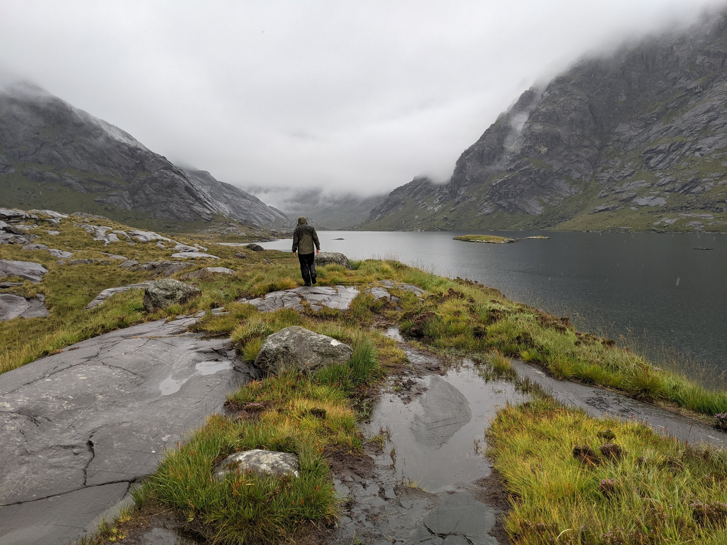
Loch Scavaig, Skye: One of the most dramatic anchorages on the west coast of Scotland is on the south coast of Skye surrounded by the peaks of the Cuillins. The nearly enclosed bay is the home of the Coruisk Memorial Hut, a bothy or climbing hut belonging to JMCS which we were tasked to photograph. The freshwater loch, Loch Coruisk lies just inland, separated from the ocean by a short spillway.

Helacious anchored in Loch Scavaig, Skye


The Small Isles: There are four islands between Ardnamurchan and Skye which we visited in August 2021. The weather was perfect and we enjoyed exploring them with Justine and Philip. Even though they are all so close it was surprising how each had their own character and vibe.
Rum: This is the largest of the Small Isles it is quite mountainous and is the home of a large herd of red tailed deer which have been in the longest continuously run survey since 1970’s. At the head of the anchorage at Loch Scresort is Kinloch castle, an Edwardian mansion built by crazy textile tycoon, George Bullough as a summer residence.

Kinloch Castle, now it is closed but was a happening place in its day.


We take a walk to the northern shore and find the herd of deer, and also suprise a deer watcher. We take the boat over to the northern anchorage and enjoy watching the deer from the boat for a couple of days.


Eigg: the most easterly and second largest of the Small Isles, Eigg has a very recognizable profile with the Sgurr of Eigg rising above the anchorage. Eigg is owned by a collective of the residents. It is self sufficient using wind and solar power exclusively.

Sgurr of Eigg.
We meet a few of the local characters and take a soggy walk across the island to the Singing Sands beach. We discover the delight of smoked mackerel and immediately go fishing to provide supplies to make our own.


We hike to the top of the Sgurr and enjoy the panoramic views.
Looking north toward Rum and Skye, below the wind trimmed trees and view of the anchorage.


Muck: What a strange name for an Island, this turned out to be our favorite of the Small Isles. The only one still owned and managed by a family, we had the distinct pleasure of meeting Lawrence MacEwen, the Laird of Muck. We bought some lamb from his well managed farm, hiked to the summit of the island enjoying the views and had lunch at the Muck Tearoom with local residents passing by.


Canna: The westernmost of the Small Isles is currently owned by the National Trust for Scotland. It is actually two islands, Canna and Sanday joined by a single lane bridge. We enjoyed a walk around the island, watching the sheepdogs round up the sheep spread over the hills. It was such a warm day, some of us felt the need of a dip.

Canna boat harbor on the west coast of Sanday.


While on Canna we explore the “historical” sites; Prison Rock is a structure high atop a rock stack with treacherous access. It is said to be the place Marion Macleod was imprisoned in 17th century for being unfaithful to her husband. We also searched out the Celtic cross which was sadly missing two of its arms, supposedly due to it being used as target practice in Napoleonic wars and the punishment stone, a place where offenders would have their thumb wedged firmly in a hole in the side, and left to ponder their crimes.


The Outer Hebrides. We did not really do the Outer Hebrides justice in the two years we were cruising Scotland. Here are a few of the places we visited, leaving many more for a return visit.
Lock Skipport, South Uist: Wizard pool is a nearly 360 degree protected pool. We stayed here a couple of days to allow bad weather to pass. We met Ewen and Jane on Mora Lass on our hike across the island to the dramatic beaches of the western coast, and enjoyed their company for a couple of sundowners.

Loch Skipport.


Flodday Sound, N. Uist: The sound between Ronay and N Uist provides a sheltered spot inbetween many rocks and sandbanks. The area was perfect to spot otters. The climb up to the hill above the anchorage gave us a view over the sound all the way to the Atlantic ocean.

Flodday Sound.


Stornoway: On Lewis, the northernmost island of the Outer Hebrides is the main town of Stornoway.

Stornoway Harbor.
Stornoway harbor is watched over by Lews Castle and its impressive grounds. The museum houses some of the incredible Lewis chessmen dating from Viking times.


Using Stornoway as a base we explored the area. We visited Bostadh Iron Age settlement on Great Bernera.


We checked out the Callanish Standing Stones from late Neolithic era.

Callanish Standing Stones


The blackhouse village of Gearrannan where we watched a fascinating example of weaving Harris tweed cloth.

Black houses in Gearrannan


Heading back to Ardrossan for winter 2021-2022 we had some fun sailiing with Charlie, stayed in many scenic and snug anchorages, too many to list. We crossed to the Firth of Clyde via the Crinan canal, anchored in Lochranza to hear the stags bellowing across the hills, and Broderick Bay on Arran, to clmb Goat Fell.


View from summit of Goat Fell.
We returned to Ardrossan October 20th, just in time. The winter storms began shortly afterwards. Helacious was hauled out and safely secured for the winter when we returned to continue the adventure north to Norway.

Sailing across Scotland
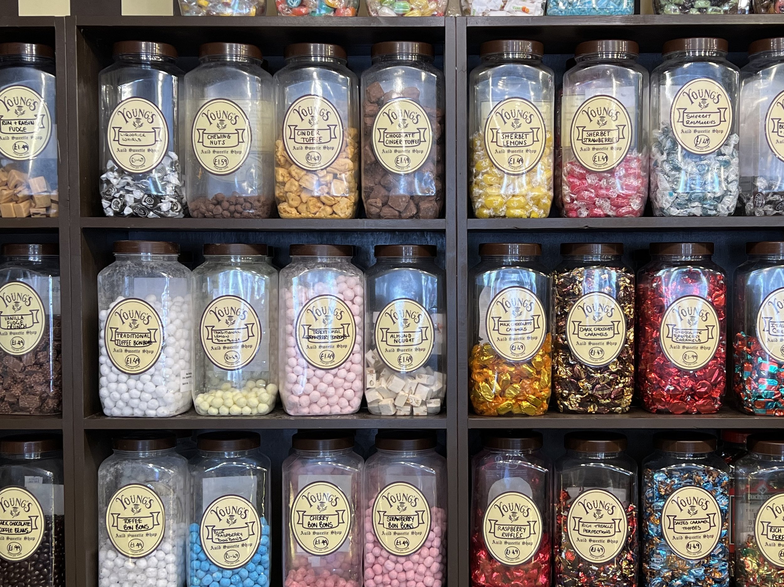
A fine display of sweets in an Inverness store. I had to get some sherbet lemons.
We make landfall after our North Sea passage in Inverness and spend a couple of days cleaning off Helacious and enjoying the familiar sights and sounds of Scotland. We were back in the land of solid stone buildings, good bookstores, and reasonable priced restaurants.


After stocking up on smoked haddock, whisky and other Scottish delights we had been missing, we left the marina and motored over to the Clachnaharry sea lock for the start of the Caledonian canal. We had managed to nab one of the incredibly difficult to obtain one week licenses to transit the canal, they sold them like a lottery, only 5 released at 5pm on a Thursday! Fortunately we scored. We passed through the first two locks and tied up in Seaport marina next to Moondance. We celebrated the beginning of the voyage across Scotland with Moondance crew, Ellen and Frankie. The following day we took Helacious through the swing bridge and the first series of locks called Muirtown Flight, that would raise us up to the height of the canal.


Motoring along the canal was sublime, passing the fields and hamlets at a stately 4kt, waving at people who were walking the towpath or enjoying the water on kayaks. It was fantastic weather as well, which of course helped.
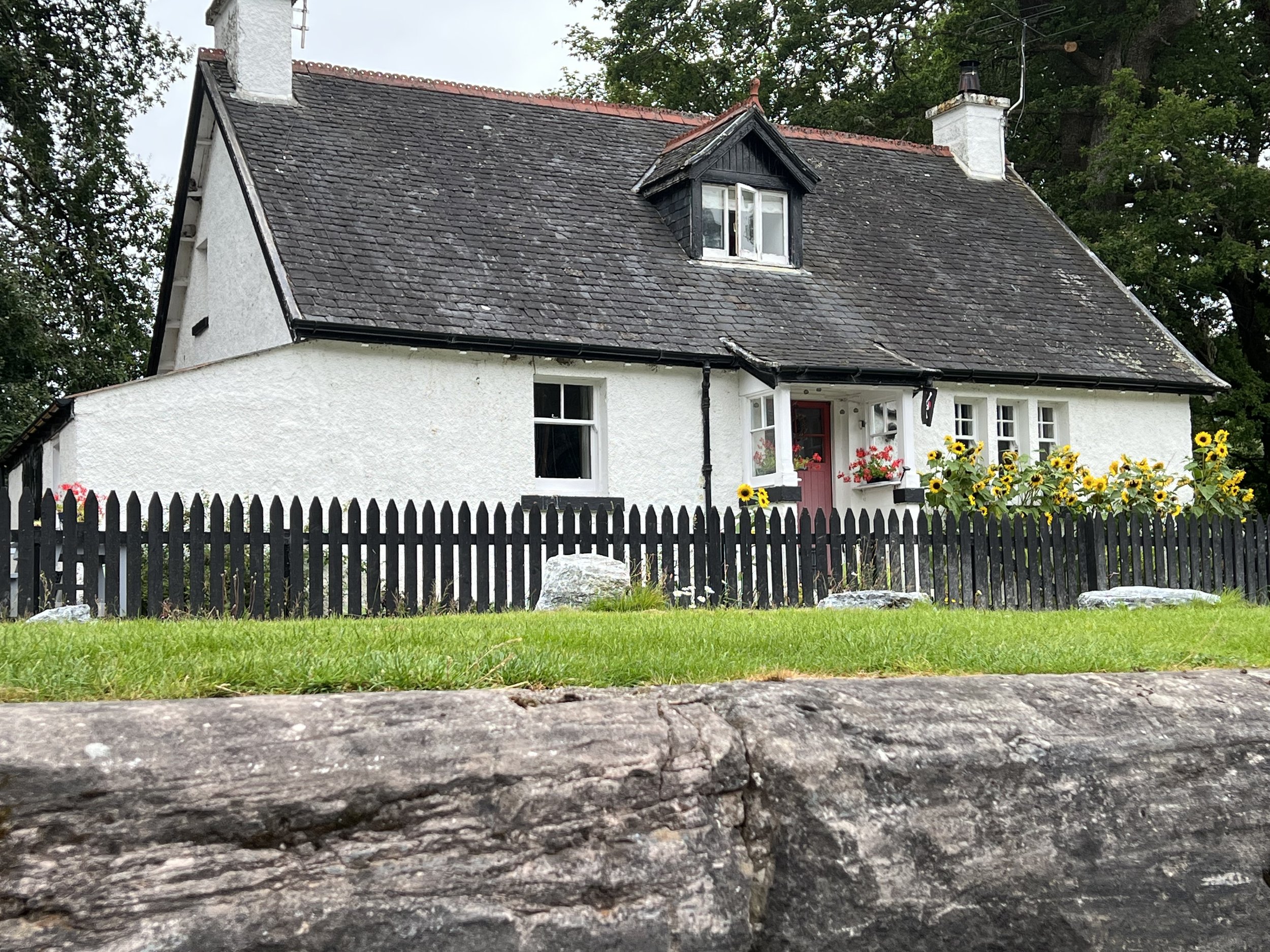
Cottage along Caledonian canal.


Before we knew it, we were at the entrance to Loch Ness
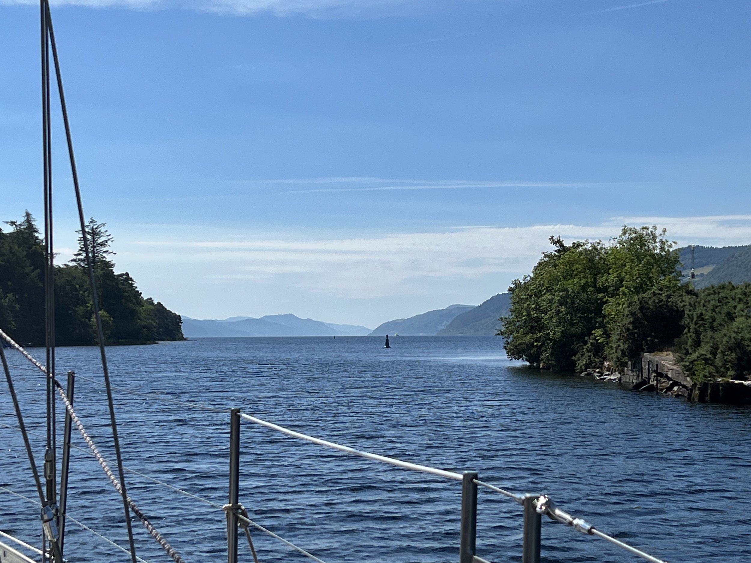
We quickly raised our sails and had a wonderful sail down the loch in near perfect wind. We had planned to stop at Urquhart castle for the night, however the wind was from the north and gusting quite strongly at this point, the loch is extremely deep just feet from shore and there was no safe place to anchor without being blown onto the rocks. We had to satisfy with a fly by and sail on south.


Half way down the loch, off the southern shore we discovered the perfect anchorage. It was not indicated on any of the charts we had. Just south of Foyers Bay there is a gravel ridge about 300ft from shore that was about 20ft deep, with water all around being 100ft or more. We set the anchor and watched the fog roll down the loch.

Fog on Loch Ness
The next morning was windless and the fog slowly cleared as we motored the rest of the way down Loch Ness to Fort Augustus.


Fort Augustus is a lovely town built up along the banks of the canal at the southern end of Loch Ness. We tied up to the pontoon and took a look around town. The weather forecast and ominous clouds indicated rain, but we were determined to stretch our legs, so we set off for a hike to get a nice view back down the loch.


Stormy skies over Loch Ness.
On our hike we met a lovely young German student, Antje, who we started chatting with. She was hiking by herself across Scotland, camping rough as she travelled. The stormy skies and gloomy forecast lead us to invite her onboard, at least for dinner. She was such good company she stayed with us two nights. That evening we had a party onboard Helacious along with the Moondance crew, showing off our mackerel smoking skills and the next day set off down the canal with Moondance close behind.


We stopped in Loch Oich and tied up to the sketchy pontoon allowing us to explore Invergary Castle and the grounds of the old hotel. The castle was in pretty bad shape, merely a propped up facade, but the mature woodland around and the old buildings of the hotel made the stop worthwhile. The evening was spent on Moondance, drinking G&T and playing guitar.


The next morning Antje jumped ship to Moondance who were pressing on through to the end of the canal, while we wanted to enjoy the countryside a little more and go for a good hike. We parted ways at Laggan at the head of Loch Lochy, the highest point on the transit, where we tied up and spent a quiet evening onboard.
The next morning the skies were clear and we had wonderful weather for our hike up Ben Tee, at 2966ft, it was almost a munro, so good training for our future family gathering in September.


The view from the summit of Ben Tee
The highlands begin here, looking north from Ben Tee.
Loch Lochy was the last loch in the Caledonian canal, from here it was canal all the way to the top of Neptunes Staircase at the western end of the canal in the small town of Banavie where there were 9 locks in series named Neptunes Staircase, followed by the final sea lock at Corpach. We left the Caledonian canal just as the heavens opened and we were treated to near white out conditions on our sail south toward Oban and a rendevouz with Supertramp.
The zen like process of descending in a lock, Neptunes Staircase, Caledonian canal.


Brian has made a video of our transit, you may watch it on our “Adventures on Helacious” channel
https://www.youtube.com/channel/UC7IeMiNV6nOwDbC7PZjsNiw/featured

Bergen and North Sea crossing.

A maze of skerries at Søndre Ospesundet
We had a spot of covid onboard so recovering in this protected anchorage was perfect, along with a little fishing therapy. Søndre Ospesundet was one of those special places. Used in WWII to conceal the Norwegian resistance boats from the German navy, it was a maze to get in and out of.


Rocky anchorage at Søndre Ospesundet
On the way south we discovered a number of treasures, summer was at its height, the grassy meadows repolaced the snow capped mountains, the summer houses were full of families. The inlets were becoming more and more populated as we approached Bergen.


Bergen
Helacious found a berth, right on the quay in the center of town. We were surrounded by tourists and restaurants, but suprisingly it was not too loud at night, it was a very pleasant stop.


The warehouses of Bryggen, now a UNESCO world heritage site, were interesting but full of shops and restaurants. We preferred the back streets and more local flavor of the city.

A maze of rooftops in Bergen.


After Bergen we continued slowly down the coast, waiting for a weather window where we could make the crossing of the North Sea to Scotland. It took a week of waiting, and we were getting anxious as we had commitments in Scotland and still so far to travel. Brian continued to investigate the Norwegian electrical grid. Finally we were anchored on the tiny island of Røvaer determined to leave the next day. The seas outside the harbor were rather lively but still we departed the next day under overcast skies.


Leaving Røvaer.


Trondheim and foul weather.

Warehouses along the river front in Trondheim
We arrive in Trondheim in cloudy and blustery weather. The marina is quite large, but full of local boats and there was one last visitors spot we managed to squeeze into. It was not our favorite marina, enough said. The following day was glorious sunshine and we went on a walking tour of this wonderful city. It is Norways 3rd city, and although the suburbs spread out, the historical center is compact, surrounded on three sides by river or canal and is eminently walkable. In fact there was a well marked trail around the city that we followed.


Nidaros Cathedral, originally started in 1070, has suffered many fires and been rebuilt a number of times, the latest completed in 2001. The finished product is spectacular. The wonderful carvings on the exterior, threatening untold horrors for the unbelievers. The soaring nave with its incredible stonework was so beautiful and graceful. The modern metalwork was in keeping with the original and to an extremely high standard.


Our guests arrived and once onboard we set off. The clouds descended and the rain started, and rarely let up for the whole week. Still we did not let it dampen our enthusiasm, we fished, we hiked, and we crocheted.


The hikes got pretty soggy, but we were well equipped. We spotted otters, eagles and caught some dinner. We escaped the charging herd of sheep and found the worlds largest ant nest. It was a good week.


After our guests left, we moved on, westwards now, back past Ålesund and toward the notorious headland of Statt. This is a exposed offshore passage that is so dangerous, an escort service is available for small vessels. They are also considering building a tunnel through the headland for cargo ships to be able to avoid this stretch of water, plans are still in discussion. We therefore took it quite seriously and waited a couple of days before heading off. Our passage turned out benign, infact the winds were lighter than we would have liked and we had to motor.


We passed down some magnificent sounds and spent a rainy few days in Florø. By now we had turned the corner and were heading south toward Bergen.


The arctic plunge

Yes she did!
Travelling south we stayed in some lovely spots, too many to list. The winds were still contrary, so there was a lot of motoring. We stopped in Bødø and stocked up, not least on some aquavit for the liquor locker.


Work boats in Bødø


We were approaching the arctic circle latitude, time was running out for Helen to take the plunge in arctic waters. Finally the day was deemed warm enough, and she jumped in…. and straight back out-elapsed time 12.2 seconds.


On Støtt there were the remains of German WWII fortifications and bunkers which were built by POW labor. We explored the tunnels and cannon mounts overlooking the straits. This area was quite active during the war as the Germans tried to prevent fuel and steel supplies from reaching the Allies, shipped from Russia via Narvik to the north.


We make a detour to an outpost island. Myken has a population of just a few dozen, but it has reinvented itself with the opening of a whisky distillery in the abandoned fishing warehouses. We arrived just as a tour was starting, so tagged along. The tour guide was so kind, he explained everything in Norwegian for the majority of the audience, then did it all again in Engish, just for us.

One of the four whisky stills on Myken


We did not stay for the tasting, a quick check at the price list indicated the product was not in our budget, besides we were heading back to Scotland. We left Myken and sailed south in the search of puffins.

Hetmannen (the horseman from the Norwegian legends)
Lovund, an isolated island far off the coast is the home of one of the worlds largest puffin colonies. We were right in the middle of the season when they were nesting on the island so we had high hopes of seeing some puffin action. The pontoons were snug at the base of the mountain and a brief walk around town indicated it was a thriving community, the main income appeared to be support of the fish farms.


The northern slope of the mountain was a designated protected area, the puffins made their nests in the spaces between the rocks on the steep scree slopes. Unlike the nesting site on Lunga in the Treshnish Islands of Scotland, where you could walk amongst the burrows and nests, here we were not allowed anywhere near the birds. It was frustrating to see the tiny specks flying back and forth, out to sea to fish, and not really see anything.

Lovund.


Time to hurry south. We begin to revisit some of the places we passed on the way north. The Seven Sisters range as an example, this time in much better weather

The Seven Sisters


We pass through Rorvik and discover the Norwegian marina electrical systems, unlike most everything else in Norway, does not appear to be well maintained. Installing and testing our very expensive new isolation transformer, we think it blew up. We have sightings of pilot whales and one day of fantastic wind to push us south toward Trondheim.


Straumhamn
Fresh water lake at Straumhamn with Hammerskaft peak.
Straumhamn, on the mainland in the very northeast of Vestfjord deserves its own chapter. This was our turning around point and although we were disappointed with the weather we were getting in Lofoten, to discover this treasure and the fine weather we had for the few days we were there, made for some great memories.
We approached in stiff winds, but once inside and at anchor the late evening sun shone on the surrounding hills. The anchorage off a beautiful sandy beach was a little tight and we put out lines to the rocks to prevent us swinging around. The views back to the west of the Lofoten, clouds now lifted, were stunning.


Helacious safely at anchor with lines ashore. Lofoten range in the distance.
We explored the area; the seawater inlet is separated from a freshwater lake by a narrow isthmus. The freshwater lake is only about 10 feet above sea level. In the valley beyond we spotted our one and only reindeer.


Mussels on rocky islet.


We ate well, the few days we were in Straumhamn. We found a small rocky island, just downstream from the freshwater lake outlet that was covered in mussels. They were concealed beneath heavy curtains of seaweed. Brian went fishing and cought not one, not two, but FOUR cod. Our freezer was full.


Before we knew it the calender indicated it was time to get going. We had to be in Trondheim by July 13th, 500 miles to the south. We had been told that after June the winds traditionally blow from the north, which would make our journey south a pleasant sail. This year, possibly due to the extreme heat wave in central Europe, the weather patterns were quite different. We never got those north winds and our journey south was a hard slog.

Lofoten, land of cloud
Reine, Lofoten
Lofoten, the archipelago of islands arcing out into the Arctic waters are considered the best cruising ground of northern Norway. Remote anchorages and dramatic coastline with the most magnificent mountain scenery. This had always been our destination and the furthest north we intended to sail. A fine place to spend midsummer and enjoy the land of the midnight sun.
The reality was a little different. We arrived in thick fog and tied up to the pontoon in Sørvågen. The following day we walked to the end of the island where the road stops in the town simply named Å. Here we saw more of the cod drying racks, many now emptying of their load as the season was coming to an end. We visited the Tørrfisk museum, explaining the air dried cod industry, and learnt that much of the cod fished and dried was destined for the Portugese market. The heads, we saw later, were considered a speciality in Nigerian cuisine. The clouds hung low over the mountains as we made our way to the next town up the chain of islands, to Reine.


A couple of days later the clouds finally lifted and we could see the peak of Reinebringen towering over the town. The sun emerged and the raw beauty of this area was apparent. In the fine company of Peter (yes Supertramp Peter) we went for a climb.


Reinebringen is 615m (2000ft) and is a popular hike. The Nepalese craftsmen had been busy and the steps all the way to the top made it a manageable and safer climb than in the past. The sun stayed out and the clouds stayed away allowing us to enjoy magnificent views over the town and north east along the chain of Lofoten islands.


The following day we pulled up the anchor and sailed northeast, looking for a quiet spot where we could make water and do other housekeeping chores for a couple of days. We found the perfect spot in Strømøy, where Brian also managed to top up our fish supply in the freezer. The cloud returned and we moved on to another classic spot in Lofoten, Henningsvœr.


Henningsvœr looking toward Vågakollen.


Lake on the climb up Vågakollen.

The clouds descended again and the forecast indicated unsettled weather for the forseeable future. We realized we were unfortunately not likely to see the midnight sun under these conditions and in the time we had available, so we cut our losses and left the islands, heading back toward mainland. We would begin our journey south, retracing our steps but finding new places to explore.
Lions and eagles

Approaching Rødøya.
Why is it we look for animals and faces in our rocks? They are frequently rather obscure, but in the case of Rødøyløva, the mountain on Rødøy, it seemed so obviously a lion waiting to pounce…. or maybe an elephant.
We arrive at Rødøya with wind howling down the face of the mountain, once in the shelter of the bay it was a little calmer. We wandered around to the “town”, really just a small grocery store, church and few houses. The partially restored warehouses along the waterfront told of more industrious times. Along the modern quay we passed a building however that confirmed business was still ongoing, a shed full of bales of salted and dried cod waiting for export. We were astounded at the sheer volume of fish, little did we know of what we were to see later. Inspired Brian threw a line in the water after dinner, but no luck.


The following day the winds had abated a little and we climbed Rødøyløva. We were surprised to find the trail was extremely well maintained, in fact much of the climb up was on enormous granite steps, apparently installed by Nepalese craftsmen. The views from the top were spectacular; the skerries to the south west with Hestmannen and Lovund in the distance, Svartisen glacier and the snow capped mountains stretching to the north and east.


The view looking north from the summit of Rødøyløva
The following day we left Rødøya and made our way north toward the Lofoten. We had planned on a stop to top up our provisions in Bødø, the capital of Nordland, but the wind died and we decided our full freezer was probably sufficient. We anchored for a couple of nights on Fleina, a small island about 20 miles south of Bødø and waited for the wind to allow us to make the crossing of Vestfjord to Lofoten. The anchorage was just perfect, an almost enclosed lagoon, a wonderful hike up the hill over spongy mosses and huge slabs of granite.

The anchorage on Fleina


And then, high above, an eagle circled us on the summit of the hill.


Finally, to complete a perfect day.

Glacial beauty

Svartisen glacier.
Svartisen glacier is the second largest glacier in mainland Europe and not to be missed. The best view and access was from the water at the head of Nordfjord. We could see the glacier capping the mountain range as we approached up the fjord. At the head of the fjord there was a pontoon with room for a few boats and not much else. A tourist launch brought daytime visitors, but in the evenings we had the glacier to ourselves.


The next day we set out joined by our friend Peter from Supertramp. The foot of the glacier was 3km from the lake, distances were deceptive as it did not seem to get any closer however high we climbed.


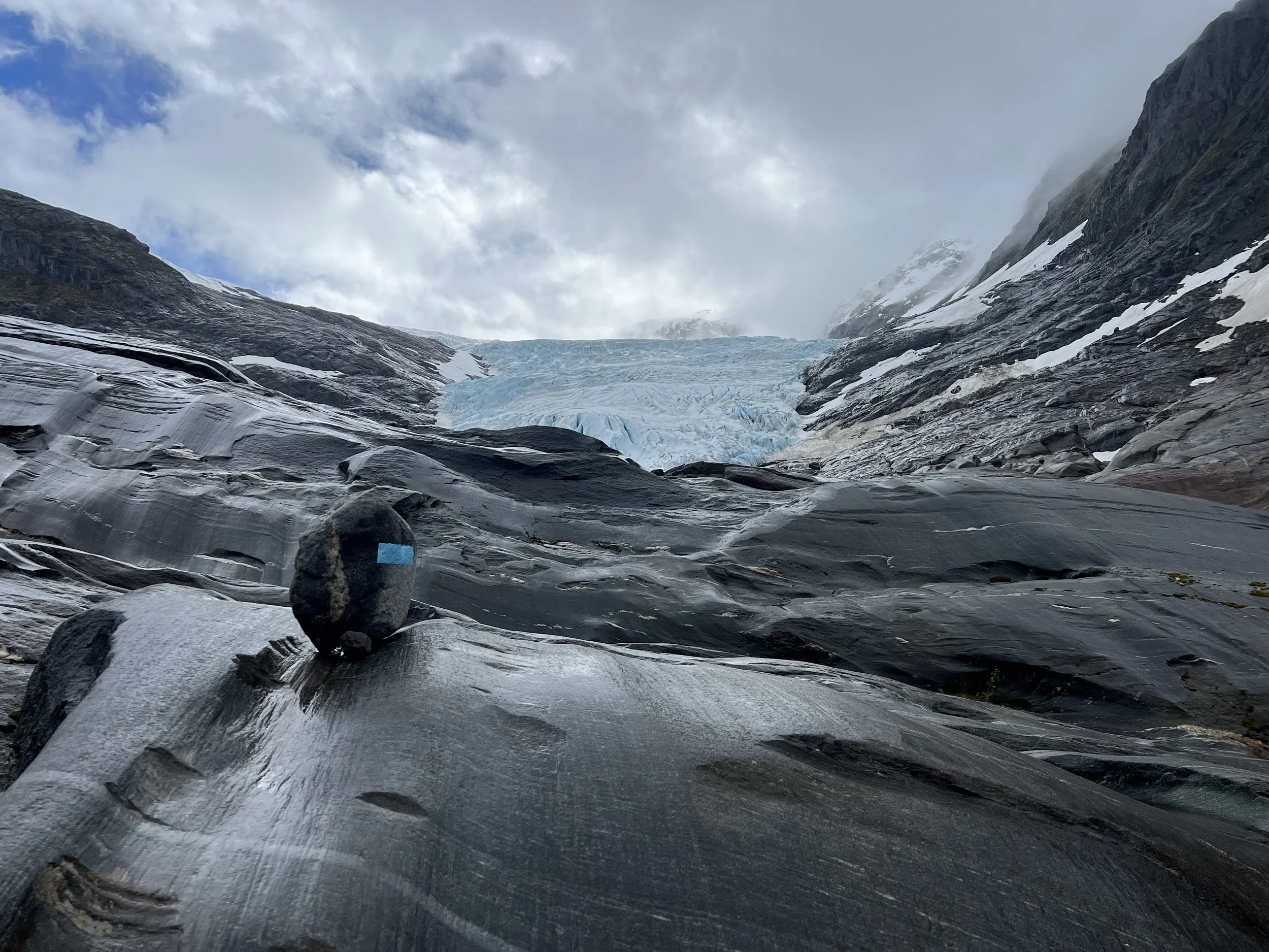

The hike over the terminal rocks was very interesting, so many different kinds of rocks, the colors and patterns were wonderful. I wish I knew more geology.


Inspecting the foot of Svartisen glacier.
And finally we were there. The size of the glacier was hard to believe unless you had someone in frame to act as a reference.


The color of the ice was an intense aquamarine, so clear as you looked deep into the crevasses. The ice was not solid, which was rather alarming, it seemed to be made of ice balls stuck together by pressure. Very easy to knock apart. There was no way I was going to explore any of the ice caverns at the edge.


The next day we explore the other side of the fjord, renting a bicycle to head around on the trail. We enjoy a hike up into an abandoned farmstead


Finally it was time to leave, we still had a long way to go to make our midsummer destination of Lofoten Islands. We left the Svartiesn glacier and continued the journey north.

Nordfjord.

Norwegian gods, trolls and arrows.

Torghatten
We make it to Rorvik, a forgettable town but useful due to its well stocked grocery store. A couple of days there was sufficient and we moved on to anchor again as soon as we could. The winds were light so we opted to motor just 10 miles to the first island north, Leka. It was here we learned of the Norwegian myths that describe many of the mountains and landmarks stretching from Leka up to the arctic circle.
In summary Lekamøya was hired as a chaperone for the seven sisters, the daughters of Suliskongen, the king of the mountains.. One day Hestmannen, the mighty horseman caught sight of Lekamøya and the seven sisters bathing and was consumed with wild passion. He leapt onto his horse and raced south. Lekamoya and the seven sisters fled, the seven sisters soon gave up the chase but Lekamøya ran on. Hestmannen only had eyes for her and once he realiszd he was unable to catch her, in a rage he drew back his bow and sent an arrow flying toward her. Nearby another giant watching the show hurled his hat into the path of the arrow to save Lekamøya, the arrow pierced the hat and Lekamøya ran on. As the sun rose all the trolls were turned to stone and there they still stand today.
Leka was in full bloom. The fields of dandelions and spring flowers were beautiful. We climbed the hills to the base of Lekamøya, a rather disappointing rock for all the fairytales. Still the view across the sound to mainland was nice. Back on Helacious Brian celebrated by taking a brief dip in the frigid water and we enjoyed the gift of a Norwegian flag and eagle feathers we found in our dinghy at the dock after our hike.


Sailing north from Leka we arrive at Torghatten, the hat with the hole from the legend. Indeed the view from afar was somewhat hat like, although we could not see the hole. We climbed the hill and finally a huge cave was revealed. It did indeed pierce the mountain, the views in both directions were splendid.


View north from the Torghatten anchorage.
From Torghatten we sail on north toward the arctic circle. We spend a blustery couple of days in Tjøtta then pass the Seven sisters, unfortunately shrouded in cloud. We would get better views on our way south. The coastal scenery was getting more and more impressive the further north we went.


Finally we arrive at the arctic circle . A monument on the small island of Vikingen marks the correct latitude. We celebrate with a wee dram as we watch the sun set over Hestmannen.


Skerries skerries everywhere.

Lighthouse marking entrance to Sandøya.
Moving north and west along the coast past Ålesund we stop at Sandøya, our first experience of a fishing village in the skerries. We check the weather conditions for passage through Hustadvika, a potentially dangerous exposed rock and reef strewn passage with no safe havens for 30nm. The weather looked benign, and indeed we had to motor most of the way to our overnight anchorage at Golmsundet, just past Kristiansund. As we sailed along the sheltered waters of Trondheimsleia we passed many and varied lighthouses and enjoyed the vistas of mountains to the south. But we were heading north and we sailed on, Trondheim could wait for the return journey. We had a wonderful sail up to Stokksund where we tied up to the pontoon and spent a couple of days. We reprovisioned, discovered the washing machine with the longest cycle (it must have taken 2 hours to complete, not sure what setting I put it on, the instructions were all in Norwegian). We also saw our first dried cod and began to see the paint theme of barn-door red.


Sailing on we had good winds and opted to sail offshore heading for Rorvik. However it took a little longer than we had planned. We therefore diverted to a fishing village in the isolated skerries just to the south. What a treasure. We wander into “town” to pay our pontoon fees and are treated to a personal tour of the island store and museum. We learn that in its heyday, Sørgjaeslingan had a population of over 6,000 during the cod fishing season but now the remaining buildings are seasonal holiday homes. We see the kittiwakes roosting on the cliffs and sides of buildings, what a racket they make at sundown. After dinner we take an evening stroll over the neighboring islands and enjoy the late evening sun.

An aerial view of Sørgjaeslingan and the skerrie maze to enter.


View of Sørgjaeslingan on our evening stroll.

Norway land of fjords

View down Norangsfjord from Øye.
Crossing the North Sea was not as bad as we had thought. We encountered heavy fog but managed to avoid the fishing fleet and oil rigs, arriving in Ålesund after a 27 hour passage in the early evening. After a very relaxed check in at the police station the next day we explored the town. Ålesund is built up on a chain of islands and the small marina is right in the center of town. The buildings are quite different from any other Norwegian town, having been rebuilt in Art Nouveau style over 3 years in 1905 after a major fire destroyed the town center. The old lighthouse on the harbor wall had been incorporated into a local hotel as the “honeymoon suite” and we saw that pixies still live here, the evidence being a pixie sized garbage can waiting on pavement. The view from the top of Mt Aksla showed how the town was fitting into available space and from old photographs, how it had spread. The walk along the spine of the main island of Nørvøya was lovely with spring flowers and stunning views of the mountains and fjords to the south.


After a couple of days in Ålesund we leave to explore our first fjord. The most famous, Geirangerfjord, was to the south of Ålesund, but was 52nm of travel to get there, it also was likely to be full of cruise ships and tourists (not like us!). Instead we chose to visit Norangsfjord and the settlement of Øye at its head. This was equally stunning scenery and by virtue of a 13m bar across the fjord, was inaccessible to cruise ships. It was May, and still spring in Norway. The mountains were capped with snow and the waterfalls were full of meltwater. The journey in was only 29nm, but with the wind against us and swirling down the mountain sides, it took all day to motor to our destination.


We were joined at the dock in Øye by Peter and Finn on Supertramp and the next day hiked the mountain Slogen, rising high above Norangsfjord. We first passed the Union Hotel, built in 1891 and visited frequently by Kaiser Wilhelm II in his steam yacht in the early days of toursim, it looked like the decor had not been touched since. The hike was incredibly steep, but we were rewarded with the most amazing views. We were unable to reach the summit as unstable snow packs blocked the trail, probably for the best.


Helacious and Supertramp at Øye pontoon
We had dinner onboard Supertramp, enjoyed the sunset, tall tales and good company. The next morning we left and began our journey north.

Heading north to Orkney and Shetland

Vatersay Bay
We head out from Oban, up the Sound of Mull and across the Minch to the Outer Hebrides. We have a fantastic sail, using the code zero and accompanied by a large pod of dolphins for over an hour. We land on the southernmost island, Vatersay and anchor in the large bay, just off a beautiful sandy beach. After a couple of days on Vatersay we go around the corner to Bara and tie up to the pontoon in Castlebay. Here we stock up on a few items, walk up the hill overlooking the bay and Kisimul castle, stronghold of the MacNeils.


We retraced our path up the Outer Hebrides, stopping just for an overnight stay on Ronay in a rocky but protected pool. The next day we got an early start to catch the tides and wind and made a run all the way up to Stornoway. Here we spent a couple of days to wait out some bad weather up north and then when the forecast looked favorable we set out for Orkney. Unfortunately the wind died on us just past Cape Wrath yet the large seas remained. The worst combination and the Captain felt a little peaky. We finally made it to Stromness and tied up to the dock. The next day we went exploring and discovered a beautiful town, caught in a 1950’s time warp. The narrow paved roads, quirky buildings and a wonderful art museum with connections to the Tate. There was also a lot of nautical history scattered around town if you looked.


We rent bicycles for a day and take off to explore the prehistoric sites of Orkney. We start off at Yesnaby Castle, a rock stack on the west coast. We cycled further north to Skara Brae, a 5000 year old Neolithic settlement. There was a recreation of what the dwellings were like and then the excavated ruins themselves, complete with stone dresser and bed. It is amazing to think this was inhabited 3000-2500BC. No rest, onwards to the Ring of Brodgar. We realised then that the wind, which had been on our backs was quite strong, necessitating us to cycle while going downhill! The final stop at the Stones of Steness completed our visit on Orkney.

Yesnaby Castle, a rock stack off the west coast of Orkney.


Dwelling at Skara Brae; large bed on left for male, smaller on right for female. Dresser facing entrance to room, firepit in center.
We move on after a storm passes across The Hole, a treacherous area of turbulent water, to Shetland. We anchor in Levenwick Bay and recover from a difficult sail, the strong winds and an accidental gybe caused us to break a sail car We spend a couple of days here, walking in the hills where we met John Sinclair, a local shepherd who invited us into his home for a cuppa. We learned about the Shetland sheep, his sheep dog Tess, and his life as a merchant mariner. We then move on to the main town of Lerwick and tie up to the pontoon.


Shoreside graveyard in Levenwick Bay.
On the way to Lerwick we stopped to visit the Broch of Mousa, the most complete and best preserved of all the Iron Age round towers found in Europe. It is though to have been constructed in 100BC and is one of 500 built in Scotland..


In Lerwick we stock up and finally find a place to fill up our propane. There is a shortage in the UK and we know there will be problems refilling in the European countries, so we are very pleased to have two full tanks. We discover there are strong ties between the Shetland Islands and Norway when a flotilla of Norwegian boats arrive to celebrate Norway independence day. Their numbers were a little scant so we volunteered and before we knew it we were marching through the streets of Lerwick waving our Norwegian flags.
We had previously seen a couple of these “boat” sheds, and were interested to chat with the creator of a particularly fine example, made with love for his wife, for her gardening tools. We also make friends on the dock with Alan, who we had initially met in Orkney, and Peter, an Australian sailor who we would meet again on our travels north.


