Northern Scottish Waters
After leaving Oban we motor up the Sound of Mull and consider our choices for an overnight spot. As we passed Tobermory, it seemed that the longer evenings, now staying light until after 9pm, would enable us to get around Ardnamurchan peninsula. With the light winds, Sanna Bay was a tempting choice. We entered the anchorage through the unseen reefs using the wonderful Antares charts, and dropped the anchor as the sun set.

Sanna Bay. Looking north toward Rum and the very recognizable silhouette of Eigg.
The next morning the sun rose to show off the soft sandy beaches and rocky shoreline to full advantage. We did not stay to explore more, however. We wanted to move on, to visit Rum where friends we first met four years ago were waiting in the bay. We sailed, then motored, north and anchored adjacent to the moorings in Loch Scresort. As we entered the anchorage we checked out the mountains to the south. We were planning on hiking Hallival, the hill to the right in this picture.

Askival and Hallival as we were entering Loch Scresort.
We met up with Jane and Ewen, catching up on past adventures over ice cream at the Rum General Store. That evening we continued the conversation on Morar Lass, Brian getting some inspiration from Ewen’s lithium battery installation. It was lovely reconnecting with them, we had shared an anchorage on the Outer Hebrides, back in 2021. The time that has passed seems like nothing. It is like that, with the sailing community, fast friendships are forged in a very short time.


The next morning we set out on our hike. The weather was fine.

View from the head of Loch Scresort, Isle of Rum.
The most prominent manmade landmark on Rum, as mentioned in previous blog entries, is the deserted and abandoned Kinloch Castle. A remnant of the innovative and decadent lifestyle of the jet set of the period. Built in 1900, it had its own electricity supply, plumbing, heating and a telephone system. There was a mechanical orchestrion for evening entertainment and a menagerie in the gardens including peacocks and alligators. It now stands abandoned, just recently it seems when viewing through the windows,

Kinloch Castle.


Our trail started in the lawns of the castle. We wound our way up well worn paths, past a healthy looking stream that was used for local hydroelectric power. It was a steep climb on a clear path –until it wasn’t. We went a little “off piste”, but no damage done. The scramble up through rocks at the summit was fun.


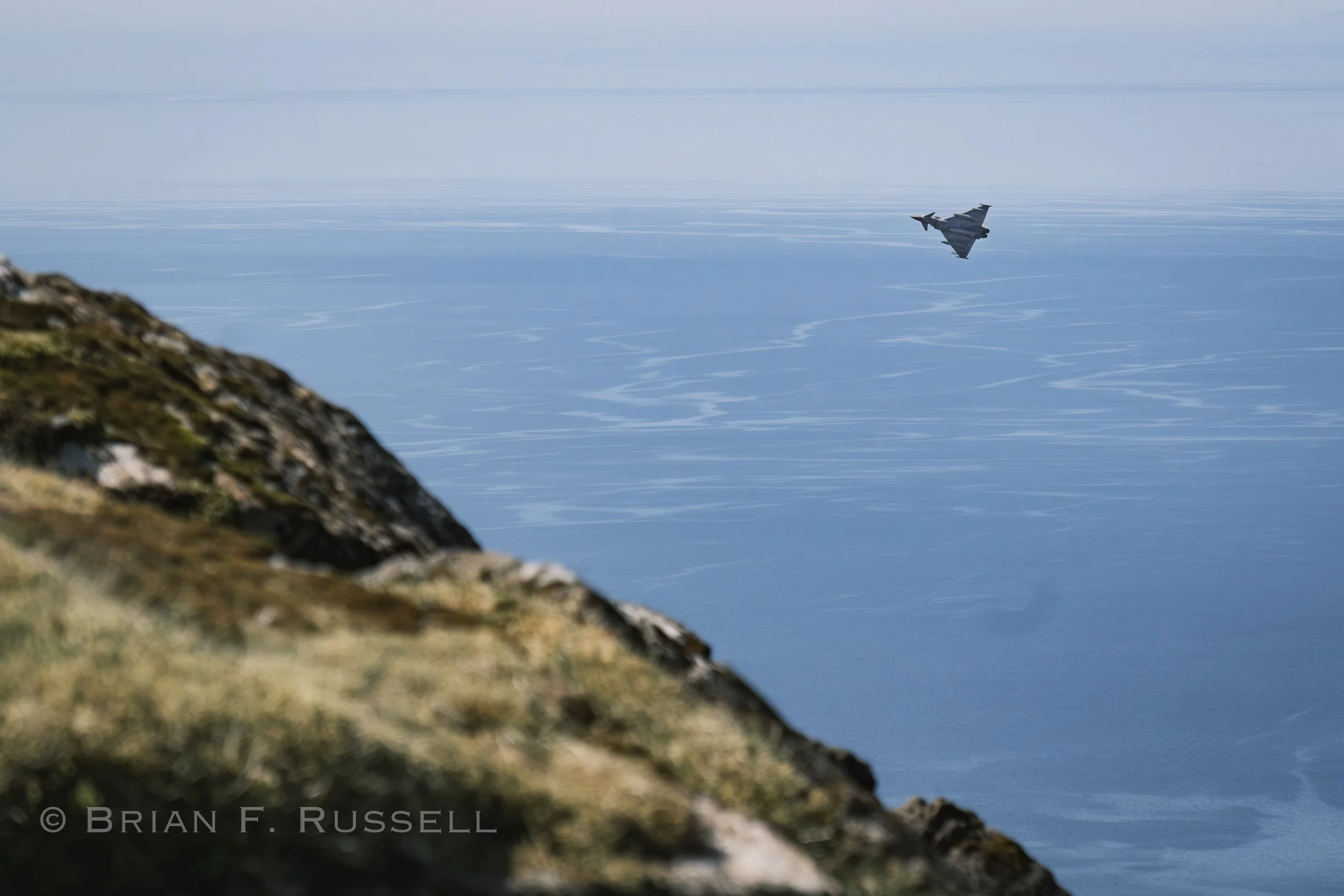
The views from the top were outstanding. We could see the length of the Outer Hebrides, south to Ardnamurchan and to the mountain ranges of the mainland to the east. The grassy knolls on the top of Hallival were due to the ground nests of the Manx Shearwater as this is one of their main nesting sites. There was a little burbling from underground if you listened carefully. As we sat eating our lunch, there was a roar as two fighter jets slipped between the peaks of Hallival and Askival. So close, and we were above them!


Looking north toward Skye and the Cullin Ridge.

The Outer Hebrides on the horizon.

Before we left the next morning Brian pulled out his pencils and made this lovely sketch to remember our visit by.


We motored over to the neighboring island, it was not far and with no wind for sailing we did not want to spend a long day with the motor droning on. As we approached Eigg we were hailed on the radio by Ab, another sailor we had met a few years back in Stornoway. We enjoyed catching up that evening over sundowners.
The next day we packed a lunch and set off to hike the Sgùrr of Eigg, a very recognizable rock, the remnants of volcanic outflow from the mountains on Rum.


Aerial view, looking west towards Rum. We are perched on the summit.
We had hiked enough hills for now, it was time for a rest. Heading north up the Sound of Sleat, we staged for passage through the narrows of Kyle Rhea at a lovely anchorage in the shelter of the Sandaig Islands. The sandy bay had a stream entering it and a deserted cottage overlooking the beach. This was where Gavin Maxwell lived in the 1950’s with his pet Otter, Mijbil, the subject of the book and movie, Ring of Bright Water. There must not be any otters living there now as we found numerous clams and mussels on the beach at low water, perfect pickings.
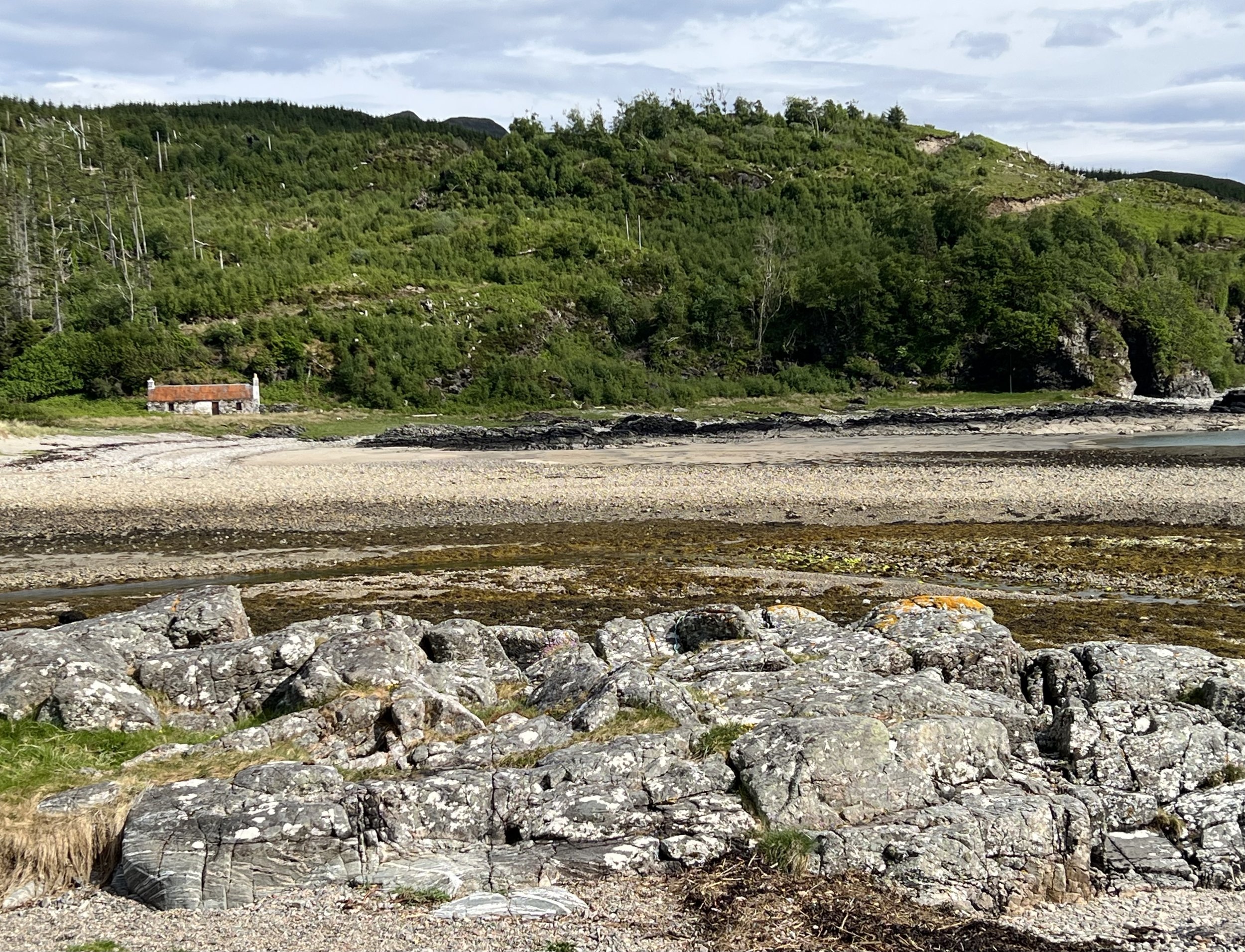


Sandaig Island anchorage.
The next morning at the turn of the tide we headed north to pass through the narrow channel between Skye and mainland Scotland. With the current assist we clocked 9.5kt and sped by a gaggle of seals feeding on something that had been attracted by the fast waters. Continuing on we tuck into a snug anchorage at the southern end of Raasay, next to the ferry dock, with good protection from the predicted north wind for the next few days.

At anchor in Churchton Bay, Raasay.
The views across the Sound of Raasay to Skye were glorious.

The following afternoon we rendezvous with Justine and Philip in Portree for a last visit onboard Helacious in Scottish waters. The visit was brief, but filled with good food and fine whisky. Shortly after anchoring in the designated area, we were politely asked if we could move, as the Waverly, a restored side paddle steamer was on her way. She was quite a sight and travelled surprisingly fast. Her narrow beam must really reduce maneuverabilty, though.


We return to Raasay and took an interesting hike around the southern coastline that passed by a number of sites related to the ironstone mining that was prevalent during the late 1800’s. There was the old hopper for storing the rock prior to loading on ships for transport and the buildings where the ore was crushed. The path followed the rail line that transported the ore from the mines down the hill. At present the local sheep had things under control.


We said our farewells and spent the following evening on Rona, the smaller island to the north. We had heard of an interesting spot, a cave that served as a church for the islands inhabitants up until as recently as 1970’s.

Helacious nestled in the Acairsaid Mhor anchorage on Rona.


The entrance to the cave formed a huge arch, under which a pillar was used as the pulpit. A font to one side was filled by the drip from above and there were rows of stones used as pews by the congregation. The clamber down a steep and boggy trail to get to Church Cave made us think they were very devoted back in the day.
The forecast for the next few days had us on high alert. A gale was approaching and we needed to find a spot to hunker down. Initially we were going to anchor in one of the deep sea lochs on the mainland side, hoping to continue our exploration of that northern mainland coast that we had not yet visited. However, the extended forecast made that not such a good choice, and we were now approaching the end of May. Our plans were to head to the Faroes, therefore we sailed across the Minch to Stornoway, on the Outer Hebrides, arriving just ahead of the gale.

Changing weather.
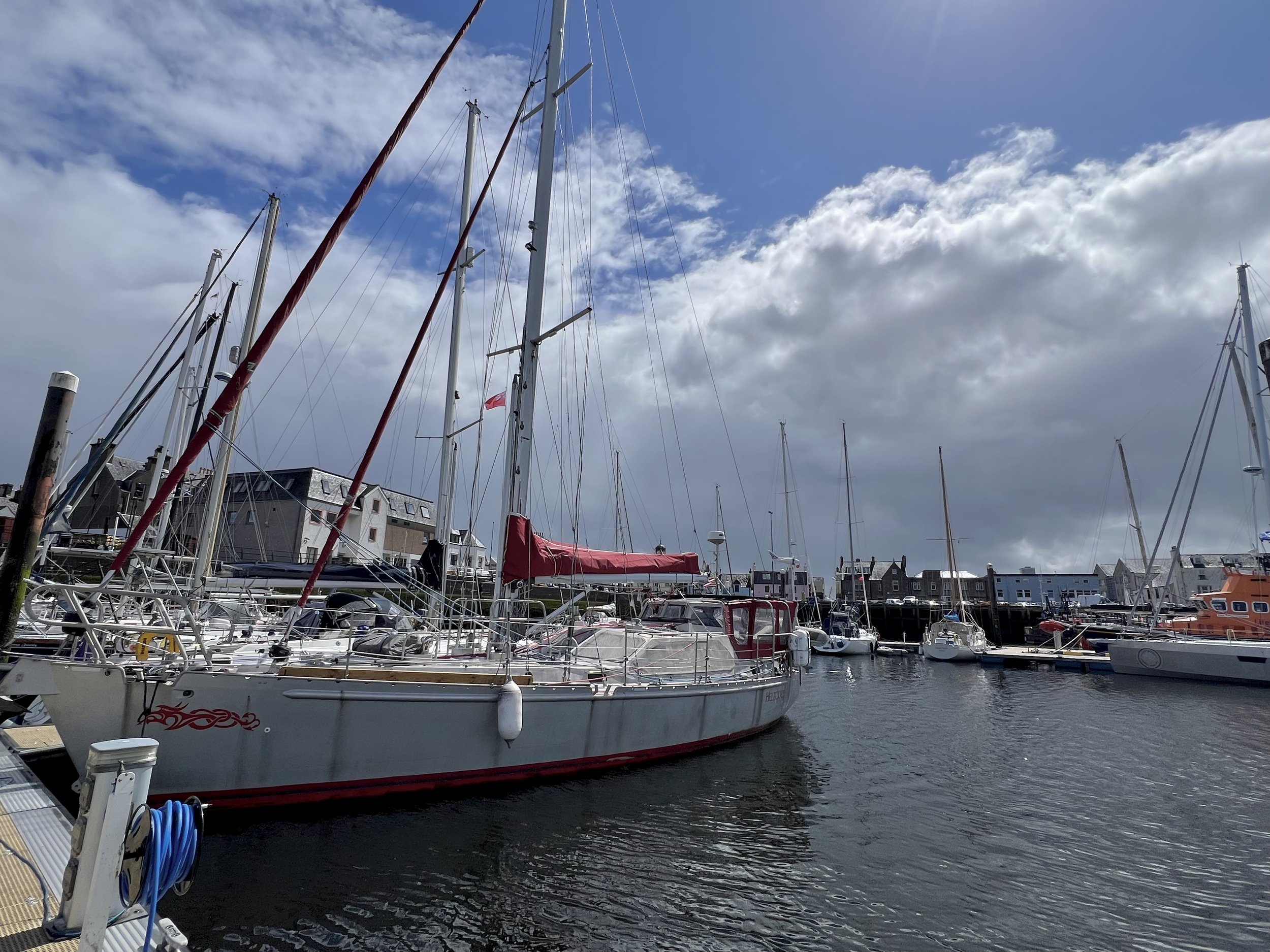
Helacious in the protected inner harbor, Stornoway.
Here we could provision with those last jars of pickled onions, marmite and black pudding – all essential items for crew moral. Laundry was done, although it took all day as the machine held our clothes hostage on wash cycle. We finally rescued the laundry, rinsed and dried it. We took a quick walk about town between the rain showers, enjoying the solidly built homes. Each one is different, all built with local stone.


The time was right. We were ready to say goodbye to Great Britain and continue our travels. Time to explore more.

Leaving Stornoway at dawn.
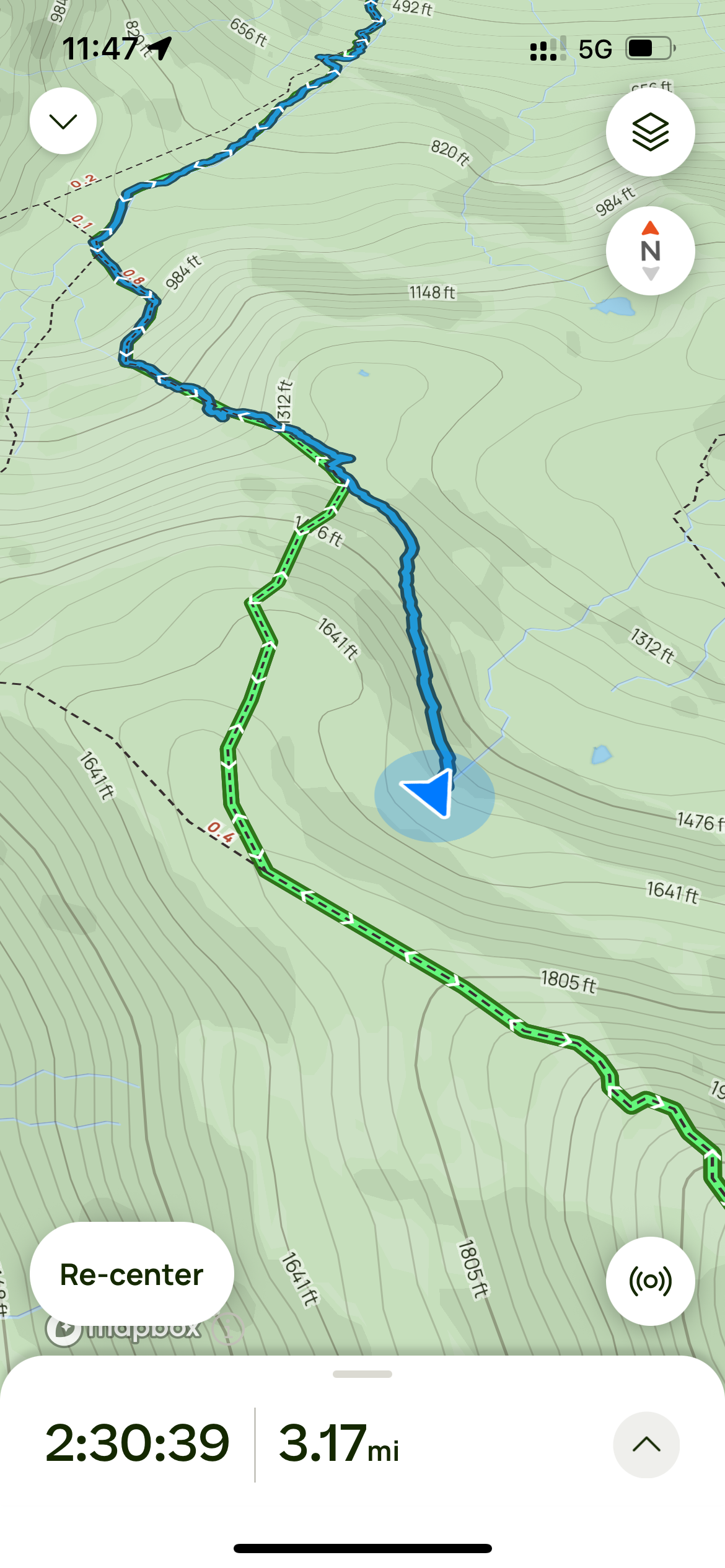
Follow our progress on the tracking page.
https://forecast.predictwind.com/tracking/display/SVHelacious/